Tuesday, September 18, 2007
The City by the Bay
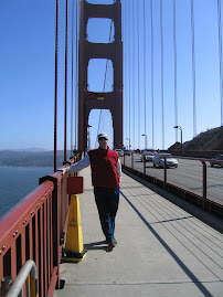
We hauled over from Yosemite to San Fran yesterday. The ride was ok until we missed a sign and went into town over the Bay Bridge and had to zig through town with the RV behind, to the Golden Gate Bridge. That's way more harrowing than being on rutted dirt roads. We are parked in Novato, about 20 miles north of the bridge on Rt. 101. It's an urban RV park, but nice enough. We will explore for a couple of days and meet up with Sarah and David Swain on Thursday. Sarah is the daughter of my cousin Joe and his wife Cindy for those of you who don't recognize the name. They live in SF and have a young son, Oliver, less than 1 year old, but probably standing and getting around by now. We remember those days.

Monday, September 17, 2007
Addendum to Bruce's blog
By now you must know that the pilot and co-pilot have different ideas of fun--yesterday's back road trip was NOT FUN for the co-pilot. Find the narrowest,dirtiest,bumpiest,most rutted road in Sussex county, and then hang it off the side of a big mountain--that's what the Buck Creek etc. road was like!!! I will remember it, and how happy I was to be done with it. At least our lovely brunch helped temper the 2 hrs. prior!!!
Dirt roads and the Ahwahnee Lodge
We headed over to Yosemite Park this am to brunch at the famous Ahwahnee Lodge. More about that later. Since we had not entered the park through the Arch Rock Entrance near El Portal, we wanted to go south to Rt 140 and enter there. At the National Parks, the entrances and exits are often the best rides. Since our RV park was on Rt. 120, and since no major north/south appeared on the map, I decided to try some lesser roads. We headed east on 120, then turned south onto Buck Meadow Road. It soon changed to dirt. It's been so dry out here that dirt roads are powdery and we left a trail of dust even at 15 to 20 mph. We were headed for Briceburg on Rt. 140 and had to take Bull Creek Rd. followed by Briceburg Rd. The road became narrower and narrower as we continued even though at about the half way mark there was an historic marker. Way back when a group of locals contributed and raised funds to build a public road to Yosemite, an act they claimed was unparalleled in modern times. We were heading steadily uphill and soon the road became filled with ruts and then deep ruts. Luckily, our big ol'truck was equal to the task. After miles of 5mph straddling ruts and switchbacks that were sharper and sharper, we arrived at a ridge top looking down into the valley where Rt. 140 leads to Yosemite. We must have been 4,000' above the road on as steep a hill as you can imagine. The road at this point was down to 10 or 12 feet wide, rutted and covered with talcom powder dust, and all switch backs. The switchbacks were wider and the only place a vehicle coming the other way could pass. At one switchback we encountered 3 motercyclists coming up. He said, "Great road, huh?" We contined our descent at about 5 mph. Both of us were happy to see flat land and blacktop at the bottom.
The ride in on 140 was scenic. The road had restrictions as a landslide had blocked the road at one point. They bridged across the Merced River and built a road there for about a mile and then bridged back to the main road. The landslide looked to be abour a quarter of a mile wide, but quite deep and extended into the river. The Arch Rock Entrance is just that. Both the entry and exit roads go under huge granite boulders which came to rest lodged on other boulders, creating a tunnel of sorts.
From there it was a short drive to Yosemite Village and the Ahwahnee Lodge. It was designed by Gilbert Stanley Underwood and opened in 1927. It's interior is Native American and spectacular. It boasts an AAA four diamond rating, whatever that is. They had a wonderful brunch, Sundays only. It was great. The best way to see Yosemite would be to rent a sporty convertible and stay a week at the Ahwahnee.
I wish our truck was convertible. In many of the parks, a roof is a huge detriment.
On the way home, we drove the 16 miles or so out to the Hetch Hetchy Reservoir. It was built after the SF earthquake and fires which destroyed the city. It required an Act of Congress since the area was already part of a National Park. John Muir, patriach of Yosemite, tried his best ot prevent it, claiming it was as special as Yosemite. It's beautiful, but no Yosemite.
A couple things missed over the last few days:
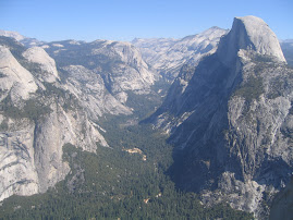
Glacier Point is the best view of Yosemite Valley, but the drought left almost all the waterfalls dry. The highest falls, Yosemite Falls at 2425' and Sentinal Fall at 2,000' were dry. Nevada Falls was the only substantial ones flowing.
Glacier Point also had two privately owned lodges near the over look, but they were burned by fires in 1969 and can not be rebuilt. That must have been an interesting discussion.
At about 7:45 am on Saturday, up near 8'000', our thermometer registered 26 degrees. It's so dry that no frost or dew drops.
Yosemite is unbelievable. Remember, rent a convertible.
The ride in on 140 was scenic. The road had restrictions as a landslide had blocked the road at one point. They bridged across the Merced River and built a road there for about a mile and then bridged back to the main road. The landslide looked to be abour a quarter of a mile wide, but quite deep and extended into the river. The Arch Rock Entrance is just that. Both the entry and exit roads go under huge granite boulders which came to rest lodged on other boulders, creating a tunnel of sorts.
From there it was a short drive to Yosemite Village and the Ahwahnee Lodge. It was designed by Gilbert Stanley Underwood and opened in 1927. It's interior is Native American and spectacular. It boasts an AAA four diamond rating, whatever that is. They had a wonderful brunch, Sundays only. It was great. The best way to see Yosemite would be to rent a sporty convertible and stay a week at the Ahwahnee.
I wish our truck was convertible. In many of the parks, a roof is a huge detriment.
On the way home, we drove the 16 miles or so out to the Hetch Hetchy Reservoir. It was built after the SF earthquake and fires which destroyed the city. It required an Act of Congress since the area was already part of a National Park. John Muir, patriach of Yosemite, tried his best ot prevent it, claiming it was as special as Yosemite. It's beautiful, but no Yosemite.
A couple things missed over the last few days:
Glacier Point is the best view of Yosemite Valley, but the drought left almost all the waterfalls dry. The highest falls, Yosemite Falls at 2425' and Sentinal Fall at 2,000' were dry. Nevada Falls was the only substantial ones flowing.
Glacier Point also had two privately owned lodges near the over look, but they were burned by fires in 1969 and can not be rebuilt. That must have been an interesting discussion.
At about 7:45 am on Saturday, up near 8'000', our thermometer registered 26 degrees. It's so dry that no frost or dew drops.
Yosemite is unbelievable. Remember, rent a convertible.
Sunday, September 16, 2007
Bodie and Back
We planned an earley departure to drive across the northern Yosemite road to Tioga Pass and the NE entrance to the park. The traffic can get thick on weekends. We were out at 6:45 and on our way. The drive is spectacular. The views back across the valley are beautiful as are the constant granite outcroppings, domes and monoliths. At one point you can see back across the valley to the rear of Half Dome. It's about a two hour ride from our RV park to the Tioga Pass. We were by ourselves for about half the time and then hourdes of hikers started showing up.
We exited the park and drove to the intersection with Rt. 395 at Mono Lake. It's a large lake that was piped for some time for western California water and the levels fell and fell. Finally removing water was stopped, but the lake has not regained full level. It takes awhile at these elevations.
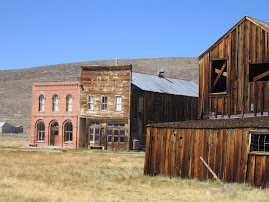
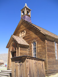
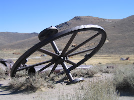
We had heard from Rosalyn Lynch that she and Brian had visited a ghost mining town named Bodie. It was about 30 miles outside of Lee Vining, a town on 395. We headed north for 18 miles and turned east on Rt. 270 to Bodie. It's in a state park off 3 miles of unpaved road at the end of 270. Bodie housed 10,000 people at one time and operated into the 1930's, so that steam powered equipment had been replaced with electric. In earley days it was a rough and tumble town known for gun fights and brawls. Much of it is preserved and some is being rebuilt. It's quite expansive with 25 or 30 buildings and out in the middle of nowhere at 8,000 of elevation. We enjoyed the walk around there.
Heading back on Rt. 270, we had a view of the Sierra stretching as far as the eye could see north and south and sprinkled with white patches of snow field and glaciers struggling to hold on a few more weeks until snows start.
We returned through the park and began looking for fuel. The first place west of Yosemite had gas over $4 and diesal at 3.98. Fortunately, near Groveland things were more reasonable. We filled up and then just missed the finale of a local chilli cook off. It was all gone when we got there.
We exited the park and drove to the intersection with Rt. 395 at Mono Lake. It's a large lake that was piped for some time for western California water and the levels fell and fell. Finally removing water was stopped, but the lake has not regained full level. It takes awhile at these elevations.
We had heard from Rosalyn Lynch that she and Brian had visited a ghost mining town named Bodie. It was about 30 miles outside of Lee Vining, a town on 395. We headed north for 18 miles and turned east on Rt. 270 to Bodie. It's in a state park off 3 miles of unpaved road at the end of 270. Bodie housed 10,000 people at one time and operated into the 1930's, so that steam powered equipment had been replaced with electric. In earley days it was a rough and tumble town known for gun fights and brawls. Much of it is preserved and some is being rebuilt. It's quite expansive with 25 or 30 buildings and out in the middle of nowhere at 8,000 of elevation. We enjoyed the walk around there.
Heading back on Rt. 270, we had a view of the Sierra stretching as far as the eye could see north and south and sprinkled with white patches of snow field and glaciers struggling to hold on a few more weeks until snows start.
We returned through the park and began looking for fuel. The first place west of Yosemite had gas over $4 and diesal at 3.98. Fortunately, near Groveland things were more reasonable. We filled up and then just missed the finale of a local chilli cook off. It was all gone when we got there.
Saturday, September 15, 2007
WOW
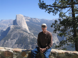
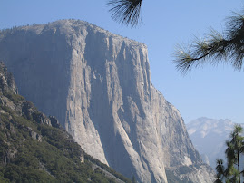
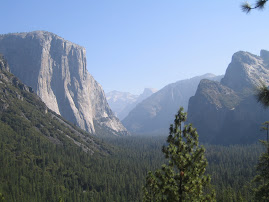
We drove out to Glacier Point in Yosemite Park yesterday. It set a new standard for natural beauty. The views down the valley, to El Capitan, the 3,000' tall granite monolith, and over Half-Dome are indescribable. The drive was very nearly in the same category. There was just a little haze, so we hope pictures come out. A guy who was guiding a small group had climbed to the top of Half Dome the day before with his father. When we were finished gawking at that scene, we continued south to the the Marisposa Grove of old growth Sequoias.
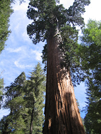
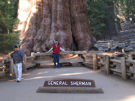
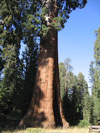
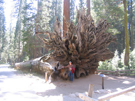
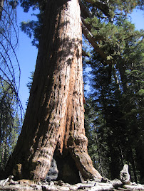
The lots were full, so we had to park 2 miles away and wait for a skuttle bus or walk. For some reason we thought we could walk 2 miles up hill at this altitude and we started out. Less than half way up we put out a thumb and were picked up by a good Samaritan. Once at the top, it was about a mile hike up into the grove where the largest trees stood. As we started a ranger was talking who getting ready to begin a guided tour. We waited and went with the tour. It was well worth it. The sequoias here were dated at about 1800 years old. Dating is not 100 per cent accurate. Sequoias are a little different from coastal redwoods. They are shorter, wider and older, and rarely grow a new tree from a stump sucker as redwoods do. The largest tree in the grove is the Grizzley Tree. It's only 209' tall, but over 30' in diameter. Immense.
By the time we walked and skuttled back down to the car we were walked out and exhilerated. It was a great day.
The lots were full, so we had to park 2 miles away and wait for a skuttle bus or walk. For some reason we thought we could walk 2 miles up hill at this altitude and we started out. Less than half way up we put out a thumb and were picked up by a good Samaritan. Once at the top, it was about a mile hike up into the grove where the largest trees stood. As we started a ranger was talking who getting ready to begin a guided tour. We waited and went with the tour. It was well worth it. The sequoias here were dated at about 1800 years old. Dating is not 100 per cent accurate. Sequoias are a little different from coastal redwoods. They are shorter, wider and older, and rarely grow a new tree from a stump sucker as redwoods do. The largest tree in the grove is the Grizzley Tree. It's only 209' tall, but over 30' in diameter. Immense.
By the time we walked and skuttled back down to the car we were walked out and exhilerated. It was a great day.
Friday, September 14, 2007
Yosemite
The drive from Tahoe to Yosemite is about 150 miles according to map quest. Most of it is on Scenic Byway highways and the ride was gorgeous. Took about 4 hours with the rig and we were on some mighty windy roads getting in here. The Yosemite Valley is tucked into the Sierra Nevada in a way that made it hard to find. The area is bone dry. The forest fire index is extreme. After setting up, we drove into the park. It is absolutely spectacular and amazing. The valley is formed by some of the highest and most severe granite outcroppings in the world. The views down the valley are dramatic. It's like entering a lost world.
We went to the visitors center to get info. Because of the valley's confinement, they have made a huge effort to reduce vehicle traffic and emissions which smog the place up. Free shuttle services are available and we may try them tomorrow. To discourage driving, they have limited parking and the parking available is a long way away from any services.
We went to the visitors center to get info. Because of the valley's confinement, they have made a huge effort to reduce vehicle traffic and emissions which smog the place up. Free shuttle services are available and we may try them tomorrow. To discourage driving, they have limited parking and the parking available is a long way away from any services.
Thursday, September 13, 2007
Sierra Nevada
We had a somewhat slow day yesterday, at least for awhile. We shopped, did laundry, changed a filter on the auxillary fuel tank, and cleaned the RV. Then Dana had a hair appointment and chatted with the stylist. She recommended we check out Gardnerville, Nv. We took Rt. 207 east up and over the mountains, once again going over the 7,000' mark. The drive over and down into the valley was great. It's one of those huge high plains valleys that the pioneers had to cross so that they could climb the mountains on the other side.
From there we went south on Rt. 395 until we turned back west on Rt. 89, a registered Scenic Byway. It was late in the day so the shadows and light were beautiful. The rest of the ride home was marvelous. The Sierra Nevada Range is rugged and bleak through these areas. Rainfall must be minimal. As we looked out over the hundreds of gullies and creak beds, we could imagine prospectors following the waterways up into the mountains looking for gold and silver. I believe the Comstock Load, the largest silver strike ever is near Carson City.
Off to Yosemite today.
From there we went south on Rt. 395 until we turned back west on Rt. 89, a registered Scenic Byway. It was late in the day so the shadows and light were beautiful. The rest of the ride home was marvelous. The Sierra Nevada Range is rugged and bleak through these areas. Rainfall must be minimal. As we looked out over the hundreds of gullies and creak beds, we could imagine prospectors following the waterways up into the mountains looking for gold and silver. I believe the Comstock Load, the largest silver strike ever is near Carson City.
Off to Yosemite today.
Wednesday, September 12, 2007
Caught in the Pass
We took an extended trip around Tahoe. It has to be one of the nicest lake areas in the world. The east side is more developed in the sense that there are more services and stores in the towns there, and they are right on the lake. On the north side, the main road drifts away from the lake, so we took a turn into Incline Village and continued on the lake front. Beautiful homes and villages were tucked in there. At the NW side of the lake, we headed north to Truckee and the Donner Pass State Park.
At the Park we saw a film about the tragic events which occurred there in 1848. A group of pioneers got a late start crossing the Sierra Nevada and then ran into delays. They then ran into a winter the film claimed has not been surpassed to this day in severity. About 90 people were trapped by storms. They split into 3 or 4 separate groups to try to survive. One group chopped down trees to make a shelter. For years the stumps of these trees acted as a marker because the axe cuts were 22' up the trees. Provisions were inadequate so starvation and canabalism followed. Nobody was accused of murder. They ate the dead. Heroic rescue efforts were all thwarted by weather. By the time rescuers got there, only about half were alive. This pass is now crossed by I-80.
We continued south down the west side of Lake Tahoe. The homes become even more spectacular with many having private gates. I'd have to guess that 75 per cent of the shore line is developed with the rest being parklands. For those of you who haven't been here, the lake is basically surrounded by 7,000' mountains, almost like a huge Crater Lake. Many ski areas surround it, and judging by the number of boats and marinas, it's also a popular summer vacation spot. The altitude makes for comfortable summers and lots of snow in winter. We stopped at a couple of state parks on the way around to view the sites. It has to be added to the "I've never seen anything prettier" list, which is getting longer.
At the Park we saw a film about the tragic events which occurred there in 1848. A group of pioneers got a late start crossing the Sierra Nevada and then ran into delays. They then ran into a winter the film claimed has not been surpassed to this day in severity. About 90 people were trapped by storms. They split into 3 or 4 separate groups to try to survive. One group chopped down trees to make a shelter. For years the stumps of these trees acted as a marker because the axe cuts were 22' up the trees. Provisions were inadequate so starvation and canabalism followed. Nobody was accused of murder. They ate the dead. Heroic rescue efforts were all thwarted by weather. By the time rescuers got there, only about half were alive. This pass is now crossed by I-80.
We continued south down the west side of Lake Tahoe. The homes become even more spectacular with many having private gates. I'd have to guess that 75 per cent of the shore line is developed with the rest being parklands. For those of you who haven't been here, the lake is basically surrounded by 7,000' mountains, almost like a huge Crater Lake. Many ski areas surround it, and judging by the number of boats and marinas, it's also a popular summer vacation spot. The altitude makes for comfortable summers and lots of snow in winter. We stopped at a couple of state parks on the way around to view the sites. It has to be added to the "I've never seen anything prettier" list, which is getting longer.
Tuesday, September 11, 2007
Into Tahoe
We drove over from Red Bluff yesterday where temperatures had been in the 100's. We woke up in Tahoe this am and temp must be below 40. It's really cold. We weren't finished up setting up until after 3, so we just took a quick lap around the lake. It is a thing of beauty. The east side is the towns etc. and the west side is more residential, and quite upscale at that. We hadn't been aware that there are casinos here, so we decided to hit the biggest one, Harrah's. It was a dump in what looked like a newer building. After wandering around the slots and tables, we looked at each other and exited.
Today we'll hit the visitors centers and see a little more.
Today we'll hit the visitors centers and see a little more.
Monday, September 10, 2007
Tahoe or Yosemite?
Don't know where we are going from here. The only important thing I had to do yesterday was call both places and see if forest fire smoke was at either. Between the Jets losing to the Pats and losing Pennington and the Giants losing to Dallas and losing Manning,Jacobs, and Umynera, my world went blank. Looks like the start of a very long season. At least in the individual sports arena, Federer and Tiger did what they do and won.
We were in a food store recently and saw lamb steaks, which we'd never seen before. Cooked them up on the grill and they were great. Best part of the day.
We were in a food store recently and saw lamb steaks, which we'd never seen before. Cooked them up on the grill and they were great. Best part of the day.
Sunday, September 9, 2007
Smoke Gets in Our Eyes
Moving east brought us once again into the arid and semi-arid lands east of the Cascades. Yesterday we tried to head north and a little east and ran into smoke from fires which were supposed to be in the northern areas of the state. Lassen National Park was our objective, but as we approached the park, the smoke became more oppressive. It began to remind me of the Glacier-Missoula area where it was really nasty. By the way, the Jocko Lake fire north of Missoula is still burning four weeks after we left. We headed back south to loop home and soon were out of the worst of the smoke.
Our RV park here allows vehicle and RV washing which most don't, so I took advantage and washed the truck and the roof of the RV. It was also Super Saturday at the US Open tennis championship, so we saw some of the action. If you saw any of the Federer-Roddick match, you saw some great tennis. Roddick played about as well as he could and was still taken out in straight sets. Federer looks unbeatable on any surface but clay and has reached 10 consecutive Grand Slam event finals.
Today was a planned downday. We'll do some chores, finish washing the RV and get excited about the Giants game. Eli's comin'.
Our RV park here allows vehicle and RV washing which most don't, so I took advantage and washed the truck and the roof of the RV. It was also Super Saturday at the US Open tennis championship, so we saw some of the action. If you saw any of the Federer-Roddick match, you saw some great tennis. Roddick played about as well as he could and was still taken out in straight sets. Federer looks unbeatable on any surface but clay and has reached 10 consecutive Grand Slam event finals.
Today was a planned downday. We'll do some chores, finish washing the RV and get excited about the Giants game. Eli's comin'.
Saturday, September 8, 2007
Into the Mountains
We left the coastal area and the big trees and headed due east to Red Bluff. The trip changed the climate from cool and humid to hot and arid. From 71 to 92. The ride was very pretty and the multiple ranges of northern Ca. beautiful and rugged. You'd never know that this state has over 36 million people, over half of which are minorities. It's a majority-minority state.
We'll be here for 3 days. Yesterday we ran up to Redding to see the Turtle Bay Park which got high reviews from some quarters. Today we'll go to Lassen National Park, a volcanic area. Tomorrow is a day off to clean vehicles and watch the New York Football Giants kick the hell out of the Bill Parcell-less Cowboys. That's a national game so we'll see it. The Jets-Pats would be lucky to have on TV out here.
We'll be here for 3 days. Yesterday we ran up to Redding to see the Turtle Bay Park which got high reviews from some quarters. Today we'll go to Lassen National Park, a volcanic area. Tomorrow is a day off to clean vehicles and watch the New York Football Giants kick the hell out of the Bill Parcell-less Cowboys. That's a national game so we'll see it. The Jets-Pats would be lucky to have on TV out here.
Friday, September 7, 2007
Avenue of the Giants
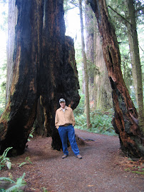
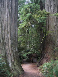
About 20 miles south of Arcata is a 33 mile section of old Rt. 101 known as Avenue of the Giants. It's a road through a large section of old growth forest with many spots to pull over and a number of trails through groves of Redwoods. It's claim to fame is that it's only about 200 miles north of San Fran and the nearest spot a traveler visiting there could go to see these trees. About the most spectacular thing we saw was the Dyerville Giant, a 362' tall, 17 feet in diameter, 1,000,000 pounds, 1600 year old bruiser that fell on March 24, 1991. It fell because another couple trees fell do to extremely wet soil and knocked it over. A person a mile away heard it and thought it was a train wreck. The trunk ran about 200' before the first limbs.
Redwoods at one time were found around the world, but climate changes have reduced the areas they thrive in to the California coast and a spot in China.
We came back on Rt. 101 which runs parallel to the Avenue, and from there, even though it runs right through the forest, you wouldn't know these immense trees are there.
Redwoods at one time were found around the world, but climate changes have reduced the areas they thrive in to the California coast and a spot in China.
We came back on Rt. 101 which runs parallel to the Avenue, and from there, even though it runs right through the forest, you wouldn't know these immense trees are there.
Thursday, September 6, 2007
Flora,Fauna and thoughts
Time for more pictures--but first---Oregon is amazing-ithasrainforests,mountains,desert,rivers of great note, and of course the seashore. Love it all!! We've walked among redwoods with ferns as high as my shoulder,walked lava fields, and the beach looking for agates and sea creaturesand driven down silent green roadways. Our mysterious birds from days ago were ospreys which we have seen carrying fish as they flew by. We've seen sea lions on the rocks and in the water. Never thought anything could be as pretty as this coast.---------D.
More Big Trees
We left Gold Beach and headed down coastal Rt. 101 to the town of Arcata and set up camp. We then backtracked north to hit some of the points of interest in Redwood Park. A commercial attraction that has a gondola (like a ski lift) strung through trees was well adverised and we gave it a shot. Mystery Trees. The mystery is why they installed it in a grove of small trees. It was fair at best.
From there we headed back south through the park. The Lady Bird Johnson Grove was the best in show. About a 1 mile loop trail zig-zagging among gigantic old growth trees. They throw your sense of proportions off. It was spectacular.
From there we headed back south through the park. The Lady Bird Johnson Grove was the best in show. About a 1 mile loop trail zig-zagging among gigantic old growth trees. They throw your sense of proportions off. It was spectacular.
Wednesday, September 5, 2007
From The Redwood Forests...
Before I get going on yesterday, there was something omitted from the day before. After we set up our RV and Greg and Barbara left, we took a ride north on Rt. 101 to Bandon Dunes. For those of you not up on the golf scene, Bandon has become a golf Mecca over the last ten years. They have 3 courses, Bandon Dunes, Bandon Trails, and Pacific Dunes. They are all supposed to be superb. We walked to the rear of the Dunes clubhouse to a restaurant over looking the first tee. It was about 2:00pm and the tee had a constant stream of players teeing off. I don't know their fee schedule, but about $250 is the rate. Most people walk; some with caddies, some carrying their own bag. A few rode carts. The courses are all links style courses being right in the dunes. The wind blew relentlessly. Time for the ol' Long Island trap shot.
Lunch was excellent. Dana had their famous Bandon Cheese Burger and I had a Crab Melt. We wandered over to the pro shop for a look. The Ashworth Tech short sleeve mock turtles were $86. At any rate, everything here looks first rate and world class.
Back to the present. Yesterday we drove south to Brookings, Or., to a Chevy dealership to have some maintainence performed on the truck. Trans fluid, fuel filter, air filter. The brakes have 47,000 on them and the service guy said they still have 80 to 90 per cent of the pads left. They should last about 200,000 miles. Never heard such a thing. Had my second hair cut in 5 months at a salon. Shampoo, massage and trim. Took an hour and a quarter and cost $25. Never heard such a thing.
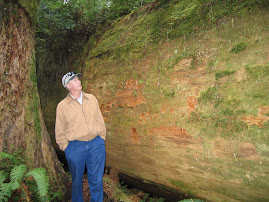
We then headed south to the main event of the day, retracing our path on the way into the area through parts of Redwood National and State Parks. The parks have a northern and southern section and we just did the north area for now. We stopped and took a walk through the Simpson-Reed Grove. It's difficult to find words to describe these things. They grow in an environment of 100" of rain per year plus many days of dense fog off the ocean which provides close to half of the tree's water needs. On sunny days, they transpire about 500 gallons of water. Some trees are over 300' tall and between 500 and 1,000 years old. They have shallow root systems (10-12 feet deep), but their roots intertwine with nearby trees to strenthen one another. The areas in the park are preserved old growth with ferns covering much of the ground between trees. It is really a site to see.
After leaving that area, we continued west on Rt. 199 to a Ranger station. We watched an educational film about the area and then stopped and talked to a Ranger. He suggested that we continue 2 miles east to the Stout Grove and then take Howland Hill Road SW back to Crescent City. The walk through the grove was great, but the drive on this little dirt road through an Redwood forest was unbelievable. It's like Alice in Wonderland. The narrow road twists and turns right next to trees that are up to 20' in diameter. No direct sunlight gets to the ground. We idled along at about 10 mph and just gawked at the scene. Joel's Dad, Jerre, once told me that the giant trees of California were the most awe inspiring things he had scene. He was right on the money.
Lunch was excellent. Dana had their famous Bandon Cheese Burger and I had a Crab Melt. We wandered over to the pro shop for a look. The Ashworth Tech short sleeve mock turtles were $86. At any rate, everything here looks first rate and world class.
Back to the present. Yesterday we drove south to Brookings, Or., to a Chevy dealership to have some maintainence performed on the truck. Trans fluid, fuel filter, air filter. The brakes have 47,000 on them and the service guy said they still have 80 to 90 per cent of the pads left. They should last about 200,000 miles. Never heard such a thing. Had my second hair cut in 5 months at a salon. Shampoo, massage and trim. Took an hour and a quarter and cost $25. Never heard such a thing.
We then headed south to the main event of the day, retracing our path on the way into the area through parts of Redwood National and State Parks. The parks have a northern and southern section and we just did the north area for now. We stopped and took a walk through the Simpson-Reed Grove. It's difficult to find words to describe these things. They grow in an environment of 100" of rain per year plus many days of dense fog off the ocean which provides close to half of the tree's water needs. On sunny days, they transpire about 500 gallons of water. Some trees are over 300' tall and between 500 and 1,000 years old. They have shallow root systems (10-12 feet deep), but their roots intertwine with nearby trees to strenthen one another. The areas in the park are preserved old growth with ferns covering much of the ground between trees. It is really a site to see.
After leaving that area, we continued west on Rt. 199 to a Ranger station. We watched an educational film about the area and then stopped and talked to a Ranger. He suggested that we continue 2 miles east to the Stout Grove and then take Howland Hill Road SW back to Crescent City. The walk through the grove was great, but the drive on this little dirt road through an Redwood forest was unbelievable. It's like Alice in Wonderland. The narrow road twists and turns right next to trees that are up to 20' in diameter. No direct sunlight gets to the ground. We idled along at about 10 mph and just gawked at the scene. Joel's Dad, Jerre, once told me that the giant trees of California were the most awe inspiring things he had scene. He was right on the money.
Tuesday, September 4, 2007
Return to Reality
Once again we woke up and went down to the ocean first thing. It is so serene and beautiful. We called our children and my sister Carol from the beach. After picking up a few more rocks and a piece of drift wood for a souveneir, we climbed back to the house. Barbara and Greg had prepared bacon and eggs for breakfast. As we ate, the eagles and ospreys flew back and forth as if they knew it was time to perform. Amazing.
It was time for us to pack up and return to RV living. We went to our park and set up and Greg and Barbara stopped over to check out our operation. The fifth wheel is pretty nice but an awful long way from their place.
The stay at their place has been a real treat and their hospitality gracious. It was a really wonderful time.
It was time for us to pack up and return to RV living. We went to our park and set up and Greg and Barbara stopped over to check out our operation. The fifth wheel is pretty nice but an awful long way from their place.
The stay at their place has been a real treat and their hospitality gracious. It was a really wonderful time.
Cliffhanging
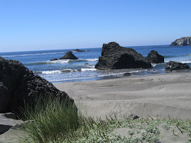
We woke up in the morning and took the tram down to the house and then the path and stairs down to the beach. The last section down is a steep set of aluminum stairs. We went by the tree with the rope around it which served as beach access prior to the installation of the stairs. The beach has huge boulders spotted about along with some smooth sections. It was low tide, so we were able to get on the ocean side of some rocks where tidal pools exist. We found a spot covered with star fish of several colors. Orange and purple mainly. Anemone are everywhere. Beaches here are also covered with smooth rounded stones and much drift wood. Greg has several drift wood sculptures set on the grounds and Barbara has found many agates, which are transparent or translucent stones. The neighboring houses are much higher and back further from the ocean than Greg's. A massive rock outcropping just below the house created the spot lower and closer that they built on. Seals are sunning out on one of the ocean boulders.
When we climbed back up to the house, Greg and Barbara had coffee and bagels ready for breakfast. As we ate, once again eagles and ospreys flew back and forth, sometimes with fish in their tallons. One could easily spend the day just watching the flow of events outside.
Greg has a project going. On the upper level next to the studio, there is a spot which, once some clearing of scrub trees and brush occurred, afforded a view line out to a small island off the coast. He had built a cement block support for a concrete bench, which he had formed and poured. A local contractor friend, Tim, was going to stop over with a skid loader with forks, to set it in place. The bench was reckoned at 700 pounds. Greg wasn't sure exactly when Tim would arrive.
Dana and I set off on a drive up the Rogue River, the main attraction in town. It's a big salmon fishing spot. We went up the north side of the Rogue and made a first stop at the Tu Tu Tun Lodge, a spot which was just awarded the "Best Small Lodge" prize for the second year in a row. We hoped to have lunch but they are not open at lunch to the public. Folks staying there can have lunch prepared by ordering in advance. The lodge is beautiful with a lot of neat spots to relax and view the river. We continued a little further up stream and crossed the river at the Lobster Bridge and returned to the coast on the south side. We stopped back in town and picked up a deli lunch which we ate on the Pacific Beach a bit south of town.
A little after we got back to Cliffhanger, Tim showed up with his skid loader. I went out to watch and help the process. The bench was on blocks in the garage and Tim slid the forks under and brought it outside. In a very slick operation, the bench was soon set with mortar and properly positioned. Greg has had topsoil delivered and will build a berm which will hide the bench from the driveway. As you walk toward the view to the ocean between several berms, the bench area will reveal itself.
We all changed and headed over to the Riverview Restaurant on the south side of the Rogue. We enjoyed a very good meal. By the time we returned home it was time for bed. After Greg and Barbara headed down the tram, Dana and I wandered over to the new bench. It was a clear, dark night. Out here, there is no ambiant light and the stars were vivid and bountiful. It's been a long time since we've seen so bright a sky.
When we climbed back up to the house, Greg and Barbara had coffee and bagels ready for breakfast. As we ate, once again eagles and ospreys flew back and forth, sometimes with fish in their tallons. One could easily spend the day just watching the flow of events outside.
Greg has a project going. On the upper level next to the studio, there is a spot which, once some clearing of scrub trees and brush occurred, afforded a view line out to a small island off the coast. He had built a cement block support for a concrete bench, which he had formed and poured. A local contractor friend, Tim, was going to stop over with a skid loader with forks, to set it in place. The bench was reckoned at 700 pounds. Greg wasn't sure exactly when Tim would arrive.
Dana and I set off on a drive up the Rogue River, the main attraction in town. It's a big salmon fishing spot. We went up the north side of the Rogue and made a first stop at the Tu Tu Tun Lodge, a spot which was just awarded the "Best Small Lodge" prize for the second year in a row. We hoped to have lunch but they are not open at lunch to the public. Folks staying there can have lunch prepared by ordering in advance. The lodge is beautiful with a lot of neat spots to relax and view the river. We continued a little further up stream and crossed the river at the Lobster Bridge and returned to the coast on the south side. We stopped back in town and picked up a deli lunch which we ate on the Pacific Beach a bit south of town.
A little after we got back to Cliffhanger, Tim showed up with his skid loader. I went out to watch and help the process. The bench was on blocks in the garage and Tim slid the forks under and brought it outside. In a very slick operation, the bench was soon set with mortar and properly positioned. Greg has had topsoil delivered and will build a berm which will hide the bench from the driveway. As you walk toward the view to the ocean between several berms, the bench area will reveal itself.
We all changed and headed over to the Riverview Restaurant on the south side of the Rogue. We enjoyed a very good meal. By the time we returned home it was time for bed. After Greg and Barbara headed down the tram, Dana and I wandered over to the new bench. It was a clear, dark night. Out here, there is no ambiant light and the stars were vivid and bountiful. It's been a long time since we've seen so bright a sky.
Monday, September 3, 2007
Gold Beach
We picked up and left Crater Lake heading to the coast and Gold Beach. My brother-in-law Mike Empson's brother lives there in a home he built on a bluff above the Pacific Ocean. He and his wife, Barbara, invited us to stay with them for a couple of days. The trip down was longer than expected because no roads run anywhere near directly through the Coastal Range. We had to angle sw down to Rt. 101 near Crescent City, Ca., and then go back north on 101. The drive was great as we passed through Redwood National Park. We will return there for a stay as we head south next week.
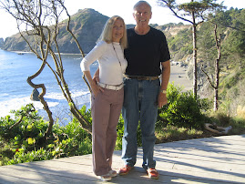
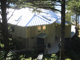
After dropping off the RV at a local place, we headed up to Greg and Barbara's place. It's down a little road a while with a gate that says "Cliffhanger" on it. The entry road curves in through thick undergrowth and trees to an opening on top of the hill. They have two single car garages with a studio/work shop on the second floor. Just ahead is the guest house. It has two sides connected by an open but covered breezeway. The left side has a garden room and the right side has two bedrooms which share an exceptional bathroom. At the front of the guest house central breezeway is a cable driven tram which descends to the front porch of the main house.
I could write quite awhile about the many features and views. It will have to be in a Housing Magazine at some time. Greg and a local builder designed and constructed the home and left no stone unturned. Greg continues fine-tuning with projects that he designs and builds. It is an amazing structure which was built into the natural features of the land. Everywhere a view to the ocean is possible is used. The rear of the home is a window wall which lends a panoramic view up and down the coast. Eagles fly by with fish. Ospreys abound. A deck wraps around the exterior and is built so that rails which would obstruct the view were unnecessary.
Greg and Barbara got us settled in and prepared a fine meal. We talked so much that we never took the path and steps down to the beach before dark. Greg and Barbara are both interested and engaged folks. In the two years or so that they've been here, they've gotten to know just about the whole town, and all their neighbors up and down the coast. We took the tram back up to the guest house and fell off to the beat of the waves on the beach.
After dropping off the RV at a local place, we headed up to Greg and Barbara's place. It's down a little road a while with a gate that says "Cliffhanger" on it. The entry road curves in through thick undergrowth and trees to an opening on top of the hill. They have two single car garages with a studio/work shop on the second floor. Just ahead is the guest house. It has two sides connected by an open but covered breezeway. The left side has a garden room and the right side has two bedrooms which share an exceptional bathroom. At the front of the guest house central breezeway is a cable driven tram which descends to the front porch of the main house.
I could write quite awhile about the many features and views. It will have to be in a Housing Magazine at some time. Greg and a local builder designed and constructed the home and left no stone unturned. Greg continues fine-tuning with projects that he designs and builds. It is an amazing structure which was built into the natural features of the land. Everywhere a view to the ocean is possible is used. The rear of the home is a window wall which lends a panoramic view up and down the coast. Eagles fly by with fish. Ospreys abound. A deck wraps around the exterior and is built so that rails which would obstruct the view were unnecessary.
Greg and Barbara got us settled in and prepared a fine meal. We talked so much that we never took the path and steps down to the beach before dark. Greg and Barbara are both interested and engaged folks. In the two years or so that they've been here, they've gotten to know just about the whole town, and all their neighbors up and down the coast. We took the tram back up to the guest house and fell off to the beat of the waves on the beach.
Crater Lake Redoux
Well Crater was so pretty the first time that we decided to do it again. Once again we went around clock-wise , but this time we ran down to Klamath Falls when we hit the southern gate to the park. Wished we hadn't. When we got back to Rim Drive, we headed right in to the Crater Lake Lodge for a very late lunch. We started out with the NW Chowder and a salad and then moved on to risotto and beaf tid-bits. Quite fine. We walked out onto the porch facing the lake for the view of the century. It was a perfect blue-sky day and the water looked bluer than normal, which is saying a lot.
We stopped at a number of other overlooks on the way back. It is just a spectacular beauty.
We stopped at a number of other overlooks on the way back. It is just a spectacular beauty.
Friday, August 31, 2007
Crater Lake
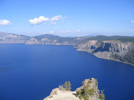
The drive down from Blue River was uneventful and quite pretty. Went past a few of these lava flows again. We set up in an RV park just north of Crater at Diamond Lake. We went down to the top of the lake and decided to go clockwise around it. Crater Lake was formed when 12,000' Mount Mazama erupted and then collapsed about 7,700 years ago. Later eruptions formed Wizard Island inside the caldera and the flows from the new caldera coated the inside of the opening. Since then, rain and snow melt filled the hollow creating the lake. Today, precipitation and evaporation are about equal and the lake fluctuates about three feet in height. The area rceives about 66" of precipitation per year with annual snow fall of 500". No streams flow in or out of Crater Lake.
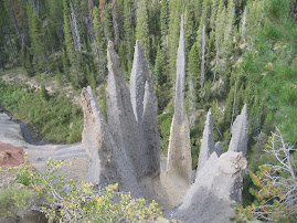
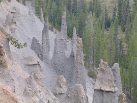
The ride on Rim Road is just spectacular. Yesterday we stopped at a few spots including Cloudclap Overlook, Phantom Ship Overlook and walked along the Sinnott Memorial Overlook. We also took a short side trip out to The Pinnacles, a group of spires which eroded from canyon walls. The spires are fossil fumaroles where volcanic gases rose through hot ash deposits cementing the ash into harder rock.
On the way way back around, thunderstorms began building and moving over the lake. We stopped at an overlook on the lake to watch. The storm slowly moved across the lake and finally got to us. It then intensified and began to hail. We vacated the area and headed for home, but the storm caught us and we finally had to pull over in the midst of a severe hail storm. The temperature had fallen to 40 degrees. The ice stayed on the truck for several hours after the storm, but fortunately no dents to the truck. Thunderstorms continued late into the evening and I wouldn't be surprised if some flash floods occurred.
Rim Road is about 33 miles around the lake. We will do it again today with a detour down to Klamath Falls if time allows.
The ride on Rim Road is just spectacular. Yesterday we stopped at a few spots including Cloudclap Overlook, Phantom Ship Overlook and walked along the Sinnott Memorial Overlook. We also took a short side trip out to The Pinnacles, a group of spires which eroded from canyon walls. The spires are fossil fumaroles where volcanic gases rose through hot ash deposits cementing the ash into harder rock.
On the way way back around, thunderstorms began building and moving over the lake. We stopped at an overlook on the lake to watch. The storm slowly moved across the lake and finally got to us. It then intensified and began to hail. We vacated the area and headed for home, but the storm caught us and we finally had to pull over in the midst of a severe hail storm. The temperature had fallen to 40 degrees. The ice stayed on the truck for several hours after the storm, but fortunately no dents to the truck. Thunderstorms continued late into the evening and I wouldn't be surprised if some flash floods occurred.
Rim Road is about 33 miles around the lake. We will do it again today with a detour down to Klamath Falls if time allows.
Thursday, August 30, 2007
Bend,Sisters and Redmond
We toured over through the above listed towns yesterday. They are just on the east side of the Cascades and so enjoy a 300 plus sunny days a year climate. Bend has about 75,000 people and looks to be a humming economy. Sister's looks like a small but nice tourist place and Redmond is more a country town. On the way we stopped at Sahalie Falls which was quite a scene. A rushing mountain stream forced through a narrow opening and down 120'. The spray was expansive and the rapids below just gorgeous. Just past that we ran into lava flows from eruptions about 3,000 years ago. Some have trees and plant growth covering it, but some looks like it cooled yesterday. There are two different types of lava named by Hawaians. One means rough and craggy and the other is smooth. This was the rough and craggy. Goes on for miles. We then stopped at Lava Butte National monument which was more and wider of the same. Today we head down to Crater Lake.
Wednesday, August 29, 2007
Sea Lion Caves
Yesterday we drove over to the coast of Oregon at Florence and headed north on Rt. 101. The Florence area is known for it's sand dunes which get as high as 300 feet. We stopped at a number of state parks and scenic views along the way. Sea Lion cave has an elevator to take you down to the edge of the cliffs where sea lions colonize. At this time of year they tend to be feeding in the ocean and not on the rocks where they tend their young in spring. We saw a number of them swimming around. They're a larger animal than I thought with males averaging 1500 pounds and some getting as large as 2000 pounds.
Further up the coast, we stopped at Cape Perpetua, another well known spot. We turned back east at Walport, a bit south of Jim Carson's hometown of Newport. We went through Corvallis and continued east on Rt. 20 back into the Willamette National Forest and more big trees. Logging is again a huge industry in the Cascades. We saw trucks with some logs which must have been 6-8 feet in diameter. They were down to 4 or 5 logs per truck. A lot of fruit and vegtables are grown in the area and we stopped and picked up some excellent produce which even turned out to be organic.
Further up the coast, we stopped at Cape Perpetua, another well known spot. We turned back east at Walport, a bit south of Jim Carson's hometown of Newport. We went through Corvallis and continued east on Rt. 20 back into the Willamette National Forest and more big trees. Logging is again a huge industry in the Cascades. We saw trucks with some logs which must have been 6-8 feet in diameter. They were down to 4 or 5 logs per truck. A lot of fruit and vegtables are grown in the area and we stopped and picked up some excellent produce which even turned out to be organic.
Tuesday, August 28, 2007
Blue River, Oregon
We left Portland yesterday and drove down to the town of Blue River, about 30 miles east of Eugene. It's a big golf and resort area. We got lost once in a detour in Springfield. We set up and took a ride down Scenic Hwy 19 into the Willamette National Forest. We ended up at the Constitutional Grove, a grove of trees along a path with a tree labeled for each signer of the constitution. The grove was doug firs and red cedars and quite impressive. It was darkish in there in the middle of the day.
Monday, August 27, 2007
More Portland
We did a little shopping in the am yesterday, then met up with Kim who took us for a tour of Portland. We took a tram ride at a new hospital facility which connects the lower portion on the Willamette River with an upper portion way up on the hillside. It gives a terrific view of the city. After that, we went to one of the many city parks, which was abuzz with activity. There were a couple musical events going on, several parties and multitudes of people riding bikes, jogging and dog walking everywhere. The park we were at could have been an auboretum, with sequoia, beech and doug firs all over.
The people here seem to be an outdoor-active bunch. Bike riders everywhere. The other day returning from central Oregon, we passed the annual Hood to the Beach run. It's a relay which travels about 197 miles. There were hundreds of runneres involved.
When Brad got back from work, we headed into downtown to the Portland City Grill, which is located on the 30th floor of one of the taller buildings in town and faces out to Mt. Hood. The clouds eventually parted enough to get a blurred view of the mountain under a full moon. It's quite a site. We've had a wonderful visit with Brad and Kim and look forward to seeing them in Peru.
The people here seem to be an outdoor-active bunch. Bike riders everywhere. The other day returning from central Oregon, we passed the annual Hood to the Beach run. It's a relay which travels about 197 miles. There were hundreds of runneres involved.
When Brad got back from work, we headed into downtown to the Portland City Grill, which is located on the 30th floor of one of the taller buildings in town and faces out to Mt. Hood. The clouds eventually parted enough to get a blurred view of the mountain under a full moon. It's quite a site. We've had a wonderful visit with Brad and Kim and look forward to seeing them in Peru.
Sunday, August 26, 2007
The Big Bang
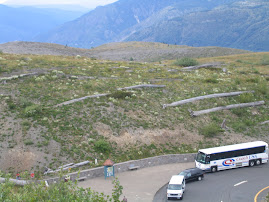
We drove up to Mount St. Helens yesterday to view the devastation from the May 18, 1980, eruption. The eruption was triggered by an earthquake which caused a massive landslide that covered 14 miles of river valley to an average depth of 150'. The landslide released trapped magma and gas producing a lateral blast of hot rock and ash. In less than 10 minutes, 230 square miles of trees were leveled. The mountain lost 1300' of height and .67 cubic miles of volume. Cement like slurries of glacial melt and boulders called lahars scoured and buried streams draining the volcano. An ash eruptions rose 15 miles up from the crater and lasted 9 hours. Avalanches of pumice and hot gasses called pyroclastic flows, shot down slopes to the north.
A number of people were killed or went missing (30-40). The eruption occurred on a Sunday morning. On Monday, thousands of loggers would have had little chance of survival. But as bad as it was, the blast was small in comparison to some previous ones. One quite a bit larger occurred in 1800. And evidence suggests that 3500 years ago an eruption occurred which left a vein of pumice from a pyroclastic flow a meter thick which runs all the way north over Mt. Ranier and into British Columbia. About 40 times more powerful than the 1980 blast.
The Visitors Center on the way in is run by Washington State Parks and had a terrific movie about the lead up to and the day of the blast. Some stories of survivors are remarkable. We continued out to the Johnson Ridge Observatory which is about 5 miles away from the still active crater. We caught a young Ranger giving a presentation on the events as we looked over the site. People were spellbound by the scope. The volcano has developed a lava dome and material is still flowing in at an amazing rate. The new dome is at 1300 feet. Unfortunately, clouds obscured our site into the crater, but the surrounding area is spectacular. As President Jimmy Carter said when he was flown over the area, "It makes a moonscape look like a golf course."
We got back and headed over to Brad and Kim's where they prepared the Peruvian national meal, ceviche, which is raw fish, in this case cod and tilapia, marinated in lime juice and spices, served with a sauted sweet potato. The acid in the lime juice "cooks" the fish. It was great.
A number of people were killed or went missing (30-40). The eruption occurred on a Sunday morning. On Monday, thousands of loggers would have had little chance of survival. But as bad as it was, the blast was small in comparison to some previous ones. One quite a bit larger occurred in 1800. And evidence suggests that 3500 years ago an eruption occurred which left a vein of pumice from a pyroclastic flow a meter thick which runs all the way north over Mt. Ranier and into British Columbia. About 40 times more powerful than the 1980 blast.
The Visitors Center on the way in is run by Washington State Parks and had a terrific movie about the lead up to and the day of the blast. Some stories of survivors are remarkable. We continued out to the Johnson Ridge Observatory which is about 5 miles away from the still active crater. We caught a young Ranger giving a presentation on the events as we looked over the site. People were spellbound by the scope. The volcano has developed a lava dome and material is still flowing in at an amazing rate. The new dome is at 1300 feet. Unfortunately, clouds obscured our site into the crater, but the surrounding area is spectacular. As President Jimmy Carter said when he was flown over the area, "It makes a moonscape look like a golf course."
We got back and headed over to Brad and Kim's where they prepared the Peruvian national meal, ceviche, which is raw fish, in this case cod and tilapia, marinated in lime juice and spices, served with a sauted sweet potato. The acid in the lime juice "cooks" the fish. It was great.


Saturday, August 25, 2007
John Day Fossil Beds
Brad, Kim, Dana and myself hooked up the RV and drove out to Prineville, Or., to see some of the central part of the state. Oregon is the 10th largest state. After we set up, we went over to Smith Rock, a very poular rock climbing formation, and a beautiful spot. We hiked around a bit and saw a couple interesting birds we'll have to look up. Brad and I made it up to Monkey Face Rock, a large rock balanced on a ridge. I was unable to ascend the last few rocks to the ridge as I'm not in peak condition and not particularly comfortable with heights. It was a great canyon type view with shear rock faces all around us.
In the am. we hooked up the RV and began a loop to visit the three locations of the famed John Day Fossil Beds. They were named for an early pioneer who, with partner, were robbed of everything they had including clothes, by indians. The larceny occurred at the confluence of the a river known as the Maw-Maw and the Columbia. The men survived and as the story spread, people began to refer to the Maw-Maw as the John Day River. The river runs south from the Columbia into central Oregon and through the area where fossils began to be found. So the famous beds took on the name of a guy who was wondering around naked and new nothing of fossils.
Over millions of years, multiple volcanic eruptions laid layer upon layer of ash and lava down which encased the flora and fauna of that particular time. Fossils from all these eras have been discovered with many new and unheard of species being found. The Beds are in three different locations. The Painted Hills Unit has a walking path through some incredible hummocks and hills. The colors are amazing. From there we hit the Sheep Rock Unit where a very interesting visitors center is located. The museum was neat and they ran a film which detailed what they knew and how this area formed. They even allowed Tikki and Gwen, their dogs into the air conditioned theatre to watch. After that we ate a picnic lunch and turned toward home and the Clarno Unit. The ride over was one of the best parts of the trip. The scenario was very similar to the North Dakota Badlands area. Steep, colorful and craggy.
On the ride home we took Rt 26 which runs past Mount Hood. Near the high point on the road we began to see signs for the Hood to the Coast Relay, an annual event where teams form and run legs of a relay all the way to Cannon Beach, about 150 miles away. There must have been hundreds of teams and it looked like a very well organized event. The road was littered with runners of all sizes and shapes. It made for interesting conversation as we passed hundreds and hundreds of runners.
We got back to our RV Park a little after eight and set up and went out to a bar-b-que joint for dinner. A long day.
In the am. we hooked up the RV and began a loop to visit the three locations of the famed John Day Fossil Beds. They were named for an early pioneer who, with partner, were robbed of everything they had including clothes, by indians. The larceny occurred at the confluence of the a river known as the Maw-Maw and the Columbia. The men survived and as the story spread, people began to refer to the Maw-Maw as the John Day River. The river runs south from the Columbia into central Oregon and through the area where fossils began to be found. So the famous beds took on the name of a guy who was wondering around naked and new nothing of fossils.
Over millions of years, multiple volcanic eruptions laid layer upon layer of ash and lava down which encased the flora and fauna of that particular time. Fossils from all these eras have been discovered with many new and unheard of species being found. The Beds are in three different locations. The Painted Hills Unit has a walking path through some incredible hummocks and hills. The colors are amazing. From there we hit the Sheep Rock Unit where a very interesting visitors center is located. The museum was neat and they ran a film which detailed what they knew and how this area formed. They even allowed Tikki and Gwen, their dogs into the air conditioned theatre to watch. After that we ate a picnic lunch and turned toward home and the Clarno Unit. The ride over was one of the best parts of the trip. The scenario was very similar to the North Dakota Badlands area. Steep, colorful and craggy.
On the ride home we took Rt 26 which runs past Mount Hood. Near the high point on the road we began to see signs for the Hood to the Coast Relay, an annual event where teams form and run legs of a relay all the way to Cannon Beach, about 150 miles away. There must have been hundreds of teams and it looked like a very well organized event. The road was littered with runners of all sizes and shapes. It made for interesting conversation as we passed hundreds and hundreds of runners.
We got back to our RV Park a little after eight and set up and went out to a bar-b-que joint for dinner. A long day.
Thursday, August 23, 2007
First Two Days
Yesterday's blog disappeared into cyber space for some reason. We had a fairly slow first day as Brad and Kim both worked. We met for dinner at Jake's Crawfish House, a truly great restaurant in Portland. Tim Eckstein joined us and it was good to see him. Our meals were fantastic.
Yesterday Brad and I golfed at a local muni course while Dana and Kim shopped. The course was well maintained with quick greens. Payed very poorly but had a good time. In the evening we went to a concert by Wilco, an alternative style band, which was outstanding. It was at an outdoor venue on a beautiful night.
Am reading reading a relatively new biography of Mao Tse Tung. He made Stalin and Hitler look like choir boys. They attribute 70 million deaths to him, the majority by intentinal starvation. He fed people less than concentration camp prisoners and sold the harvests to fund his Great Leaps Forward, which were almost entirely for military production.
Yesterday Brad and I golfed at a local muni course while Dana and Kim shopped. The course was well maintained with quick greens. Payed very poorly but had a good time. In the evening we went to a concert by Wilco, an alternative style band, which was outstanding. It was at an outdoor venue on a beautiful night.
Am reading reading a relatively new biography of Mao Tse Tung. He made Stalin and Hitler look like choir boys. They attribute 70 million deaths to him, the majority by intentinal starvation. He fed people less than concentration camp prisoners and sold the harvests to fund his Great Leaps Forward, which were almost entirely for military production.
Tuesday, August 21, 2007
Portland, Oregon
We set up in Fairview, Or., yesterday, which is in the NE side of town. A typical urban RV park. Spaces are tight, but the location is good, only about 15 minutes from where Brad and Kim live. The drive down was rainy and when it rains out here, it pours. We set up in a pretty good shower and went over to see Brad and Kim. They rent a house in a nice residential neighborhood, probably 50's or 60's vintage. I believe the style is craftsman, and many homes in town are this type. Real estate in Portland seems quite pricey, just about equaling NJ prices. Portland is a nice small city with a lot of attractions and a large number of people who bicycle everywhere. They ride in traffic like a car and take a little getting used to. When you look both ways at intersections, better keep an eye out for them.
Brad and Kim live with two dogs, Tiki and Gwen, one small, one large. Kim is actively seeking a new job as she recently received her Masters degree in social work. She has several applications out and is also looking at possible promotion with her current organization. Brad works for Precision Garage Door, a nation wide franchise group. They both love the Portland area and are very outdoors oriented.
Brad and Kim live with two dogs, Tiki and Gwen, one small, one large. Kim is actively seeking a new job as she recently received her Masters degree in social work. She has several applications out and is also looking at possible promotion with her current organization. Brad works for Precision Garage Door, a nation wide franchise group. They both love the Portland area and are very outdoors oriented.
Monday, August 20, 2007
The Burke Museum
The museum is at the U of Wa. in Seattle and is hosting an exhibit of native american art. It had some interesting stuff and a few totems outside. A terrific photo gallery on the concept of joining Glacier, Yellowstone, and a corridor up through Canada into the first International Park. Of course the artist is German and they wouldn't have to chip in anything. Or they could base it on the UN and we could donate the land, pay for everything , and let people from other countries do anything they want with immunity. Well it's a college campus, what can you expect. The museum also had a floor on Pacific Rim Cultures. It was ok, but after the Charlie Russell Museum in Great Falls, everything else seems lame.
Off to Portland, Or., today and a visit with Brad and Kim.
Off to Portland, Or., today and a visit with Brad and Kim.
Sunday, August 19, 2007
Mount Ranier
We made the ride over to mighty Mount Ranier yesterday. Ranier is about 14,400' and the tallest point in Washington. It's almost perfectly symetrical, the perfect volcano. Unfortunately, the weather has turned on us and it's been on and off rain with cloud covers. Not good for mountain observations. Also unfortunately, not all the roads around and through the park are open. There are still some snow closed roads which haven't opened this year, and some areas, trails and roads were severely damaged by heavy rains last year. It cut channels down the sides of the mountain to bedrock. All of this is second hand as the clouds would not allow a view. It also appears that the park needs some upgrades to handle the amount of traffic it receives. Like Glacier, stops for points of interest have inadequate parking and are often full. We weren't able to stop at Paradise Point, one of the primary attractions. The shuttles that are available run every 45 minutes, and anyway this is America where people drive their cars to where they want to go. It was along drive without much to show for it.
Saturday, August 18, 2007
Local Native Art
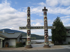
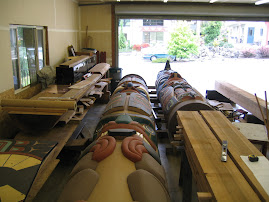
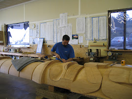
The last couple days we stopped at a two local art places of interest. The first was a carver of totem poles. There are about 7 different styles of totem carving which vary by group running basically north from here to Alaska.. The best known are ones from the Vancouver, Canada, area. At any rate the carver we spoke with was a busy guy. He had a couple finished ones laying horizontally in his shop and one that was in the carving phase. The wood for the largest one, which was huge and all painted and ready to go, came from a 600-700 year old Red Cedar. The wood cost the carver $22,000. At any rate, he was generous with his time and answered our questions. They use computers now to help with lay out and design. If you want one, you consult with the carver about the story you want told. I was trying to figure out how to tell the story about how the Jersey government spent billions of dollars to replace 56 inner city schools and ran out of money with only half completed. The pole would have been too high with many snakes wrapped around it.
The second place we stopped was a gallery advertised from the road and up a steep slope. These people did prints, carvings, weaving and specialized in glass. They were experimenting with a couple new techniques for firing glass with micas and silica sprinkled on to create special effects. It was interesting. They are leaving for an exibition at the University of Washington in Seattle over the weekend. We may go as the exibit is near the Seattle Museum with it's totem pole room.
The second place we stopped was a gallery advertised from the road and up a steep slope. These people did prints, carvings, weaving and specialized in glass. They were experimenting with a couple new techniques for firing glass with micas and silica sprinkled on to create special effects. It was interesting. They are leaving for an exibition at the University of Washington in Seattle over the weekend. We may go as the exibit is near the Seattle Museum with it's totem pole room.
Friday, August 17, 2007
Rain Forest Over-Nighter
We decided to divide and conquer by staying over night in the town of Forks, Wa. It allowed us to see as much of the western side of the Olympic Pennisula as we wanted. The drive to Forks was about 3 hours, but because we took some detours, up the Elwha Valley and near lake Crescent it took longer than that. We took a little room in Forks, which turned out to be lucky because by the time we returned to town, every place was "No Vacancy."
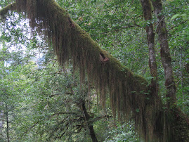
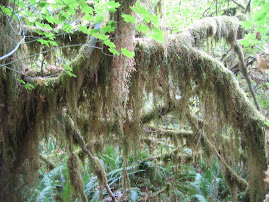
We got right back on the road and headed for the Hoh Rain Forest. The valley is on the western side of the Olympic Range and is at an elevation of about 570'. Annual rainfall is 142". The ride in is eerie. As in the south, moss hangs like a shroud on every surface including limbs, bark and rocks. The forest floor is fern covered and littered with ancient logs, mostly covered with moss and ferns also. Trees over 250' tall loom over the landscape. Some areas are so dense that almost no light reaches inside the canopy. Occasional groves of maples have a glow. The moss covers all the limbs almost to the exclusion of leaves. The entire area is an amazing tree growing machine. Lots of moisture and fertile, well draining soils provide a perfect enviroment for firs, spruces, cedars and hemlocks to thrive. The National Park has some virgin forest areas, but most of the pennisula has been logged, some areas multiple times. These areas seem to be closely monitored and many are labelled as to when they were last harvested, replanted, and when the next harvest is anticipated.
We headed back to Forks and then out to Rialto Beach. Bought some smoked salmon in Mora. Hope it's as good as the samples.
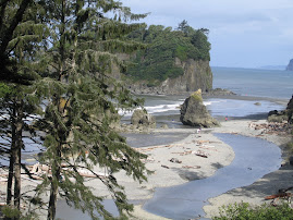
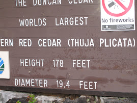
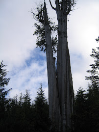
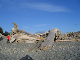
Friday we got up and drove around the south side of the park. Stopped at Ruby Beach, a gorgeous spot just off Rt. 101. Another spot with abundant washed up trees along the shore line. The rest of the ride was mile after mile of forests in various stages of growth. It appears that 20 years yields about 25 to 30 feet of verticle. Drove in aways to view a couple huge old trees, one about 20' in diameter. About 1900 years old. Amazing.
We got right back on the road and headed for the Hoh Rain Forest. The valley is on the western side of the Olympic Range and is at an elevation of about 570'. Annual rainfall is 142". The ride in is eerie. As in the south, moss hangs like a shroud on every surface including limbs, bark and rocks. The forest floor is fern covered and littered with ancient logs, mostly covered with moss and ferns also. Trees over 250' tall loom over the landscape. Some areas are so dense that almost no light reaches inside the canopy. Occasional groves of maples have a glow. The moss covers all the limbs almost to the exclusion of leaves. The entire area is an amazing tree growing machine. Lots of moisture and fertile, well draining soils provide a perfect enviroment for firs, spruces, cedars and hemlocks to thrive. The National Park has some virgin forest areas, but most of the pennisula has been logged, some areas multiple times. These areas seem to be closely monitored and many are labelled as to when they were last harvested, replanted, and when the next harvest is anticipated.
We headed back to Forks and then out to Rialto Beach. Bought some smoked salmon in Mora. Hope it's as good as the samples.
Friday we got up and drove around the south side of the park. Stopped at Ruby Beach, a gorgeous spot just off Rt. 101. Another spot with abundant washed up trees along the shore line. The rest of the ride was mile after mile of forests in various stages of growth. It appears that 20 years yields about 25 to 30 feet of verticle. Drove in aways to view a couple huge old trees, one about 20' in diameter. About 1900 years old. Amazing.
Thursday, August 16, 2007
Cape Flattery or Bust
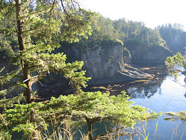
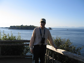
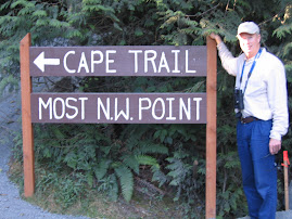
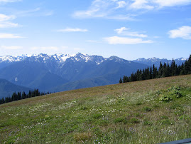
Exploration of the Olympic Pennisula was started full scale. We drove out to Hurricane Ridge, a ridgeline of Olympic Mountain peaks ranging from 5800' to 6700 ' many snow capped. Some areas on the pennisula receive massive amounts of precipitation. The wind packed snow builds up and feeds many glaciers. One of the info boards said that the packed and heavy ice and snow goes through a structural change into glacier ice which can then move. We also made a stop at Dungeness National Wildlife Refuge, a bay formed by a spit of sand five miles long. We pushed on following Rt. 112 all the way out to Cape Flattery, the most NW point in the country. Some folks try to get to all four points, with Key West, a place near San Diego and a spot in Maine being the other three. The path and board walk out to the viewing site were gorgeous, cutting through a forest of Doug Firs, Red Cedars , Hemlock etc. The ferns grow three or four feet high and are thick, as is the forest itself. Foliage looks so dense as to be impenitrable Saw a large herd of elk on the way back. It was a long, long ride and we didn't get home until 11:00 PM. The area is so large we may have to consider staying a night out on the far side of the park to avoid the three hour ride back and forth.
Wednesday, August 15, 2007
Hoodsport
We drove around Seattle, Tacoma and Olympia to get to the Hood Canal and our RV park in Hoodsport, Wa. Hood Canal is actually a fjord and subject to great tidal swings. The tide was out when we set up revealing mud flats where people clam and oyster. When we returned from a ride up to the Townsend Ferry, the tide was in and we were surprised at how high it was. Quite a shift.
On the ride down, we were able to get a pretty good look at Mt. Ranier which overlooks and dominates the sky view around Seattle. Ranier is over 14,400 feet high. It's so big that it looks as if it's right in town. Very similar to the way Mt. Hood overlooks Portland, Or. Ranier is a volcano and not dormant. The area is very populated and if that baby ever lets loose it's a big problem. "Where Do You go When the Volcano Blows?" as Jimmy Buffet would say. Actually, I believe Tacoma is the spot that all the mud and stuff would drain towards.
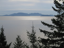
On the ride to Townsend, we stopped at a couple State Parks overlooking the Canal. From one we had a great view across the Puget Sound to Mt. Baker. Today we start further exploration of Olympic National Park. There seems to be an almost cult like interest in this area, expressed by several readers. I doubt if we penetrate the Huang Rain Forest deep enough to find Sasquatch, but you can add one to your golf bag at your local pro-shop. Tiger could use your support.
On the ride down, we were able to get a pretty good look at Mt. Ranier which overlooks and dominates the sky view around Seattle. Ranier is over 14,400 feet high. It's so big that it looks as if it's right in town. Very similar to the way Mt. Hood overlooks Portland, Or. Ranier is a volcano and not dormant. The area is very populated and if that baby ever lets loose it's a big problem. "Where Do You go When the Volcano Blows?" as Jimmy Buffet would say. Actually, I believe Tacoma is the spot that all the mud and stuff would drain towards.
On the ride to Townsend, we stopped at a couple State Parks overlooking the Canal. From one we had a great view across the Puget Sound to Mt. Baker. Today we start further exploration of Olympic National Park. There seems to be an almost cult like interest in this area, expressed by several readers. I doubt if we penetrate the Huang Rain Forest deep enough to find Sasquatch, but you can add one to your golf bag at your local pro-shop. Tiger could use your support.
Tuesday, August 14, 2007
Picture Day
Since both of us are recovering from colds, we took an easy day. Got blog pictures up to date, went shopping for groceries and visited a local arboritum at Western Washington U., right here in uptown Billingham. Leave this am for Hoodsport, over on the Olympic Pennisula. Mt. Ranier and Olympia National Park to follow.
Monday, August 13, 2007
Hi--Dana blogger back after Bruce took a lesson from Rob on how to re-organize my pictures that were in disarray after a surprise sneeze sent them all to ----!! (I was outside with Linda chatting and keeping her little friend,Mia, company). Flowers again--I whined for a couple of weeks about missing my wildflowers, but we've been enjoying the displays ever since--up in the mts. and now here in Washington--the gold colors of late summer and lupines. Ibought a bouquet of dahlias for $4 from a help yourself roadside stand--I think of Marilyn Eckstein when I see them--she always had such a lovely display--you can see it from the road.
We are constantly amazed at the beauty of this country, from windswept and barren to these gorgeous views of the Cascades and San Juan Islands. The Olympia National Forest is next!!!
We are constantly amazed at the beauty of this country, from windswept and barren to these gorgeous views of the Cascades and San Juan Islands. The Olympia National Forest is next!!!
Fins
We took a whale watching boat out of Bellingham yesterday to see if we could catch up with some orcas. The San Juan Islands are a well known habitat for them and sitings are frequent. Unfortunately, the resident whale are out of town. There are two pods that frequent the area and resident orcas eat only salmon. At this time of year the runs are about wound down and the whales are further out torward the ocean. Fortunately, there was a pod or pack of transcient whales in the area. These whales eat everything they can find. The local harbor seals and sea lions are very aggitated when the transcients are in town. Sea lions have been known to jump into boats to escape. The transcients however do not do any of the jumping out of the water tricks that the residents do and normally all you see are dorsal fins sticking out of the water. We road all the way out to Canadian waters near Victoria Island to see them, about a 3 hour ride. It was cold and everyone was bundled up multiple layers. All the whale watching boats from the American and Canadian side were in the area the whales were swimming, about 15 boats all together. We had a few good looks at them but the moment is brief. After about an hour of following them around, we headed back in. The bonus was a pretty good tour of the San Juans.
I missed the final round of the PGA do to the whales, but Grant called us and gave a report of the almost failure of Tiger to hold on. Apparently, Ernie and Woody gave it a pretty good run, but Tiger came back with a birdie after a bogie. Number 13.
I missed the final round of the PGA do to the whales, but Grant called us and gave a report of the almost failure of Tiger to hold on. Apparently, Ernie and Woody gave it a pretty good run, but Tiger came back with a birdie after a bogie. Number 13.
Sunday, August 12, 2007
The Chuckanut Drive
Dana spent the am at a Bellingham city craft show where streets are blocked off etc., while I checked out ferry and whale watching posabilities. She got some art pottery and I found out that the whales have been further out in the sound, beyond most tourist boat ranges. The orcas are very unpredictable and we hope they come back in today.
After that, we found an article about a scenic by-way called the Chuckanut Drive. It's also known as Rt. 11 and runs from Fairhaven, just south of Bellingham to Burlington, about 25 miles south. The road was built in the late 1800's, and is a windy, twisty one and very narrow. It dips in and out along the rugged coast line and has a number of overlooks to view Bellingham Bay and the Puget Sound. Along the way it passes a few oyster farms and restaurants specializing in oysters. My taste for oysters has been low recently. Somewhere I read an article by a chef out here that oysters should not be eaten raw during warm months and that they are better cooked all the time. Jim and Sandra Carson might disagree with that. Anyway, we passed on this opportunity. The road eventually came out to some flats where a beautiful view of Mt. Baker was revealed in all it's snow-capped glory.
Between these events, I caught a little PGA action, with Tiger leading by between 2 and 5 shots. Hopefully the last round will have some excitement.
After that, we found an article about a scenic by-way called the Chuckanut Drive. It's also known as Rt. 11 and runs from Fairhaven, just south of Bellingham to Burlington, about 25 miles south. The road was built in the late 1800's, and is a windy, twisty one and very narrow. It dips in and out along the rugged coast line and has a number of overlooks to view Bellingham Bay and the Puget Sound. Along the way it passes a few oyster farms and restaurants specializing in oysters. My taste for oysters has been low recently. Somewhere I read an article by a chef out here that oysters should not be eaten raw during warm months and that they are better cooked all the time. Jim and Sandra Carson might disagree with that. Anyway, we passed on this opportunity. The road eventually came out to some flats where a beautiful view of Mt. Baker was revealed in all it's snow-capped glory.
Between these events, I caught a little PGA action, with Tiger leading by between 2 and 5 shots. Hopefully the last round will have some excitement.
Saturday, August 11, 2007
Anacortes and Mt. Baker
We decided to investigate touring the San Juan Islands, so we drove to the port of Anacortes. We found a visitors center and some very helpful people. Problem is that to board your car at a couple of the ferry terminals will require lining up 2 hours early, which I have a great aversion to. After checking some schedules, we decided to return to Bellingham and see what ferries go to the islands from there. Whale watching is also big with Orca sitings being the number one draw. I'll investigate today.
On the way down I-5, the only N/S road available, we noticed something unusual. The drivers in the area are the most aggressive we've ever seen. They put the beltway boys from the DC area to shame. At 70 mph they jump back and forth between lanes when no room exists. And it wasn't just an isolated person. If you allow any room between cars, somebody jumps right in there. It's like watching a horse race. Anyway, this is the area where Starbucks started and I attribute it to over caffeinization. We finally fell in behind a Winnebago going 60 and nobody was interested in cutting in there.
We came back to Bellingham and took on supplies for a trip up to Mount Baker, a little NE of the city. The drive to Artists's Point was a great mountain climb. We passed through some beautiful forests and saw a small grove of what had to have been Redwoods, the bark was so red, and we also saw some stumps of what would have to have been old growth forests. The stumps were way larger than anything we saw alive, including the Redwoods. The ride up included some great view areas. Mount Baker has more snow and snowfields than we've seen anywhere else. The top was spectacular. We ran into a guy at one of the stops who was strapping on his ski boots. We stopped and chatted with him, his name was Jeff, and he said he skis every month of the year, even if he has to throw the skis over his shoulder and hike up to the snow fields. We'll post a picture of him to make all you ski bums back east jealous. This will drive Russ Selser over the edge.
How about Tiger's 63 at Southern Hills? He's 7-0 when up after 36 in majors. Any hoop nuts should check out Bill Simmons article on ESPN.com.
On the way down I-5, the only N/S road available, we noticed something unusual. The drivers in the area are the most aggressive we've ever seen. They put the beltway boys from the DC area to shame. At 70 mph they jump back and forth between lanes when no room exists. And it wasn't just an isolated person. If you allow any room between cars, somebody jumps right in there. It's like watching a horse race. Anyway, this is the area where Starbucks started and I attribute it to over caffeinization. We finally fell in behind a Winnebago going 60 and nobody was interested in cutting in there.
We came back to Bellingham and took on supplies for a trip up to Mount Baker, a little NE of the city. The drive to Artists's Point was a great mountain climb. We passed through some beautiful forests and saw a small grove of what had to have been Redwoods, the bark was so red, and we also saw some stumps of what would have to have been old growth forests. The stumps were way larger than anything we saw alive, including the Redwoods. The ride up included some great view areas. Mount Baker has more snow and snowfields than we've seen anywhere else. The top was spectacular. We ran into a guy at one of the stops who was strapping on his ski boots. We stopped and chatted with him, his name was Jeff, and he said he skis every month of the year, even if he has to throw the skis over his shoulder and hike up to the snow fields. We'll post a picture of him to make all you ski bums back east jealous. This will drive Russ Selser over the edge.
How about Tiger's 63 at Southern Hills? He's 7-0 when up after 36 in majors. Any hoop nuts should check out Bill Simmons article on ESPN.com.
Friday, August 10, 2007
Out of Touch
Tuesday we traveled from Missoula, Mt, to Republic, Washington. We went up through the Idaho panhandle near Lake Pend Orelle (pronounced Ponderay), and then across northern Washington. The town of Republic was a gold mining town and also is known for fossils. It's only 25 miles from the Canadian border. The terrain in the area is very unusual severe rolling ground. It was shaped in the last ice ages by massive floods caused by ice dams creating huge lakes (Great Lake size) which periodically collapsed leading to unimaginable flood waters racing to the sea. A coulee is the low area between rises. It was about a 350 mile drive and quite scenic. Our camp ground in Republic was maintained as finely as a golf course. It had automatic irrigation and the owner must mow twice a week.
Wednesday I started the day with a visit to a local health clinic. I believe the smoke from the fires around Missoula got me. The Doc said she thought "flatlanders" could be suseptable to such conditions at the higher elevations. Never recall having a combination ear, sinus and bronchitis situation before. Glad I went instead of doing the normal and putting it off. Dana kicked my butt into going.
Upon return, we loaded up and headed south to the Grand Coulee Dam. The ride south on Rt. 21 was spectacular, through canyons, mountains and coulees. Roads designated as Scenic By-ways are marked in the atlas and we try to ride them when possible. The dam is unbelievable. Four times as large as Hoover Dam, and a mile across. Produces more electric than any dam in the world. The visitors center was great and we saw a movie on the Great Flood, where we got info on the local land formations, mentioned above. On the way back, we cut through the Colville Indian Reservation which was another scenic ride, but not denoted in the atlas. Got home and basically collapsed after dinner.
Thursday, Andy's birthday, we left Republic heading for Bellingham and the Strait of Georgia, just north of Puget Sound. We took Rt. 20 west which turned out to be the ride of a lifetime. The road through North Cascades National Park was as pretty as anything we've scene. Washington Pass was spectacular but the prettiest place we saw was the Diablo Overlook above Lake Diablo. Hopefully the picture do it justice. The water is torquoise caused by "glacial flour,"the powder that is produced by glacial movement over terrain.
The town of Bellingham is right on the water, and is a sea port. Our RV park is urban in nature, but nice. We had dinner at the Bayside Grill and Bistro overlooking the marina on Bellingham Bay and had some very good halibut. Went to a local park and watched a country trio play a few tunes, and called it a day.
Wednesday I started the day with a visit to a local health clinic. I believe the smoke from the fires around Missoula got me. The Doc said she thought "flatlanders" could be suseptable to such conditions at the higher elevations. Never recall having a combination ear, sinus and bronchitis situation before. Glad I went instead of doing the normal and putting it off. Dana kicked my butt into going.
Upon return, we loaded up and headed south to the Grand Coulee Dam. The ride south on Rt. 21 was spectacular, through canyons, mountains and coulees. Roads designated as Scenic By-ways are marked in the atlas and we try to ride them when possible. The dam is unbelievable. Four times as large as Hoover Dam, and a mile across. Produces more electric than any dam in the world. The visitors center was great and we saw a movie on the Great Flood, where we got info on the local land formations, mentioned above. On the way back, we cut through the Colville Indian Reservation which was another scenic ride, but not denoted in the atlas. Got home and basically collapsed after dinner.
Thursday, Andy's birthday, we left Republic heading for Bellingham and the Strait of Georgia, just north of Puget Sound. We took Rt. 20 west which turned out to be the ride of a lifetime. The road through North Cascades National Park was as pretty as anything we've scene. Washington Pass was spectacular but the prettiest place we saw was the Diablo Overlook above Lake Diablo. Hopefully the picture do it justice. The water is torquoise caused by "glacial flour,"the powder that is produced by glacial movement over terrain.
The town of Bellingham is right on the water, and is a sea port. Our RV park is urban in nature, but nice. We had dinner at the Bayside Grill and Bistro overlooking the marina on Bellingham Bay and had some very good halibut. Went to a local park and watched a country trio play a few tunes, and called it a day.
Tuesday, August 7, 2007
Inside Missoula
Linda took us around Missoula and to Polly and Rob's house on the SE side of town. Their house has a lot of room with a couple bedrooms on the main floor and two more downstairs. It sits on a bluff with a great view over town to the mountains beyond, but yesterday they were hard to see with all the smoke around. It's an older home and they have joined the ranks of all homeowners who never have to worry about having something to do around the house. They've repainted inside, redone a bath room and some flooring, found hardwood under carpet and exposed it, and are half way done painting the exterior. (There's a painting party at their place Wed., which we're sorry to say we'll miss.) Masons were there working on a new patio and front walkway, both being done in stamped concrete. They also have a nice in ground pool in the back. Way to go.
We left and visited Jake's house in another section of town. Lost my bearings and can't tell you which area it's in. Jake bought a house with a detached garage and then rented out the house and lives in the garage. In the fall he's leaving for a nine month tour of Africa, travelling around the perimeter using local transportation. He's going to see it from the natives point of view.
From there we went to the Rocky Mountain Elk Foundation. Rob works there and likes it a lot. They have been instrumental in reestablishing elk herds around the country, especially in Pa., Ten., and Ky. The visitors portion of the building is well worth seeing if you're here and want to see elk.
We picked up some steaks at the store and headed out to Alberton for dinner with Chuck, Linda and Mia, a friend of their's 9 year old daughter they were looking after for the day. We had a great meal finishing up with ice cream cones on the back stoop. We've had a great visit with with them and can hardly believe we're leaving already. We'll see them again in Peru.
We left and visited Jake's house in another section of town. Lost my bearings and can't tell you which area it's in. Jake bought a house with a detached garage and then rented out the house and lives in the garage. In the fall he's leaving for a nine month tour of Africa, travelling around the perimeter using local transportation. He's going to see it from the natives point of view.
From there we went to the Rocky Mountain Elk Foundation. Rob works there and likes it a lot. They have been instrumental in reestablishing elk herds around the country, especially in Pa., Ten., and Ky. The visitors portion of the building is well worth seeing if you're here and want to see elk.
We picked up some steaks at the store and headed out to Alberton for dinner with Chuck, Linda and Mia, a friend of their's 9 year old daughter they were looking after for the day. We had a great meal finishing up with ice cream cones on the back stoop. We've had a great visit with with them and can hardly believe we're leaving already. We'll see them again in Peru.
Monday, August 6, 2007
Big Day for Lydia
Yesterday was Lydia's baptism and a wonderful day it was. The church had a very good turn out and the service was extra nice. Lydia was dressed in 130 year old christening dress which was the one Louise King was baptized in, and didn't even fuss when the water and oil were placed on her head. Jake and Jerilyn were God parents and Polly and Rob and the grand parents were beaming. Coffee and cake were served at the church and then everyone returned to Linda and Chuck's for a celebration. They planned for 50 and that must have been about the number. The food was great and plentiful, and everybody had a great time.
The smoke situation was not bad at all in Alberton, but as we headed back to our spot in Missoula, the smoke became worse. It was mixed with some clouds and smoke from the local pulp mill which made an ugly soup. About 200 people NE of us were evacuated from their homes. The high sun, heat and wind have made things so dry it's hard to describe. One of the big fires, the Milepost 124 Fire, they believe was started by a vehicle with a bad wheel bearing which disintegrated and the pieces started a number of fires in the grass along the road and it was off the races.
When we got back, our cell phone came to life, and I had a message from Dave Mangold who lives up in St. Ignatius, Mt. Dave lived across Schoolhouse Rd. from us back in Milton and did some baby sitting and dog sitting for us years ago. He and his wife, Marci, are both Physician's Assistants and have allergy practices in Missoula, Kalispel and St. Ignatius. We hopped in the truck and drove the 35 miles north on Rt. 93 to their ranch. They have a couple of dogs, a couple of horses, garages for vehicles and trailers, and a beautiful home on 50 acres at the base of the Mission Mountains. The smoke was so bad up there that the mountains were barely visiable and believe me these are real mountains. They had just returned that day from a trip back to the Jersey shore and Milton. We had not met Marci before. She is a Wyoming girl who has climbed Grand Teton Mountain, so she's right at home in the Montana environment. It was great to catch up with them and see how well they're doing.
The smoke situation was not bad at all in Alberton, but as we headed back to our spot in Missoula, the smoke became worse. It was mixed with some clouds and smoke from the local pulp mill which made an ugly soup. About 200 people NE of us were evacuated from their homes. The high sun, heat and wind have made things so dry it's hard to describe. One of the big fires, the Milepost 124 Fire, they believe was started by a vehicle with a bad wheel bearing which disintegrated and the pieces started a number of fires in the grass along the road and it was off the races.
When we got back, our cell phone came to life, and I had a message from Dave Mangold who lives up in St. Ignatius, Mt. Dave lived across Schoolhouse Rd. from us back in Milton and did some baby sitting and dog sitting for us years ago. He and his wife, Marci, are both Physician's Assistants and have allergy practices in Missoula, Kalispel and St. Ignatius. We hopped in the truck and drove the 35 miles north on Rt. 93 to their ranch. They have a couple of dogs, a couple of horses, garages for vehicles and trailers, and a beautiful home on 50 acres at the base of the Mission Mountains. The smoke was so bad up there that the mountains were barely visiable and believe me these are real mountains. They had just returned that day from a trip back to the Jersey shore and Milton. We had not met Marci before. She is a Wyoming girl who has climbed Grand Teton Mountain, so she's right at home in the Montana environment. It was great to catch up with them and see how well they're doing.
Sunday, August 5, 2007
Preparations
We spent the better part of the day helping Linda and Chuck get things in order for the party after the christening of their new granddaughter, Lydia. The girls prepared food while Chuck and I sat outside and watched the sprinklers cover the lawn. (We really did more than that.) Sam and his friend John stopped by and dropped off extra chairs and a keg of beer which had to be iced and set up. Before you know it, the day was gone. We went into Missoula for dinner at an Italian restaurant which was good shy the glass in Dana's pasta and the forgotten salads. We also stopped by the RV park and showed them our traveling accomodations.
After dinner, Chuck and Linda needed to head home because Jetur and Mike Riggs had arrived in town and are staying in Alberton with them. The boys had rendezvoused with Jake and done a float near Flathead Lake.
Saw smoke from some more fires and have heard that the Skyland Fire NE of Missoula was, according to the governor, in God's hands. They had just ordered the evacuation of 200 homes near the area. The heat,dry and wind make for impossible situations. Hopefully a cool front or rain will arrive soon.
Thanks to Grant for updating the travel map. I have no idea how that works.
After dinner, Chuck and Linda needed to head home because Jetur and Mike Riggs had arrived in town and are staying in Alberton with them. The boys had rendezvoused with Jake and done a float near Flathead Lake.
Saw smoke from some more fires and have heard that the Skyland Fire NE of Missoula was, according to the governor, in God's hands. They had just ordered the evacuation of 200 homes near the area. The heat,dry and wind make for impossible situations. Hopefully a cool front or rain will arrive soon.
Thanks to Grant for updating the travel map. I have no idea how that works.
Saturday, August 4, 2007
The Clark Fork Float
Yesterday and the day before friends and relatives of Polly and Rob started arriving for the christening of Lydia, their 3 month old daughter. Sam, Jake and Polly arranged for a float down the Clark Fork River for the group. Besides the afore mentioned, the group included Jerilyn, Rob's sister Karen from Philly, Polly's friend Christine and her boy friend Chuck from New York City and two friends of Sam and Jake. They had two rafts and a white water canoe. They hit the river at about 3:00 pm and Linda, Chuck, Dana and myself took on the task of watching Lydia for the day. At about 9:00 pm the floaters returned to a dinner of burgers, fresh corn, potato salad and garden salad prepared by the baby sitting staff, who had a great time pulling it together.
The floaters had an invigorating day on the river, but the people who were really worn out were the folks back at camp. I certainly didn't recall the energy required to look after youngsters. Lydia was lots of fun but gave us a run for our money. Chuck was the granddad with the golden touch all day, and Lydia is just a beautiful and attentive three month old with big blue eyes.
The floaters had an invigorating day on the river, but the people who were really worn out were the folks back at camp. I certainly didn't recall the energy required to look after youngsters. Lydia was lots of fun but gave us a run for our money. Chuck was the granddad with the golden touch all day, and Lydia is just a beautiful and attentive three month old with big blue eyes.
Friday, August 3, 2007
Alberton, Mt.
Linda and Chuck live in Alberton, which is about 20 miles west of Missoula on I-90. They are only a few minutes off the highway, but what a difference. It's very rural. They have had some projects underway and are bringing them to conclusion just in time for their grand daughter's christening and ensuing party at their place this Sunday.
Yesterday Chuck took me for a tour through some of his favorite hunting grounds while Dana and Linda hit Missoula to shop. The tour was terrific. Later, Sam stopped over and had a new sight for his bow. It's impressive as were the three arrows he put in the middle of a target about 25 yards away. These new bows are a far cry from what we had as kids. Everybody out here is counting down the days to the start of bow season.
Yesterday Chuck took me for a tour through some of his favorite hunting grounds while Dana and Linda hit Missoula to shop. The tour was terrific. Later, Sam stopped over and had a new sight for his bow. It's impressive as were the three arrows he put in the middle of a target about 25 yards away. These new bows are a far cry from what we had as kids. Everybody out here is counting down the days to the start of bow season.
Thursday, August 2, 2007
Into Missoula
We made it down from Kalispel to Missoula with no problems. The trip down skirts Flathead Lake, the Mission Mountains and other beautiful scenery which was hardly visiable because of the forest fire smoke. Fires in the Missoula area are about the same as the ones up north. We set and went into town for a while then headed out to Alberton to visit Linda and Chuck Gardner. They had just finished a stamped concrete project for their walkways around the house. It looks great. Their house is up in the woods and very nice. We had dinner and talked and talked. They're grandparents now and the christening of little Lydia, Polly and Rob's little girl, is this weekend. A good number of eastern folks are coming out for the event and we're looking forward to it.
Wednesday, August 1, 2007
Hungry Horse Dam
This huge dam was built as most are for flood control, irrigation water, and hydroelectric power. It's between Flathead Lake and Glacier Park. The ride back in is nice and the ride on the after crossing the top of the dam is better. We walked out to center of the dam, and Dana started to yell into the chasm for echoes. I've never heard such language. The rest of the day was spent catching up with some bookwork and planning. We'd made reservations at places through Labor Day and I need to start checking availability at the more popular spots coming up. South to Missoula today.
Tuesday, July 31, 2007
Early Bird Special
When a place is as crowded as this place is, what is a tourist to do? We got up at 5:00 AM and headed for the park entrance. We were in the park as the sun rose and it was a much different look than yesterday. For starters, we had the place to ourselves. Secondly, the haze in the air clears out over night, so that the views are sharp and in focus. Well, we continued through the park and out and down to East Glacier where the Glacier Lodge Resort is located. Stopped in for a buffet breakfast and a tour of the lodge. Quite a place.
We then drove north up to Babb, Mt., and took the less known Many Glacier entrance into the park. As the name indicates, many glaciers are visiable from this road and it was a worth while trip. The shortest way home was back across the Going-to-the-Sun Road and this time the trip was slow, crowded, and hazy.
I heard today about the passing of Brian Moore. It was a huge shock. Brian was a great guy and a devoted family man of the highest order.
We then drove north up to Babb, Mt., and took the less known Many Glacier entrance into the park. As the name indicates, many glaciers are visiable from this road and it was a worth while trip. The shortest way home was back across the Going-to-the-Sun Road and this time the trip was slow, crowded, and hazy.
I heard today about the passing of Brian Moore. It was a huge shock. Brian was a great guy and a devoted family man of the highest order.
Road to the Sun
The famed Going-to -the Sun Road begins in West Yellowstone and heads diagonally NE across Glacier Park. It has a number of notable areas to stop and walk or hike. It is really a hikers place as trails spread out through the park in all directions. Going-to -the Sun Road is the only road that actually makes it all the way through the interior of the park and only one real glacier, the Jackson Glacier is visiable from the road. We hit the park around noon and made a quick stop in the Lake McDonald Lodge for lunch. And what a lunch it was. An elk, bison, venison sausage appetizer with three sauces, all terrific. Dana had soup and sandwich and I had a chief's salad. All great. We then walked to the Mcdonald Falls and headed out. The Logan Pass area of the road has to be one of the most spectacular roads in the country. The road was built in 1932 and just hangs off the walls of the cliffs and canyons. Breathtaking. The Park service and hotels run shuttle services and "Touring Cars" which are open air vehicles, and encourage people to use them because Glacier Park's infrastructure is woefully inadequate. At the areas of interest, parking is almost nonexistant. Rest room facilities are also short. (Yellowstone must get the lion's share of the park systems capital budgets. ) As we continued through the park, we were unable to stop at any other areas for lack of parking. It was Sunday, so we attributed it to the weekend. The road ends in St. Mary's and we exited south down Rt 89 to Rt 49 to East Glacier and the intersection with Rt. 2. Route 2 follows the park boundaries, and we observed the Skylands fire along the side of the road. Dry weather, heat and wind have made fire control impossible, and the air quality in some areas is Code Orange, whatever that means. (Rt. 2 was closed the next am as they started backfires to clear the edges of the road.) The ride home was long and we got back around 6 pm.
Sunday, July 29, 2007
Into Glacier
We came into Glacier National Park from the east on Rt 2. The drive up from Helena was very pretty but everything out here is hazy from the heat (mid 90's today, 100's tomorrow)and from smoke from forest fires. We set up just east of Kalispel in the Rocky Mountain Hi RV park and took a nap. After regaining consciousness, we went on a quick spin around Kalispel and then drove up to Columbia Falls for a local rodeo. They had bronc riding, bull-dogging, barrel racing,bull riding, calf roping etc. It makes for a fun night and the local announcer did a great job keeping everything moving and entertaining.
Today we explore Glacier.
Today we explore Glacier.
Saturday, July 28, 2007
Great Falls
We said goodbyes and extended our thanks to Bob Nystrand for his wonderful hospitality, then headed up I-15 to Great Falls, Mt. Lewis and Clark had a major challenge to portage all their boats and gear around the Great Falls. We set ourselves up at our RV park and headed into town. We first went to The Charles Russell Museum. Charlie Russell, the Cowboy Artist, was a prolificate producer or paintings, sculptures, clay and porcelain painted figures, and books of the west. At 12 years old he won a sculpture prize at a St. Louis Fair, but was unable to devote himself to art at that point. His parents tried sending him to New Jersey to a military school to straighten him out, but it didn't take. He was sent to Montana with a family friend to work on the range in the hopes that the hard work would prove discouraging to him. He called Montana home from that moment on and worked as a cowboy while teaching himself painting. Eventually, local folks bought enough of his work for him to devote himself to art. His water colors of western scenes are just amazing, as are his oil works. As his poularity grew, he went on the road to do shows in galleries around the country and began to meet and learn from artists in many different mediums. He must have worked sun up to sun down to produce all the work. Even his thank you notes and personal letters contained little sketches, which are now highly prized. The museum has five or six rooms of his work and then a number of rooms of other western artists. For my money, it's the most enjoyable art museum yet. A can't miss stop if you get to Great Falls.
From there we went to the Lewis and Clark Interpretive Center. I guess the government not only wants us to learn about history but also wants to help us interpret it . What would they do if the populous was to interpret facts on their own? The government learned this trick from the news media which has long felt they needed to help us think about things. But, to get back on message, the exhibit was excellent and we spent a couple hours following the voyage of The Corp of Discovery. A number of years ago, Steven Ambrose wrote a book called "Undaunted Courage" about Lewis and the expedition. It's an excellent read for anyone interested in stuff like that.
Today we head for Kalispel and Glacier National and the Going-to-the-Sun Road. Now that's exciting.
From there we went to the Lewis and Clark Interpretive Center. I guess the government not only wants us to learn about history but also wants to help us interpret it . What would they do if the populous was to interpret facts on their own? The government learned this trick from the news media which has long felt they needed to help us think about things. But, to get back on message, the exhibit was excellent and we spent a couple hours following the voyage of The Corp of Discovery. A number of years ago, Steven Ambrose wrote a book called "Undaunted Courage" about Lewis and the expedition. It's an excellent read for anyone interested in stuff like that.
Today we head for Kalispel and Glacier National and the Going-to-the-Sun Road. Now that's exciting.
Friday, July 27, 2007
Gate to the Mountains
Bob Nystrand led us up I-15 and over to a park called Gates to the Mountains. Here the Missouri River cuts through the first hills of the Rockies and the spot was named by Meriweather Lewis on the famous expedition in 1805. As they made their way upriver they entered these limestone canyons which at the entry from the river look like a gateway. A tour boat took us on a trip down the river to this area and then turned around to view the gateway. The trip was particularly interesting yesterday because a good deal of the canyon on one side of the river was on fire. It's a national wilderness area where they normally let things burn. Because there were some structures about half down our boat ride and because the Park Service had an historic shed up in a gulch somewhere, they had started some "hot-spot" control in the area. They had a huge twin engine Sky Crane helicopter swooping down to the river,dropping a suction hose in and filling up. It then flew to the top of the canyon and dropped it's load. We saw this operation numerous times. About half way back, the fire looked like it was intensifying and jumped up into the crowns of some trees. The winds picked up considerably as we returned and then blew hard all afternoon. From Bob's valley, it looked like the fire was winning. In the evening, things calmed down and it even looked like some rain may have fallen. This morning, the smoke was pretty well gone and it appeared that the fire must have retreated.
Last night Bob broke out some elk steaks which were terrific. Lisa and her family, Kevin, Fred and Gnise stopped over and we had a nice visit. They are all avid outdoors people and love hunting, fishing and propagating local wild plant species.
Last night Bob broke out some elk steaks which were terrific. Lisa and her family, Kevin, Fred and Gnise stopped over and we had a nice visit. They are all avid outdoors people and love hunting, fishing and propagating local wild plant species.
Thursday, July 26, 2007
Helena, Montana
We are visiting Bob Nystrand. Bob moved out here in '02 and has a home and 20 acres just outside of town. His daughter Lisa and family live up the street. Bob has always been a great outdoors man and loves it here. He took us on a tour around the area and a pretty good fire is burning a couple of ridges over. It's on land where they will just let it burn. Last night the smoke and cloud combination made an eerie sky. For those of you who know Bob, he's doing great and still is hunting and fishing all the time.
Wednesday, July 25, 2007
YNP
We spent a last day on a short drive over to West Yellowstone and the area outside the park. We cut the trip short as we are so tired of driving. It's too big. Since we pulled into Moran Junction over a week ago, we've driven about 2500 miles, from the south end of the Tetons to the top of the Beartooth Highway near Red Lodge, Mt. The lay out of the roads past the many beautiful viewing sites has been great. It's like a huge example of Central Park or the Biltmore Estate. New delights await the eye around every curve. They have mountains, valleys, lakes, rivers, water falls, canyons, cascades, buttes, bluffs and then throw in a whole bunch of thermal displays, springs, fountains and geysors. Yesterday we did get out and walk the boards at Mammoth Springs. Another absolutely beautiful scene. As Dana mentioned, it leads to scensory overload. And of course the time of day means so much as the lower sun angles bring out colors that look artificial and shadows that change by the minute.
It would have been better to see the whole place in the Fall, but that wasn't an option with our plans. In the Tetons we had a few instances where we thought we had the place to ourselves, but that doesn't happen in Yellowstone in July. Hopefully Glasier National Park isn't quite as popular.
It would have been better to see the whole place in the Fall, but that wasn't an option with our plans. In the Tetons we had a few instances where we thought we had the place to ourselves, but that doesn't happen in Yellowstone in July. Hopefully Glasier National Park isn't quite as popular.
Tuesday, July 24, 2007
I'm in the laundry room also--just had to say that Yellowstone is wearing me out--just so much to see--it's sensory overload every time you turn a corner, or see things in a different light. The Beartooth Highway(featured in the Life Mag. 100 places to see in the U.S.) was magnificent, and we're caught in the hazy season--so was the Chief Joseph scenic byway-----When we finally came out of the mts. the other night, we got caught in a buffalo jam--hard to see in the dark--but they were snorting away at each other and the cars--they hate the diesel truck, so Bruce inched forward and one moved enough to let us by--it was late and we needed to get home. We've seen coyotes about 4x and a quick glimpse of a moose crossing a stream.
We've seen so much--mostly from the car since it's been so hot, but Yellowstone demands that you engage in some activity to truly "see"it--next time for us will be cooler, and we'll be ready to hike more.
I fouled up my pix the other night--sneezed while dragging some around--a mess--but I'll get squared away sometime soon!!!
We've seen so much--mostly from the car since it's been so hot, but Yellowstone demands that you engage in some activity to truly "see"it--next time for us will be cooler, and we'll be ready to hike more.
I fouled up my pix the other night--sneezed while dragging some around--a mess--but I'll get squared away sometime soon!!!
More Yellowstone
Yellowstone is just huge. It has 5 entrances, and yesterday we got around to going out the last one, the East Gate. The entrance highway is under construction which meant a half hour stop on the way through. Route 14 runs to Cody, Wy., so we took off. The ride, like all the entry-exit rides, is a trip in itself. Might be the prettiest thing the Park offers. Cody seemed like a nice place, and we found a steak and ribs place for a late lunch-early dinner. (looking for those early-bird specials.) The food was good, the dessert great, and we wandered around Cody a bit. The trip home brought us in the Northeast Gate so we had to traverse the park to the North Gate and the Roosevelt Arch. Another 300 mile trip. Today is our last day here and we leave for Helena, Mt., and a visit with the old sea dog, Bob Nystrand.
Moving Day
We moved from the Moran Junction site across Yelowstone to the north entrance at Gardner, Mt. It was an uneventful drive outside of a traffic ticket for speeding. I was doing 49 in a 35 which I thought was a 45. The Rangers are on a zero tolerance program because a woman pushing a jogging stroller was hit by car and badly injured two days ago.
After we set up, we found out that our site is only partially covered by wi-fi, so I'm down in the laundry room typing away. Anyway, after setting up I convinced Dana to go on a trip out the northeast gate to Cooke City and up Rt 212 known as The Beartooth Hwy to Red Lodge, Mt. (Three of the parks 5 entrances are in Montana even though only a tiny amount of park is in there. ) It was a great ride upover 10,000 feet and back into Alpine and some Tundra areas. If I haven,t mentioned, the weather has been high and dry most of the time here, with day time temps in the low 90's. At these altitudes, that's hot and dehydration is a big thing. Fortunately, from the cab of an air conditioned truck, the heat is not too bad. On the trip back from Red Lodge, we took a slight detour to pick up another piece if scenic highway. We were still in the mountains when the sun went down and didn't return home until 11:00 pm.
After we set up, we found out that our site is only partially covered by wi-fi, so I'm down in the laundry room typing away. Anyway, after setting up I convinced Dana to go on a trip out the northeast gate to Cooke City and up Rt 212 known as The Beartooth Hwy to Red Lodge, Mt. (Three of the parks 5 entrances are in Montana even though only a tiny amount of park is in there. ) It was a great ride upover 10,000 feet and back into Alpine and some Tundra areas. If I haven,t mentioned, the weather has been high and dry most of the time here, with day time temps in the low 90's. At these altitudes, that's hot and dehydration is a big thing. Fortunately, from the cab of an air conditioned truck, the heat is not too bad. On the trip back from Red Lodge, we took a slight detour to pick up another piece if scenic highway. We were still in the mountains when the sun went down and didn't return home until 11:00 pm.
Sunday, July 22, 2007
More of the Same
Yellowstone continues to amaze. Yesterday we drove up to Mammoth Springs, just another thermal activity center here. Elk were grazing throughout the downtown area. Rangers hurried about trying to convince people that 25' was close enough to these things. They were mainly does with fawns who had just about lost their spots. Very cute. Soon I'll be able to identitify most local wildlife by the scat cleaned off my shoes.
We have now ridden on all main interior roads of Y.P., and most of the side shows. We'll never get them all. Today we move up to Gardiner, Mt., to our new site to view the north areas of the park. There are several note worthy rides just outside the park which we hope to make.
We have been lucky with traffic so far, and have not been in any gridlock situations, which can happen here. People pull off at the site of any animal, and sometimes don't take the time to get far enough over to allow other traffic to pass. The Park is in a 20 year road renovation program to upgrade all roads to allow shoulder space everywhere. The few General Stores in the Park tend to be crowded and under staffed.
We've been lucky to see great close ups of elk, bison, moose, coyote, mule deer and the rather large western chipmunks. Have yet to see a good close up of bears.
Will Sergio have what it takes to finish the British Open? Could Tiger make a run from 7 back? How about Jimmy Furyk going low the last day?
We have now ridden on all main interior roads of Y.P., and most of the side shows. We'll never get them all. Today we move up to Gardiner, Mt., to our new site to view the north areas of the park. There are several note worthy rides just outside the park which we hope to make.
We have been lucky with traffic so far, and have not been in any gridlock situations, which can happen here. People pull off at the site of any animal, and sometimes don't take the time to get far enough over to allow other traffic to pass. The Park is in a 20 year road renovation program to upgrade all roads to allow shoulder space everywhere. The few General Stores in the Park tend to be crowded and under staffed.
We've been lucky to see great close ups of elk, bison, moose, coyote, mule deer and the rather large western chipmunks. Have yet to see a good close up of bears.
Will Sergio have what it takes to finish the British Open? Could Tiger make a run from 7 back? How about Jimmy Furyk going low the last day?
Saturday, July 21, 2007
So Big
Yellowstone Park is just huge. Today will begin day three of getting around it and we should begin some of the northern loop. Yesterday we visited the Grand Canyon of Yellowstone and saw the Upper and Lower Falls. All beautiful. We hit the ranger stations for some information and saw a film called "Ten Years Later," a take off on the old rock group. It was about the regrowth of the forests since the terrible fires of 1988.
The fires of 1988 made big news in the media where the Park Service took a big hit for letting the fires burn. They had actually made the change to this policy some years earlier. Fire was looked on as a natural part of the eco system. The years of controlling fire had lead to the development of huge amounts of tinder in the forest floors, and some experts believed that the fuel quantity was so large that fires would burn super hot and sterilize the soil and kill all seed. The fires of 1988 burned about a third of the Yellowstone forest, and to many people devestated the park. "Ten Years After" chronicles the regrowth of the forests and maintains that the fire was a natural and necessary part of the Yellowstone history. Most areas have vigorously regrown, mostly with the native Lodgepole Pines. The cones from a Lodgepole are held or glued together by a substance that only breaks down and releases the seeds when exposed to fire. The release of these seeds was prodigious, and most areas immediately began regrowth. Some areas either because of climate or exposure take longer and some areas were burned so hotly that regrowth was hampered. But overall the park looks great. The fire revealed the severity of the terrain here which the forest softens. The Park service maintains that the fire created more "edge of the forest" environments which is good for wildlife. The surface received more sun light so more species of plants grow. At any rate, people who thought the park had been ruined were wrong. It's just changed a little.
The fires of 1988 made big news in the media where the Park Service took a big hit for letting the fires burn. They had actually made the change to this policy some years earlier. Fire was looked on as a natural part of the eco system. The years of controlling fire had lead to the development of huge amounts of tinder in the forest floors, and some experts believed that the fuel quantity was so large that fires would burn super hot and sterilize the soil and kill all seed. The fires of 1988 burned about a third of the Yellowstone forest, and to many people devestated the park. "Ten Years After" chronicles the regrowth of the forests and maintains that the fire was a natural and necessary part of the Yellowstone history. Most areas have vigorously regrown, mostly with the native Lodgepole Pines. The cones from a Lodgepole are held or glued together by a substance that only breaks down and releases the seeds when exposed to fire. The release of these seeds was prodigious, and most areas immediately began regrowth. Some areas either because of climate or exposure take longer and some areas were burned so hotly that regrowth was hampered. But overall the park looks great. The fire revealed the severity of the terrain here which the forest softens. The Park service maintains that the fire created more "edge of the forest" environments which is good for wildlife. The surface received more sun light so more species of plants grow. At any rate, people who thought the park had been ruined were wrong. It's just changed a little.
Hi--it's late--we started at 5:15a.m.--There's only one way to describe Wyoming--BIG and BOLD!!Forgive me the nature pix, but everything is so amazing. I didn't take the camera one time today, and as we walked along a river by the rapids there were 3 pelicans standing there, in the sun,in the white water--just minding their own business--maybe looking for breakfast--didn't at all care that we were there.--everywhere you turn, something surprises you. The animals are around, people out looking,or hiking,or kayaking,or horseback riding--In my mind the National Park System has done a good job of making these treasures accessible to everyone--there are paths and boardwalks and trails that can be used even by the least hearty person.
The colors out West are amazing too--just like the real photographers" pictures. Come West if you can!!
Gotta go--sleepy-----------------------------------------------------------------------------
The colors out West are amazing too--just like the real photographers" pictures. Come West if you can!!
Gotta go--sleepy-----------------------------------------------------------------------------
Friday, July 20, 2007
Yellowstone
We began our assault on Yellowstone National Park. We entered through the South Gate and headed up to West Thumb where we saw our first geyser. We headed west toward Old Faithful and pulled into the lot at the Old Faithful Inn at about 12:30, so it seemed lunch would be appropriate. We went in and had an excellent lunch of baked brie, red pepper and smoked gouda soup, spinach salad and a veggy reuben sandwich. All was very good and the lodge is just amazing. After lunch, we watched Old Faithful go off and then walked the many boardwalks through the thermal areas. This is a really weird valley. Hot water and steam come out of the ground everywhere. They warn everybody not to walk off the boardwalks do to the danger of falling through the thermals, but buffalo pies are everywhere and right up to the geysers.
We left the Old Faithful area and proceded west to the town of West Yellowstone, Mt., where the West Gate sits. It's a little more touristy and we killed some time hoping that traffic would thin for the ride home. That worked, and we rode through a number of other thermally interesting areas on the way home. Once more got home late and didn't sit down to dinner until 9:00 pm.
We left the Old Faithful area and proceded west to the town of West Yellowstone, Mt., where the West Gate sits. It's a little more touristy and we killed some time hoping that traffic would thin for the ride home. That worked, and we rode through a number of other thermally interesting areas on the way home. Once more got home late and didn't sit down to dinner until 9:00 pm.
Thursday, July 19, 2007
Tetons?
These mountains were named by early French trappers who were looking for beaver and according to our float guide the name is a french reference to an ample bosom, which they can resemble from certain points. They must have been some lonely guys. Anyway, we started yesterday taking a tour boat across Jenny Lake to Cascade Canyon, a popular hiking and rock climbing area. We hiked about a mile in and up to Inspiration Point looking over the lake and valley. Just beautiful. The hike was quite inclined and about enough for both of us.
We left there and headed south to the sight of the Gross Ventre Slide. A massive land slide occurred there in 1925, caused by excessive rains. The slide brought trees and dirt from 9000 feet up down into the canyon in minutes and dammed the Gros Ventre River. Two years later, the dam burst and wiped out the town of Kelly and killed the 6 people who remained there. The wound in the mountain is still clearly visable as is the downstream debris from the dam burst. (the landslide is one of the largest movements of earth known) It was about a 40 mile drive out and we hadn't been looking in the rear view very much because when we turned around to drive back, we were greeted with an unbelievable view of the Tetons.
A visit to the National Museum of Wildlife Art just south of Jackson was next. The building is quite new and tucked neatly into the hill side. We took a guided tour and then spent some time backtracking and looking at various preferred works. If you're out here, it's worth the stop.
We scampered back to Moose Junction to take the 4:30 dinner float down the Snake River. They drove us about 12 miles up stream to their camp feeding area and we ate before departing. The float was very serene and we saw a number of beavers, an eagle or two and a few other animals. We had hoped to see moose but none appeared.
At the end of the float, we heard a couple people talking about seeing moose on the Moose-Wilson Road, a dirt road which runs over to Teton Village. Away we went and luckily we did run into a couple of moose. One, a young Black Moose male was standing legs splayed next to the road. In the light of dusk, it took a minute to realize he was taking a leak. And what a leak it was. He must have a 10 gallon bladder. He ambled down a stream bank and started to feed. The light was very dim and our pix may not be very good. We exited toward Jackson and headed home, about an hour's drive, at 9:45. Way past my bedtime.
We left there and headed south to the sight of the Gross Ventre Slide. A massive land slide occurred there in 1925, caused by excessive rains. The slide brought trees and dirt from 9000 feet up down into the canyon in minutes and dammed the Gros Ventre River. Two years later, the dam burst and wiped out the town of Kelly and killed the 6 people who remained there. The wound in the mountain is still clearly visable as is the downstream debris from the dam burst. (the landslide is one of the largest movements of earth known) It was about a 40 mile drive out and we hadn't been looking in the rear view very much because when we turned around to drive back, we were greeted with an unbelievable view of the Tetons.
A visit to the National Museum of Wildlife Art just south of Jackson was next. The building is quite new and tucked neatly into the hill side. We took a guided tour and then spent some time backtracking and looking at various preferred works. If you're out here, it's worth the stop.
We scampered back to Moose Junction to take the 4:30 dinner float down the Snake River. They drove us about 12 miles up stream to their camp feeding area and we ate before departing. The float was very serene and we saw a number of beavers, an eagle or two and a few other animals. We had hoped to see moose but none appeared.
At the end of the float, we heard a couple people talking about seeing moose on the Moose-Wilson Road, a dirt road which runs over to Teton Village. Away we went and luckily we did run into a couple of moose. One, a young Black Moose male was standing legs splayed next to the road. In the light of dusk, it took a minute to realize he was taking a leak. And what a leak it was. He must have a 10 gallon bladder. He ambled down a stream bank and started to feed. The light was very dim and our pix may not be very good. We exited toward Jackson and headed home, about an hour's drive, at 9:45. Way past my bedtime.
Wednesday, July 18, 2007
Both Sides Now
We spent yesterday circumnavigating the Grand Teton Range. We entered the north gate and then exited north of the park to the area of the south gate of Yellowstone Park. We'd seen a road on a map called Grassy Lake Road which runs west from the Flagg Ranch Visitor's Center over to Ashton, Idaho. It was 57 miles of dirt road, half of it in pretty poor condition. It's as close to the wilderness as these city slickers have ever been. At about 1:00 pm we arrived at the Grassy Lake Reservoir. We drove down a steep accessway to an area that had been used as a camp and right onto the edge of the reservoir, which was down quite a bit. We turned off the engine and began our picnic (slimfasts) lunch. As we were finishing, we heard the strangest sounds coming from out on the reservoir. Dana grabbed the binoculars and watched out on the lake surface as two loons performed a dance. I believe it was two males competing for the attention of a female, and we could see a third bird further up the lake which didn't participate in the activities. The loons took turns flapping their wings and walking on water with chests stuck out in military fashion, all the time calling away. That lasted a little while, and they then went back to diving for food and surfacing. It made for great viewing. After we got back on the road, we saw a glimpse of a mule deer, but the rest of the ride to Ashton was uneventful. We did pass through scattered areas that had been burned. It looks like fires bounce around a good bit and pass over areas which are patches of green in the otherwise burned out landscape.
In Ashton, we turned south and began the ride down the west slope of the Tetons. The west slope is more gradual and rounded than the east slope, which is where the shear occurred when the mountains rose and the valley fell. From the road it still looked spectacular and the farmers and ranchers have awesome views.
The tour was completed by going through Teton Village and into Jackson Hole. From there it was due north back up the east side of the mountains. We went in through Jenny Lake again and while at a rest area saw a young Grizzly Bear about 50 yards away. It was probably under 200 lbs. People were all anxious to get close for pictures. I'll buy a post card. We stopped for several photo ops, but it was again hazy enough to make real good pix unlikely. We'll see. Back home, we cooked burgers and had iceberg wedges with diced tomatoes and blue cheese dressing. Klondike Bar for dessert. Can't be beat.
In Ashton, we turned south and began the ride down the west slope of the Tetons. The west slope is more gradual and rounded than the east slope, which is where the shear occurred when the mountains rose and the valley fell. From the road it still looked spectacular and the farmers and ranchers have awesome views.
The tour was completed by going through Teton Village and into Jackson Hole. From there it was due north back up the east side of the mountains. We went in through Jenny Lake again and while at a rest area saw a young Grizzly Bear about 50 yards away. It was probably under 200 lbs. People were all anxious to get close for pictures. I'll buy a post card. We stopped for several photo ops, but it was again hazy enough to make real good pix unlikely. We'll see. Back home, we cooked burgers and had iceberg wedges with diced tomatoes and blue cheese dressing. Klondike Bar for dessert. Can't be beat.
Tuesday, July 17, 2007
WOW
We drove from Rawlins, Wy., to our new RV park in Moran Junction, Wy., yesterday. Just after we passed through Dubois, we were passing one of these huge bottom dump truck-trailer rigs when my truck slowed down and gradually lost power. We pulled over and after consulting the owner's manual, decided that the fuel filter was most likely the culprit. Pulled a U-ee and limped back into Dubois where no dealerships exist. We stopped at the first gas station and their mechanic was a Duromax diesel expert who had just left a dealership. He had the diagnostic tools to determine the problem (it was the filter) and the new filter in stock. In less than an hour we were back on the road. Miraculous. Other than that, the trip over was just another gorgeous trip through Wyoming.
Our RV park here is a little dusty, but so is everthing in the area. We set up and took off for Grand Teton National Park. We started at the northern end and went past Jackson Lake and took the cut off to Jenny Lake. The views and sites are beyond my ability to describe. The Teton range soars above Jackson and Jenny lakes and reflects back in them. The high point is just over 13,000 feet. When the mountains formed, the peaks pushed up, but the valley floor also fell, hence the name Jackson Hole. The fall in the valley was 3 times the rise of the peaks. We were there late in the day on a reconnasance mission and will do in depth exploring today.
I was just about to call my sister Carol to get her input on what to do and see in the area, when my phone rang. It was Carol. She worked in the Lodge at Yellowstone Park summers during college and not only became very familiar with the area, but met her husband Mike. He was the maitre'de at the time. Today he would be charged with work place harassment and jailed or fired instead of starting a happy lifetime partnership with Carol. She gave me some tips on the area and said not to miss West Yellowstone. We won't.
Our RV park here is a little dusty, but so is everthing in the area. We set up and took off for Grand Teton National Park. We started at the northern end and went past Jackson Lake and took the cut off to Jenny Lake. The views and sites are beyond my ability to describe. The Teton range soars above Jackson and Jenny lakes and reflects back in them. The high point is just over 13,000 feet. When the mountains formed, the peaks pushed up, but the valley floor also fell, hence the name Jackson Hole. The fall in the valley was 3 times the rise of the peaks. We were there late in the day on a reconnasance mission and will do in depth exploring today.
I was just about to call my sister Carol to get her input on what to do and see in the area, when my phone rang. It was Carol. She worked in the Lodge at Yellowstone Park summers during college and not only became very familiar with the area, but met her husband Mike. He was the maitre'de at the time. Today he would be charged with work place harassment and jailed or fired instead of starting a happy lifetime partnership with Carol. She gave me some tips on the area and said not to miss West Yellowstone. We won't.
Monday, July 16, 2007
The Great Divide Basin
Rawlins, Wy., is located just east of the Continental Divide and the start of the Great Divide Basin. This huge area drains to neither the Atlantic or Pacific. It didn't say where it drained but I suspect it's self contained. The Continental Divide is low throughout this area as it zigzags around ranging from a low of 6700 to 7550 at South Pass. This is the area the Oregon Trail, Overland Trail, Cherokee Trail and many other lesser known trails pass through the divide. South Pass was also known as "Parting of the Ways" as travelers here heading for Oregon took the Oregon Trail and those heading to Utah or California headed south. The tracks from the wagon wheels are still clearly visible. When you see the terrain these pioneers crossed, it's hard to see how they did it, and crossing the Continental Divide here also marked the completion of the easy part of the trip and the beginning of the hard part. Today this area is where I-80 passes through the Divide as well railroads, pipe lines, electric lines and everything else.
We started a lap around this area by heading west on I-80 for about 110 miles. We try hard to stay off interstates, but it's the only east-west road in the area. We set the cruise at 80 and see more truck traffic than we've seen all trip. The terrain is rolling with buttes, bluffs and rock outcrops everywhere. Immense. We hit Rock Spring and turned north on Rt. 191 up to Farson past the Red Desert and took Rt. 28 NE. This lead us to historic South Pass and South Pass City and Atlantic City, a couple of revived gold mine towns. Rt 28 then intersects Rt 287, and we headed back SE to Rawlins. Our loop traveled about 330 miles and the scenery was spectacular. Once again, I've never seen anything prettier.
Something really noticeable out here are the large, long, high sections of snow fence always on the west side of the road. They aren't like snow fences back home, but are metal structures with A-frames connected by horizintal struts. In some areas they are layered up to five or six deep. They appear to be over 6' tall. The wind is a constant through this area.
Back in Rawlins, we looked for a place to eat and finally located the Aspen House. It was a real treat with fine food and service. I take back everything I said about Rawlins yesterday. Off to the Tetons today.
We started a lap around this area by heading west on I-80 for about 110 miles. We try hard to stay off interstates, but it's the only east-west road in the area. We set the cruise at 80 and see more truck traffic than we've seen all trip. The terrain is rolling with buttes, bluffs and rock outcrops everywhere. Immense. We hit Rock Spring and turned north on Rt. 191 up to Farson past the Red Desert and took Rt. 28 NE. This lead us to historic South Pass and South Pass City and Atlantic City, a couple of revived gold mine towns. Rt 28 then intersects Rt 287, and we headed back SE to Rawlins. Our loop traveled about 330 miles and the scenery was spectacular. Once again, I've never seen anything prettier.
Something really noticeable out here are the large, long, high sections of snow fence always on the west side of the road. They aren't like snow fences back home, but are metal structures with A-frames connected by horizintal struts. In some areas they are layered up to five or six deep. They appear to be over 6' tall. The wind is a constant through this area.
Back in Rawlins, we looked for a place to eat and finally located the Aspen House. It was a real treat with fine food and service. I take back everything I said about Rawlins yesterday. Off to the Tetons today.
Sunday, July 15, 2007
Who picked this place?
We drove north from Loveland, Co, to Fort Collins and picked up Rt 287 NE to Laramie, Wy. It is a pretty trip. We took Rt 130 through the Medicine Bow Mountains which has a high point of about 10,700 feet. The mountains peak at just over 12,000'. That was spectacular. It's the highest we've been with the rig.
We ended up in an RV park just off Rt 80 in Rawlins, Wy, which is a small blue collar looking community with many cheap motels, bars etc. The add in Woodalls Dieectory had said it's windy here, and they weren't lying. Albert would hate the place. It blew up to 40 mph constantly for a number of hours. People have built wind breaks in outdoor locations to shield them. Picnic areas etc.
Since we are close to an interstate, we decided to check out a couple truck stops to see what the scene is like. There was a T/A place which segregated truckers from others, and then stopped at a Flying J. They offer truckers parking spots, showers which can be reserved and rented, a lounge room with tv, games, internet hook ups and buffet style meals. ("Not drooling yet" was the comment one trucker made as he checked it out.) Home away from home.
We ended up in an RV park just off Rt 80 in Rawlins, Wy, which is a small blue collar looking community with many cheap motels, bars etc. The add in Woodalls Dieectory had said it's windy here, and they weren't lying. Albert would hate the place. It blew up to 40 mph constantly for a number of hours. People have built wind breaks in outdoor locations to shield them. Picnic areas etc.
Since we are close to an interstate, we decided to check out a couple truck stops to see what the scene is like. There was a T/A place which segregated truckers from others, and then stopped at a Flying J. They offer truckers parking spots, showers which can be reserved and rented, a lounge room with tv, games, internet hook ups and buffet style meals. ("Not drooling yet" was the comment one trucker made as he checked it out.) Home away from home.
Saturday, July 14, 2007
On the Road Again
We had a great time visiting the Simpsons in Webster, Mass. Their lake home is magnificent. We road on boats, went to lake fireworks, sailed in Naragansett Bay off Newport, saw Blueman Group in Boston, cracked lobsters with rocks at the Barking Crab on the Charles River, and played Horse with Jesse. Grant and Michelle came up for the first 5 days and it was great to see them. They had a blast being towed through the water on tubes and knee boards and playing with Riley and Blinckey, the Brittany Spanials.
The trip home ran a little late, and Loveland is having a Summer Fest this weekend. When we got there, no rooms were available so we got into Carl and Marion's home for the night. The good thing was we heard an add for a concert at Redrock Amphitheatre with KD Lang and Lyle Lovett on Friday night. We went on the internet and got tix. Kevin joined us and we drove down to the affair just south and west of Denver. Redrock was built in a redrock canyon on natural terrain, and is breathtaking; overlooking the distant Denver skyline. The seating is bench style but wide and roomy. The concert was excellent. KD was real good and Lyle had 13 pieces and four vocalists including Francine Reeves, who's a killer jazz/rock and roll singer. He went two hours non stop and must have done 25 tunes. Third time we've seen him and the best yet.
We head for Rawlings, Wy., today.
The trip home ran a little late, and Loveland is having a Summer Fest this weekend. When we got there, no rooms were available so we got into Carl and Marion's home for the night. The good thing was we heard an add for a concert at Redrock Amphitheatre with KD Lang and Lyle Lovett on Friday night. We went on the internet and got tix. Kevin joined us and we drove down to the affair just south and west of Denver. Redrock was built in a redrock canyon on natural terrain, and is breathtaking; overlooking the distant Denver skyline. The seating is bench style but wide and roomy. The concert was excellent. KD was real good and Lyle had 13 pieces and four vocalists including Francine Reeves, who's a killer jazz/rock and roll singer. He went two hours non stop and must have done 25 tunes. Third time we've seen him and the best yet.
We head for Rawlings, Wy., today.
Subscribe to:
Posts (Atom)