Friday, June 29, 2007
A Much Needed Vacation
We're flying back to Boston to spend a couple weeks with the Simpson family on Webster Lake in Mass. The constant blogging and picture taking, moving from site to site, and changes in altitude have been exhausting. No further blogging will occur until our return on July 14. See you then.
Thursday, June 28, 2007
Higher and Higher
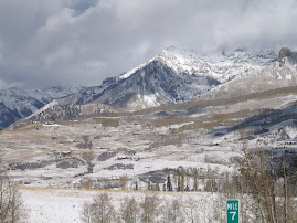
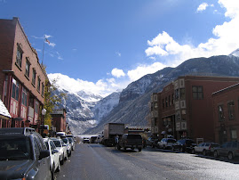
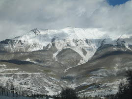
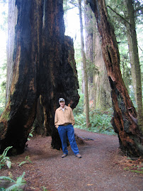
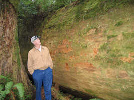
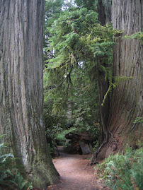
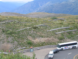
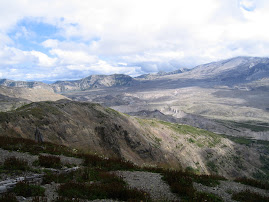
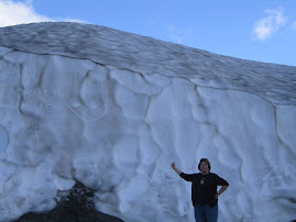
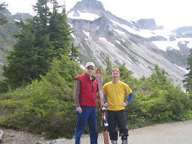
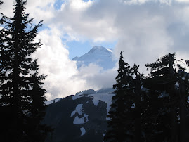
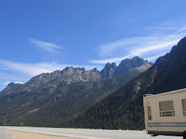
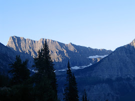
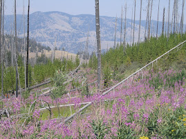
We took an extended tour through and around Rockey Mountain National Park. The weather for the day was shakey, and as we started out on the NE side if the park, visiability was poor. As we continued up, on and westward, we broke out of the clouds and into the highest parts of Rt. 34. Peak altitude on the road is 12,200'. The views became terrific, and we made two or three stops and took walks at points of interest. There is still a good deal of snow up here and the tundra landscape of low growing shrubs, flowers etc is breaking out into bloom. Tundra means "land without trees" in Russian. We had some close encounters with elk, and saw some marmins, which are western ground hogs. We headed south down the western edge and began to see the devastation wreaked by the pine beetles. They are wiping out just about everything in their path above a certain altitude and it looks loke these areas will be barren in a couple of years. Trees grow very slowly up in the mountains and will take generations to reestablish a forest. This beetle is just beginning to make its way over the Continental Divide and onto the eastern slopes.
Stopped for lunch in Winter Park and continued south. No roads cross east to west through the park until we hit I-70. We went east and then back north up to Center City and Blackhawk in the heart of the old gold mining region. There still appears to be some active mines up there, but the towns were allowed to use gambling to try to resurect the area economy. Doesn't appear to have worked, and the casinos look third rate. Once again on the eastern slope, visiability declined. We completed the loop by heading up through Boulder which has a reputation as a hippy enclave even today. We didn't spend much time looking around, but the U of Co. is located in town and probably contributes to the reputation. Took Rts 72 and 7 north back up into Estes Park which completed the loop.
Stopped for lunch in Winter Park and continued south. No roads cross east to west through the park until we hit I-70. We went east and then back north up to Center City and Blackhawk in the heart of the old gold mining region. There still appears to be some active mines up there, but the towns were allowed to use gambling to try to resurect the area economy. Doesn't appear to have worked, and the casinos look third rate. Once again on the eastern slope, visiability declined. We completed the loop by heading up through Boulder which has a reputation as a hippy enclave even today. We didn't spend much time looking around, but the U of Co. is located in town and probably contributes to the reputation. Took Rts 72 and 7 north back up into Estes Park which completed the loop.
Wednesday, June 27, 2007
Lovely Loveland, Co.
Had some service done on the truck early yesterday and then took an extensive tour of the area after lunch. It's a really nice town with a lot to offer. We drove through a number of subdivisions on the edges of town, and then went into the downtown to a gallery where Marion has her art work displayed for sale. We then toured the Loveland Museum, which was very interesting.
Marion had us over for dinner. By 9:00 pm everybody was beat and we beat feet for home and bed.
Marion had us over for dinner. By 9:00 pm everybody was beat and we beat feet for home and bed.
Tuesday, June 26, 2007
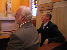
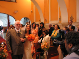
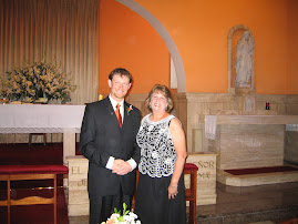
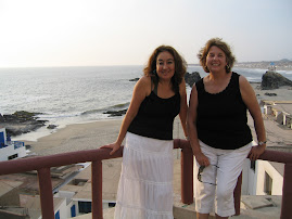
It's picture time again--I hope. Might be too slow and frustrating. This area is gorgeous--You have to be happy when you're in the sun, and the scenery is so spectacular--some photos are good, but can't do justice to the wide open vistas!! Lovely wildflowers, but too busy standing with our mouths open in awe of everything else!!
Easy Does It
We took a slow one yesterday. Did some shopping with Marion and found an RV place to have a few minor repairs and store it while we are gone. Watched some Soprano's last night. Some show.
Monday, June 25, 2007
Colorado Rocky Mountain High
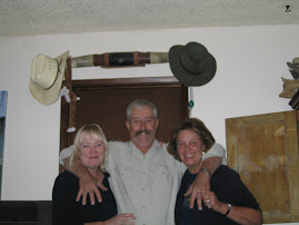
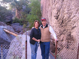
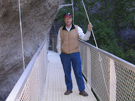
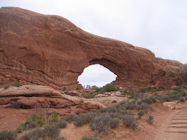
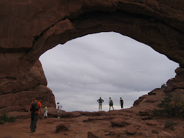
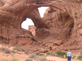
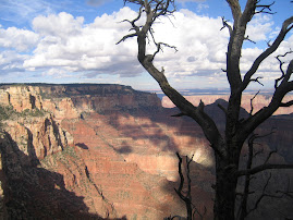
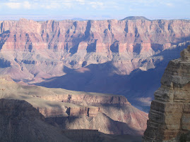
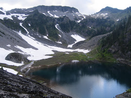
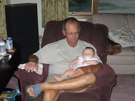
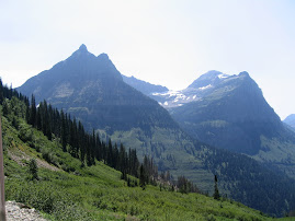
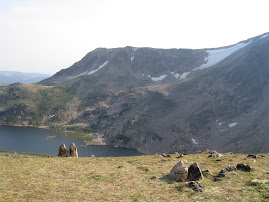
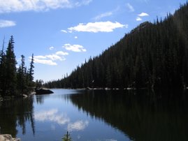
We took a ride up to Rocky mountain National Park just west of Loveland. Mt. Long is the dominant peak in the area and is one of 54 14ers in Colorado, as they say out here. It's just a little over 14,000' and still has snow on top. We hiked up from the parking lot to an elevation of just a little bit over 10,000'. Streams were running full and snow was still on the trail in places. Once up there, the views were magnificent. The rides up and down through the canyons are awesome. The trails run through all sorts of wild flowers. It was a busy day on the mountain as folks from this area really get out and take advantage of the great out doors. Dana and Marion stopped by Dream Lake and painted with water colors while the rest of us went a little higher. Their drawings came out very well.
We all got home and cleaned up and Carl and Marion and Kevin took us out to the Chop House in downtown Loveland for dinner. It was great. We went back to their house and played Apples to Apples. It was good time spent. Amy leaves for her mission tomorrow early am and Jessica the next day. We wish them both the best on their journeys.
We all got home and cleaned up and Carl and Marion and Kevin took us out to the Chop House in downtown Loveland for dinner. It was great. We went back to their house and played Apples to Apples. It was good time spent. Amy leaves for her mission tomorrow early am and Jessica the next day. We wish them both the best on their journeys.
Sunday, June 24, 2007
Estes Park
We road up to Estes Park with Carl, Marion, Amy and Kevin yesterday and took an aerial tram up to the top which is about 9,000 feet.The ride up is breath taking. The views into the Rockies were beautiful. It's a summer resort area and there are no ski areas around here. In town we shopped and had lunch. Headed home and Dana and I food shopped. Later, everybody came over to our place for dinner. It was a hot day, well into the 90's, and the camp electric went out for a short time. Things in an RV heat up or cool down fast. Fortunately it was not out for long.
We can watch folks rafting and tubing by on the Big Thompson river just out the back of our rig.
We can watch folks rafting and tubing by on the Big Thompson river just out the back of our rig.
Saturday, June 23, 2007
The Rockies
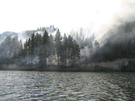
The drive from SD to Loveland,Co, was uneventful. We went south through Nebraska into Colorado and then east. Lots of flat and open. We were hoping to get that great view of the mountains on the way in, but later in the day storm clouds rise over the mountains and they completely covered the view. We set up in our RV park and quickly found that our cell phones have no signal here. ( They pick up about 3 miles east) Our site backs up to the Big Thompson River, site of a tragic flash flood in the '70's. Very comforting.
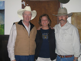
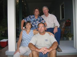
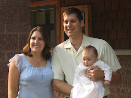
We turned on our GPS tracker, plugged in Carl and Marion's address and took off. Their home is only five minutes east of here. We're just catching their two daughters, Jessica and Amy, who are both leaving for mission work early next week. Jessica is going to the Azores and Amy is going to Uganda. Kevin came over and we all enjoyed a hearty minestrone soup that Marion made. We took a walk up the street to a local sculpture park. Loveland puts 1% of their budget to parks and the arts and you can't believe the place . About 75 bronze sculptures set in a well thought out surrounding. Once again, property taxes are very low, about $1300 for a home that would pay $10,000 in Jefferson, NJ.
We turned on our GPS tracker, plugged in Carl and Marion's address and took off. Their home is only five minutes east of here. We're just catching their two daughters, Jessica and Amy, who are both leaving for mission work early next week. Jessica is going to the Azores and Amy is going to Uganda. Kevin came over and we all enjoyed a hearty minestrone soup that Marion made. We took a walk up the street to a local sculpture park. Loveland puts 1% of their budget to parks and the arts and you can't believe the place . About 75 bronze sculptures set in a well thought out surrounding. Once again, property taxes are very low, about $1300 for a home that would pay $10,000 in Jefferson, NJ.
Friday, June 22, 2007
Hail
We took a day off yesterday. Dana did some laundry and I did a number of little repairs around the RV which I'd been putting off. Also washed the truck from the day before's trip over a couple of gravel roads. When all that house hold stuff was out of the way, we headed into Hill City,SD, to look around stores. Lots of neat shops around here. We ended up at a DQ for a cone and noticed that the thunder heads were rising high and fast. We hurried back to the RV and some open windows just in time. A thunder and lightening storm hit and hail began to fall. The largest hail was about golf ball size, and fell early in the storm. As things continued, the hail became smaller in size and more plentiful. Inside the RV was almost like being inside a drum. I was sure some damage was occurring, but when the storm passed, everything seemed fine. The hail stones felt light, as if they had air in them. Storms of this nature are apparently fairly common in this area of the Black Hills.
We head for Loveland, Co., today, about a 400 mile ride. Dana's sister Marion and her family and her brother Kevin moved out there from Jersey about two years ago.
We head for Loveland, Co., today, about a 400 mile ride. Dana's sister Marion and her family and her brother Kevin moved out there from Jersey about two years ago.
Thursday, June 21, 2007
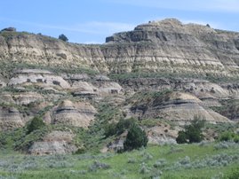
Badlands of South Dakota
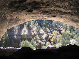
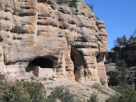
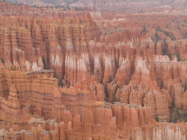
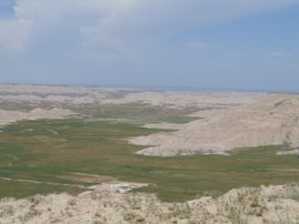
We drove east yesterday on a trip around Badlands National Park. The scenery was once again spectacular. These areas started at one time as flat layers of varying sediments and with time,wind and water, gradually eroded. The harder materials eroded at slower rates than softer material so that hills were left and gullies created. The colors are amazing and the shapes are all different. We jogged in on a side trip to a place called Sheep Mountain Table. A table is a high section of land, flat at the top, which for some reason eroded slower than surrounding areas. It's an island. Traversable areas between the low Prairie of the bottom sections and the high areas of the high Prairie are called passes. The gravel road through the pass to the top of Sheep Mt. Table was steep and windy, and they were doing some roadwork to fix potholed areas. At one of the work areas we stopped to get out and met a young man from Haddenfield Hts, NJ, who had graduated from Georgetown and was working the summer as the resident Paleo-monitor. Whenever any disturbance of earth occurs in the Badlands, his job is to be there and check to make sure that any fossils run into are properly inspected recorded. The area is loaded with fossils. As the layers continue to erode, fossils are often exposed. The road from where we ran into him and the tip of the table top ran through Indian Reservation land and became rougher and rougher. We dropped into 4-wheel and forged along to the very end. The views were spectacular. It was mid day, so there were few shadows and pictures will probably be bleached out. From there north to the main Badlands Loop. Sensory overload.
We headed home and I started suffering from indigestion of some sort and went down hill until night fall. Had to bail out on Tom and Joyce who were heading over to see the night show at Rushmore. We thought they were staying until Friday, but are leaving tomorrow am. We had a wonderful visit with them.
We headed home and I started suffering from indigestion of some sort and went down hill until night fall. Had to bail out on Tom and Joyce who were heading over to see the night show at Rushmore. We thought they were staying until Friday, but are leaving tomorrow am. We had a wonderful visit with them.
Wednesday, June 20, 2007
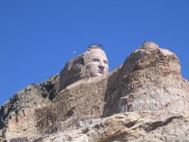
Crazy Horse
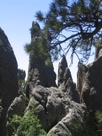
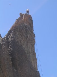
Another huge mountain sculpture in granite. In the '40's, Souix tribal leaders decided that the Red Man needed to know that they had heroes also. An artist named Karsaik(sic) who had experience at Rushmore was contracted for the work and the leaders had to choose a subject. Crazy Horse was selected because he had never signed a treaty or lived on a reservation. The artist began work by himself and had to build laddering all the way up and then rig a system of piping for compressed air to run drills. For the first five years he worked alone, carting all his equipment, dynamite etc. up the ladders to the top. A couple college girls showed up one year to volunteer their time and he married one of them. They had ten children over time, and after the old man died in '82, they carried on the work. It has been financed privately with no state or federal funding, and their goal is to keep it that way. The head, 90' tall, is completed and much of the over burden covering the horse has been removed, but a lot of work remains. After that, we road a number of the scenic byways in the area, including Custer State Park, which has a large buffalo herd. The roads are spectacular with a number of narrow tunnels, two of which exit directly into a view of Mt. Rushmore.
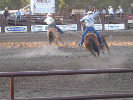
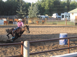
We went to a cowboy dinner with Tom and Joyce Gerlitz followed by a show by the Riders in the Sky, a grammy winning cowboy group who sing old songs with a mix of humor. They were very good. From there to the laser light show at Crazy Horse Monument, which was also quite good. It's light until 10:00 pm and again by before 5;00 AM. Hard to get enough sleep.
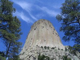
Something we started seeing at Devil's Tower, is an Rv that is half RV and half horse trailer. Horse people go to facilities with stables and ride the state and national park trails on horse back. Everybody around here has horses and the trails go forever.
We went to a cowboy dinner with Tom and Joyce Gerlitz followed by a show by the Riders in the Sky, a grammy winning cowboy group who sing old songs with a mix of humor. They were very good. From there to the laser light show at Crazy Horse Monument, which was also quite good. It's light until 10:00 pm and again by before 5;00 AM. Hard to get enough sleep.
Something we started seeing at Devil's Tower, is an Rv that is half RV and half horse trailer. Horse people go to facilities with stables and ride the state and national park trails on horse back. Everybody around here has horses and the trails go forever.
Tuesday, June 19, 2007
North by Northwest
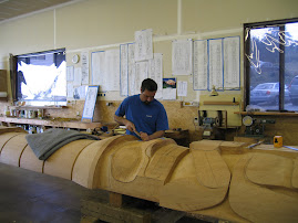
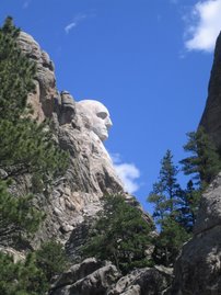
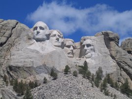
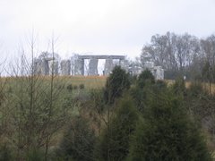
Or how did those big heads get there? Yesterday we went to the Borgym(sic) museum in downtown Keystone to learn about the artist's life and times and then up to Mt. Rushmore to see the famous granite heads of our Presidents. What a creation. Because of the height of the sculptures, all the views are a good bit away. The trail around the base takes you to many different angles. The scope of the work is staggering. The Roosevelt head is recessed because they had to remove over a hundred feet of granite to get to stone that was crack free and durable. The artist wanted to remove the rubble at the base from all the construction, but that was never done. He actually died before the completion of the last head and his son completed the work. His original plan called for the sculptures to go to the waist and Washington has a waistcoat on. He used a staff of unskilled laborers whom he trained and highly praised for their effort and desire to learn. He used dynamite for the bulk of the removal and then jack hammers and shaping tools to finish. A safety advocate, no one died and only one man was injured badly enough to miss any work during the whole operation. He had to be a genius to figure it all out.
From there we went to Rapid City where Dana shopped for a little bit while I had the oil changed in the truck. It was a nice little town.
Had Tom and Joyce Gerlitz over for dinner last night, then went over to their site for a campfire. The weather here has been a mixture of sun and clouds with wind and a bit cool. It was in the mid forties yesterday about 9:oo am. The wind finally stopped about 8pm last night.
For anyone with comments, the procedure is fairly simple. You need an active e-mail address and when you sign in, follow the prompts to establish a google account if don't already have one. There's no charge for the account.
Our campsite offers all you can eat pancakes every morning from 7-10. It's almost as cheap as my normal Cheerio's with half a banana breakfast.
Monday, June 18, 2007
Now somewhere in the Black mountain hills of Dakota
It was a short trip over to Hill City, SD, from Devil's tower. We were in and set up by about 1:00, and I sat down to watch the experts play Oakmont Country Club. Just as we got tuned in, there was a knock on the door and Dana's cousin Tom and his wife Joyce were here. They are about three RV's away. We had met previously a couple of years ago when they stopped by Bowling Green to play, and then stopped down at the house. They came in and we nibbled on some smoked trout from Lake Superior and chatted while the boys tried to figure out Oakmont. Tom and Joyce have enjoyed RVing for several years, at first in a class C and now in a fifth wheel. They live in Warwick, NY, and spend time in Florida, the Outer Banks, and on the road. They invited us over for dinner, and after the golf we went over. They had terrific marinated spare ribs. Had a real good visit and we'll have them over tonight.
Tiger hasn't been making all the shots and putts that lead to wins in the last two majors, but he's the only one out there who could be in contention with his B or C game. The par saving putts on 15,16 and 17 were as pressure packed as you can get. Real pukers as they say. He knocked all three in dead center. My buddy Jimmy Furyk hit driver off the tee on 17 into what looked like eight inches of extra thick blue grass. He said later that a pea shooter like himself had no chance for the green and that he was didn't think he could hit it far enough to get in trouble. After birdies at 14,15, and 16, the adrenalin must have been pumping. He, Tiger and Angel all bogied the 17th which at 306 yards, was called a "birdie" hole at least 50 times by the commentators. But you have to give credit to Angel for hanging tough and making an easy par on 18 after hitting an absolutely monsterous drive. Last man standing, and great back 9 action for us viewing choppers who love to see the big boys brought to their knees. I heard somewhere that the USGA had to slow the greens down which had gotten to 14.5 on the stimp. Frightenly fast, even for those guys.
Mount Rushmore today.
Sunday, June 17, 2007
Close Encounters of the Third Kind
We are at the Devil's Tower KOA, where much of the filming for the movie was done. Every night at sundown they show the movie on an outdoor screen. Last night thunder and lightening storms were all over, so I dug our old video copy out and we watched in the rv. We got here early afternoon, set up and went to the National Park. They have a trail at the base which is located at the edge of the boulder field, that goes all the way around the tower. It's quite something and worth a stop if you're in the area. The walk is 1.3 miles and the path is paved, so it's an easy walk. (At Pompey's Pillar, I'd run up quite a few of the stairs to the top for a little exercise, and yesterday had to take Advil to go on the walk.) After that, we took a drive around the local area, which is partly in the Black Hills National Forest, and ended up on a 30 mile gravel road on which we saw one other car and a couple of ranches.
Today is one of my favorite days. It's Father's Day, but just as importantly, it's the final day of the US Open golf tournament. We'll move over to Hill City, SD, and the Mt Rushmore area, where our campground has cable hook up, and I shall sit my butt down and watch to see if Tiger can win another Open before he's a father.
We spoke to Dana's cousin Tom a couple days ago and he and his wife, Joyce, are on a trip including a reenactment of Custer's Last Stand and up to the Callgery Stampede. As fate would have it, they are staying in the same RV park in Hill City that we are. There must be a hundred spots in that area to choose from, so it's quite a coincidence. At any rate, we'll have company for a few days over there.
Saturday, June 16, 2007
Pompey's Pillars
After a maintainence morning of truck and trailer cleaning and laundry, we headed north to view a place called Pompey's Pillar, the only known evidence that William Clark left in this area of his exploration. He named it for the child of a french fur trader and Sacagawea, the Indian translator who helped the Expedition of Discovery along. He was quite fond of the boy and had him travel in the same boat when possible. Recent rainfall and continued mountain snow melts have local streams and rivers at near flood stage. It has also led to a very green look everywhere, which I believe is normally more tan or brown. The area receives less than 20" annual rainfall.
To get where we were going, we took a road which was unpaved for about half the way and really out in the middle of nowhere. Beef country. It made us very hungry for steak, so we went into Billings, Mont., and wandered around town. It's quite an industrial looking area with coal and gas produced in the area, but the down town area was quite nice. Jake's claimed to be the steak place to be, so we went. It was very good.
By the way, we have received a number of comments posted back. We really enjoy the feedback, so don't be shy. It can't be hard to do.
Friday, June 15, 2007
The signal is very strong here, so I'm again catching up on pictures. North Dakota was amazing--as we traveled we passed many ponds and wetlands along the road--they were ringed with yellow flowers, and mallards were in each one--never saw so many mallards.The fields are emerald green, and very hilly, or wide and flat, or rocky and barren-- very diverse--
many pheasants just wandering around in the fields--you could ride for miles looking out to nowhere, and then there are cliffs and rocks in front of you.
I wish I had time to enlarge and crop these pictures--someday--ask me
The Little Big Horn Battlefield was so interesting--nothing has changed since it happened, so you could really envision how it all unfolded.Looking at this terrain--hundreds of people could hide just a few hills away.
Enjoy the pix--you'll have to backtrack to get the text-------Dana
How many Indians did you say were over that hill?
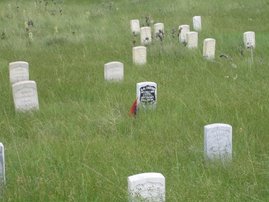
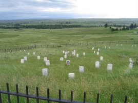
We drove about 400 miles yesterday from Beaulah, ND, to Hardin, Mont., and the Little Big Horn Battlefield. The drive was once again beautiful and once again long. We set up in a KOA and headed over to the battlefield. We bought the cd self guided tour and were able to view the progress of events while observing the terrain. Custer split his forces up to try to prevent the Indians from escaping into the hills. The Indians were quite surprised by the attach being launched against them because there were 7,000 people in the camp of which 1500 to 2000 were able bodied warriors. Custer had a total of about 400, but split down into 5 groups. At the end of the day, 260 soldiers were dead. The others survived because the main body of the army which Custer was scouting for arrived on the scene. It is rolling ground with valleys and gullies everywhere. White markers are in the ground where historians think soldiers fell and red markers where indians fell. Not many red markers.
In yesterday's entry, I left out an interesting story. Back in the late '60's, my brother Andy was hitchhiking cross country and was on the road near Fargo, ND, which is on the eastern border of ND. A couple picked him up and headed west going about 90 miles per hour. They drove all the way across ND and were heading into the Theodore Roosevelt NP at the Painted Canyon area when Andy asked to get out. They let him out and went one way and Andy began hitching. A couple ranchers eventually picked him up and were talking about a couple who had robbed a bank in Minneapolis and were last scene heading west. How about that?
In yesterday's entry, I left out an interesting story. Back in the late '60's, my brother Andy was hitchhiking cross country and was on the road near Fargo, ND, which is on the eastern border of ND. A couple picked him up and headed west going about 90 miles per hour. They drove all the way across ND and were heading into the Theodore Roosevelt NP at the Painted Canyon area when Andy asked to get out. They let him out and went one way and Andy began hitching. A couple ranchers eventually picked him up and were talking about a couple who had robbed a bank in Minneapolis and were last scene heading west. How about that?
Thursday, June 14, 2007
Theodore Roosevelt National Park
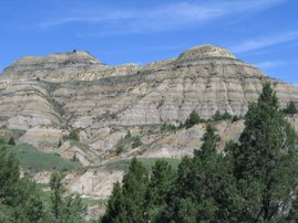
The TRNP is in the far western area of ND and split into a North and South section. The ride over was through rolling praire and we saw lots of Prong Horn Antelope along the way. We first went to the North section which has a 14 mile in and out road to ride. Route 85 going to the park breaks into Badlands terrain just before the entrance and is absolutely spectacular. The day was clear and coolish and recent rains had greened up vegitation and in the case of the abundant Sage, Blued up. The terrain is radical with Buttes and knobs jutting up and ridges running in all directions. The sedimentary rock has layers of different colors with black seams of coal mixed in. The views go on as far as the eye can see. We bought our National Park Pass entering the North area, which is smaller and by what's written, lesser than the South area where TR resided. I would beg to differ. The North has higher, larger meadows and plains while the South sports a slightly more rugged look. You wouldn't want to have to find your way out of either section.
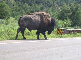
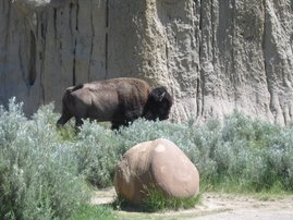
Wild life is plentiful and the Parks are home to just shy of 400 American Bison or Buffalo. Signs warn people and hikers to beware of these beasts which are quicker and more agile than their looks would indicate. The bulls weigh up to 2000 lbs. In the North secton we encountered two bulls at a pull over area that were on what appeared to be a regular commute. They crossed the road next to our truck and Dana got some good pix. They are huge and looked healthy, fit and muscular. As bulls age they tend to become more and more solitary, fraternizing only during mating periods. We saw more out in the high plains areas, but at quite a distance. In the South area we encountered a single bull wanting to cross the bridge we were stopped on. He wouldn't cross with us on it, so I pulled through and over. He dashed past and crossed over. Just after that we saw one laying down on ledge that looked like a spot for mountain goats. The last one we saw was posing on a ridge top just off the road. He held pose as car after car stopped and clicked away.
Wild horses also live there, and we saw two having a pretty good dispute just off the road. They were nipping, snorting and rearing at one another. An amazing site. Prairie dogs were everywhere. Overall, I'd have to say we've never been to a prettier place. TR had gone to the area in the 1880's for health reasons and fell in love with it. He went in as a partner on a cattle ranch and then added a second area which he owned by himself. A Frenchman had also come to the Medora area to establish a beef empire. Both were doing very well until a severe winter in the late 1880's destroyed 80% of the herds. The rivers were clogged by carcases in the Spring, and neither ranch recovered from the disaster. The Frenchman left and TR got into politics.
On the way back, we detoured to go on the Enchanted Highway which is known for the roadside sculptures artists have constructed. It was anti-climactic and we were wearing out by the time we got through it. Capped the day off with a traffic ticket from the local boys in Beulah,ND. Hit 40 leaving a 25 area following some motorcyclists. He didn't get them, but he got me. It's a $15 ticket and according to him, ND only has reciprosity with Montana and SD. A bad end to a great day. As the sun went down at our site, the coyotes were howling in the backround.
Wednesday, June 13, 2007
The Long Haul
Drove 530 miles yesterday from Minneapolis, Min., to Beulah, ND. It was our first exposure to the Great Plains and the terrain was more rolling than expected. ND looks like the backround of Dancing With Wolves. (We saw wolves twice, once on the UP and once in northern Wisc.) Went past the tallest structure on earth, a TV tower, and saw a number of the huge excavators used in strip mining for coal. They are visible from miles around and all lit up tp work 24 hours a day. Our campground is mainly occupied by fishermen, with a sprinkling of the huge motor coaches. Out here, the horizon is so far off that it looks like the clouds are forming and rising from the edges. The sunset was beautiful.
Joe Riggs called yesterday with the sad news that Jim Egan passed away while on a golfing trip to Atlantic City. He died in his sleep. Jim was quite a character and will be missed greatly.
Joe Riggs called yesterday with the sad news that Jim Egan passed away while on a golfing trip to Atlantic City. He died in his sleep. Jim was quite a character and will be missed greatly.
Tuesday, June 12, 2007
MOA
That stands for Mall as in Mall of America. Biggest, highest anywhere. There's an amusement park inside with water rides and roller coasters. Karen Lufek was our guide. It's a big attraction, drawing 2.5 million visitors a year. We toured, had lunch and I bought three shirts, the only purchase of the day besides lunch. When we left and got back to Karen's home, she showed us how to hook up to the wireless campsite routers which just about everybody has. It is much faster than the Verizon Broadband Wireless here. A big thanks to Karen.
We hit the road for N Dakoda this am.
We hit the road for N Dakoda this am.
Monday, June 11, 2007
Hi again--i just need to add a bit--the Upper Peninsula of Michigan, and Upper Wisconsin are gorgeous. Tried to convince Bruce that we could run a motel on Madeline Island, Wi. for the summer, and go south in the winter--He's not buying it--too cold, too much snow--(I hate housework, so it's not really for me either), but Lake Superior can seduce you--so beautiful. The area of Bayfield, Wi. is so pretty--lupines covering the banks of the roadways. I really wanted to tell you all that we've seen 2 wolves so far--Bruce missed one--he was driving--very cool--no moose yet though. We've overdosed on smoked trout--fresh from the fishery--can't look at any for a while.
Enough--having fun with friends-------------------------------------------------Dana
Enough--having fun with friends-------------------------------------------------Dana
Twin Cities Spin
We made it down to Minneapolis-St.Paul and set up in a KOA NW of town. Friends of ours from Oak Ridge, Karen and Jay Lufek, moved out here four years ago when Jay was transferred. He is a native of Minneapolis. They came over and took us for a great tour of the area. About two million people live in the greater metro area. The city has a series of 3 lakes and parks that are all connected by walkways and bike trails, and everything is clean and well kept. The cities have many residential areas that look like our suburbs. The city areas also look the same. In the city, areas are connected by enclosed overhead walkways so that in winter people can park in heated garages and connect anywhere without walking outside. It's really a necessity here with the severe winter temperatures. We visited St. Paul's Cathedral, a structure which reminds one of Europeon churches. They then took us out to dinner at a terrific favorite place of theirs. It was a great day and this is a beautiful area. Jay has to depart today on business, so Karen and us will probably hit the Mall of America.
Sunday, June 10, 2007
Lazy Day
We found out the tix for our Aposle's Island boat tour were down stairs only, and after a barely audible moan, they offered to refund our money. We jumped on it and headed up to a neat State Park north of Bayfield where we walked the shore and collected interesting stones just like old folks do. This trip could be the final episode of "Cocoon." Bought some Brown Sugar Smoked Trout and dip, hit a few shops and enjoyed an alfresco lunch overlooking Lake Superior. Back home we cooked local Whitefish for dinner. It was great. Twin Cities next.
Saturday, June 9, 2007
Storm Front
We left Munising and drove west through Marquette on our way to the western edge of the Michigan UP. Predictions of violent T-storms, damaging winds and possible tornatic conditions were broadcast on the radio all day. Our destination is River Pines RV park in Ontonagon, Mich. We checked into our site and found that the owner had just baked fresh Pasties for sale. Pasties are big up here. A pastry crust is filled with ground meat, potatoes and anything else left in the frig. We set up and then drove up the Keweenaw Pennisula (don't you love those Indian names) as far as the road went, Copper Harbor. Fueled up out of fear of wide spread power outages, and while doing that, Dana walked across the street to a cafe. By the time I got there, she had established a relationship with the owner. He roasts his own beans, and we enjoyed a great cup of coffee and bought a bag to go. It was almost as good as CozyCabinCoffee, my tour sponsor (Klondike Bars rejected my recent offer of co-sponsorship). Once again, the tour was longer than it looked, and we got back in time to make dinner and wait for the storm. It came through like a wall and for a while it rained White Pine limbs. When it passed, nothing was worse for the wear and things cleared up.
Yesterday we left western Michigan and the Eastern time Zone, and drove along the coast of Lake Superior into Wisconsin. Our stop was in Bayfield near the Apostle Islands National Lakeshore. Met some real friendly people, then headed downtown to catch the afternoon boat cruise to the islands. Since it is still "off season," there was no tour, so we bought tix for tomorrow morning and started looking around town. Found a fish shop selling fresh Whitefish, Brown Sugar Smoked Trout, and Trout dip. Will stock up tomorrow. Next door was Oley's barbarshop, so I popped in for a trim. Oley turned out to be the head of the local Chamber of Commerce, so it was an informative trim. We stopped in some great craft shops and then headed back into town to catch a ferry to Madeline Island, a little upscale ,off shore enclave. Just about everything was closed, so we took a walk and came back. It was beautiful out, so the boat ride was worth it.
We got home, cooked dinner and then started chatting with the people next door. They're from Ventura County, California, and doing what we're doing, but backwards. It was nice because we could share notes on where we'd stayed and gone. As we spoke, a group of younger campers approached us about participating in a bean-bag toss game. That was a hoot. Then it was over to some other folks spot to compare notes on campgrounds. He was a sports trainer for clients at the Mayo Clinic and she is a young Mom who runs marathons. I was tired talking to them. It was after 10:00, finally dark, and way past my bedtime. Chao
Thursday, June 7, 2007
Kitch-iti-ki-pi Springs
That's the Indian name of a very neat place up here in the UP (Upper Pennisula) or Yoopees as they refer to it and themselves. Most of the UP was logged over the years and left to grow back. One man with vision came across this deep spring area when it was full of clearing debris and realized it was a gem in the rough. He acquired the land, began cleanups, and then donated the area to the state. It is now in Palms Book State Park a little NW of the town of Manistique. They have built a passenger powered, cable guided raft with a roof and the centerleft open for viewing down into the water. You can clearly see all 45' down to the bottom and the colors are beautiful. The spring flows at 14.5 million gallons per day, small by Missouri standards, but quite something. Passengers turn a large wheel attached to a cable to propel themselves across and back. A guy from Traverse City back in Mackinac told us about it and it was truly a gem.
We found a place to eat lunch overlooking an inlet from Lake Michigan. I asked the cashier if there were someplace local to buy fresh fish, and she directed us to her family's fish store in town. We bought some fresh Whitefish and a piece of Brook Trout just out of the smoker. We grilled the Whitefish while nibling on the Trout. both were good, but the trout was superb. Wish we'd bought more.
Had an appoitment at a local Chevy dealer to service the truck. Oil and filter, trans fluid and external filter, lube job, and tires rotated and a complementary wash for $102. At a dealership!
Wednesday, June 6, 2007
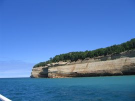
Pictured Rocks Boat Tour
We moved west and north from St Ignance to the Port of Munising on Lake Superior. After setting up, we headed into town to check out the well advertised boat tours of the Pictured Rocks National Lakeshore. These sandstone cliffs project as high as 200' above the lake level for fifteen or twenty miles of the coast. We went in to sign up and the girl at the ticket counter made sure we were aware that it was really rough out there today. It had been a cold blustery day up to then. Morning temps were low 40's and the high was about 50, with winds out of the north. We left, but then decided it was so bright and clear that it was worth a shot. We signed up and the boat loaded at about 2:10 pm for the 3 hour ride. The boat had a capacity of about 150, but was less than half full. It was divided between the lower enclosed but not heated level and the open upper. It took about half an hour to clear the well protected harbor and get into Lake Superior, which was running a three foot chop, and another fifteen minutes heading east to get to the cliffs. As we approached the cliffs, we left the lower area and went up top. The cliffs are beautiful. Mineral laden water which seeps out of the rock and comes over the top has colored the stone in a manner to resemble murals. The day was so clear that the views were stunning. The water is deep straight down so that the boat could run very close to the cliffs in some areas. Lake Superior is the largest fresh water lake in the world by surface area, about 170 miles wide and 400 miles long, and up to 1300 feet deep. In normal winters, the edges will freeze a couple of hundred feet out, and about every 20 years, will freeze all the way across. In a chat with the captain, he said the busy season was only July 15 to Aug 15, with the shoulders starting at June 15 and wrapping up in Sept. Winter storm activity keeps vegatation from growing on the cliffs up about 25 feet and nothing grows on the real sheer spots. It was a worth while trip and the seas didn't prove to be as punishing as we were lead to believe. One little boy hurled, but fortunately it didn't start a chain reaction from other land lubbers.
Hit the 10,000 mile mark yesterday. An unusual site up here are the massive long haul trucks. The biggest ones are 38 wheelers. Nine dual wheel axles and the front steering tires. Some of the log trucks may even have more.
When we set up camp here, we originally decided on a woods site, but as we tried to set up, the biting bugs changed our minds. We moved out into a wide open site and they were more tolerable. I believe they're known for the density of the insect population at certain times.
Monday, June 4, 2007
apologies and pix(I hope)
Hi All--It's me again--Bruce has kept you posted, but now some "girlie" things. First off, sorry no pictures lately--busy,busy, and we've been in VERY SLOW reception areas. I'll try now, and see what happens--I'll be catching up since Graceland.
It's been fun observing the terrain as we drive. I hate to tell these other states, but sections of a lot of them look like "Joisey" to me. At this point Bruce and I have seen all 5 Great Lakes--not all this trip. The views here have been serene, different, and beautiful--We're in a rain pattern, so this is certainly a different view of the lakes. It's an area known for lilacs--taller than I've seen before. Saw yellow lady slippers, and a bird never seen before--the American Bittern--about the size of a wild turkey hen on long legs.
The marshes and swamps are also beautiful--flowering hummocks in the midst of the water--"ghost forests"--areas where the marsh has overtaken the forest and left dead, bleached trees standing for acres--neat.
Hope the weather clears because we have at least 3-4 more days to explore Michigan--ta-ta-Dana
The Lake Superior Trail
Unsettled weather has followed us from Missouri north to the Upper Pennisula. We had planned on taking the jet ferry to Mackinaw Island but overcast, cloudy weather persuaded us to wait a day. Instead we climbed into the truck and hit the Superior trail. We headed north and west up to the Tahquamenon Falls, the second largest falls east of the Mississippi. It was worth the stop as the views are nice and they also had a nice place to eat lunch. Whitefish is the fish of the day everyday around here, so we shared a smoked cheese and whitefish dip and a lightly fried whitefish sandwhich. We continued north along Lake Superior and stopped at a spot with beach access that was spectacular. The terrain and flora and fauna make up a wilderness. Traffic is extremely light and most places look more like fishing and hunting camps than places for family vacations. From there, north to Whitefish Point. The area off this point is known as the shipwreck capital of the Great Lakes and a little village and museum are found there. We had to travel south and then east on Lake Shore Trail to get over to Sault Ste. Marie where the Soo Locks which connect Lake Superior to Lake Huron are located. Locals say that boat traffic has been increasing the last few years after diminishing over a number years. Michigan is still hurting economically and is considering passing laws to become a "right to work state" to attract businesses which are reluctant to come to a pro union state. A guy next to us at the campground was from Traverse City and said that the resort business down there and up here had been badly hurt by a series of regulations restricting rentals. Everything up here seems empty, but schools are still in session and maybe it will be busier as they get out for summer vacation.
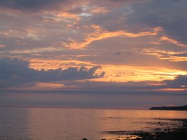
We got home in time to make dinner and get down to the Lake Michigan beach to watch another spectacular sunset. We are at the west edge of the eastern time zone and sunset occurs at about 9:35 PM.
We got home in time to make dinner and get down to the Lake Michigan beach to watch another spectacular sunset. We are at the west edge of the eastern time zone and sunset occurs at about 9:35 PM.
Sunday, June 3, 2007
Gateway and Long Drives
From Springfield we drove over to a campground on the SW side of St. Louis, Mo. We set up and ran into town to view the Gateway Arch. It sits right on the Mississippi River and is a remarkable structure. You can take a tram to the top, but the day was so hazy we didn't go up. It's constructed of triangular stainless steel pieces of diminishing size. Quite a site. When we returned, Jeff Meshach (for non family, Jeff is the son of my cousin Marilyn and Ernie Meshach, which is a cousin once removed?) met us and we followed him out to his home. Jeff and Katrina, along with their children, McCoy and Marilyn, live on the top of a ridge on 30 acres in the town of Pacific. It's a long trail off the road to their home. It had been an A frame type home until just recently when, as Katrina says, they added a house to the A frame. It was designed by Katrina and built by a contractor friend of theirs. It came out great and probably tripled the size of the house. They served a dinner of bar-b-q venison, St. Louis style, with asperagus and potato salad, all of which was delicious. McCoy is 10 and Marilyn 8, so Jeff and Katrina are running with activities of the ages, and loving it. Jeff gets his deer right on his own property for the most part. We had a great visit with them and are happy we were able to connect.
Friday, June 1, and we headed out on the longest drive of the voyage. We drove from St. Louis across mid Illinois to Terre Haute, Indiana. The scale of agriculture is amazing. We drove back roads and every ten or fifteen miles there was a small town with a grainery. Large graineries. Miles of farmland, and in this area, little sign of dairy or horses. We crossed into Indiana and jogged north and east all the way up through South Bend, Ind., and into southern Michigan. We stayed at a campground in Niles, Mich. We covered about 470 miles.
Sat., June 2, we headed north up Rt. 31, which follows the east shore of Lake Michigan. We didn't see the lake until we got up to Traverse City. Rt. 31 was another close to vacated highway for most of the way. It's a big orchard and vineyard area. Peaches, apples and cherries galore. Traverse City looks like a huge resort area, similar to shore spots. It must not be their busy season yet. Most of the hotels and motels along the water were only partially filled. North and east of Traverse, the scenery improved with rolling ground and lake views. The Macinaw Bridge is spectacular. It connects the mainland to the upper pennisula and Lake Michigan and Lake Huron meet beneath it. We drove just under 400 miles for the day. We are staying right on Lake Michigan at an RV park in the town of St. Ignace. It has a walkway to the shore, from whence was observed a spectacular sunset last night. We chatted with another Bruce who has been on the road for 19 months and was a commercial photographer. At first he allowed the sunset was pretty good, but as time passed, it became prettier and prettier. When we were chased in by mosquitoes, he stayed shooting pictures and slapping mosquitoes away. We also took a bunch of shots and hope to get some posted.
Subscribe to:
Comments (Atom)