We are enjoying our down time with our friends, and reflecting upon the last months. I always asked our kids what they liked best when we went on a trip, or they went on a field trip. Recently Grant asked that of me, and I just answered with what I had just seen, but I've been thinking about that for a couple of months. We have seen such a beautiful country !!! I'm amazed at the tremendous forces that have shaped our landscape-volcanoes,rivers,glaciers,wind and rain. I'm amazed at the amount of land that has been set aside for all people to enjoy, and I have developed a great respect for the American spirit. You can't look out at the ruts across the desert ,the tree stumps at Donner Pass, or the incredibly difficult mountain passes without realizing how perserverent our ancestors were.
And now for the last pictures from this great trip!!!
Saturday, November 10, 2007
Wednesday, November 7, 2007
Th-Th-Th-That's All Folks
We finished our national tour yesterday, arriving at the home of our friends, Jim and Donna Simpson, in the foothills of Tucson, Az. They have two children, Christina who's a freshman at the U of A in town, and Jesse who's a freshman at Catalina HS in town. Christina has a boyfriend, Sonny who is also preparing to start college and is a computer wiz. They just completed their new home, which is beautiful and set in the hills with views of the city and the mountains. Jimmy and Donna designed and laid out the house and the attention to detail shows. It includes an outdoor pool and basketball court among other amenities.
Our trip has been great and although we didn't see everything, we saw a great deal. Our country is really amazing and beautiful in a physical sense and most people we talked to are optomistic and upbeat about the future. There are still a lot of can-do people out there who think the way our pioneering ancestors did and don't expect the gov'ment to fix all their problems.
We hope this blog was entertaining and hope you enjoyed it. We certainly enjoyed doing it and enjoyed the feedback we received.
We plan on spending the winter in Tucson and perhaps settling here. OUR BEST TO ALL.
Tuesday, November 6, 2007
Weekend in Alto
Friday, Nov. 2, we drove east to Alto,NM, where Carol and Mike Empson have a mountain home. Their place looks across to Sierra Blanco, the highest peak in the area at a little over 11,000 feet. Their home is over 7,000 feet, in the Alto Lakes community, which is just north of Riudosa. Riudosa is the quarterhorse capital of the country, and they pack in tourists and horse people during the summer racing season.
Since the last time we were there, they have added a two car garage with adequate space for a golf cart and redone the exterior of the house to stucco which looks great. The interior features a huge Great Room with a fireplace with brick to the ceiling and walls of Michigan barn siding. It's a unique home and even has a silo with a spiral staircase attached. The rear deck runs the length of the house, and they also recently had it stripped and refinished. The decking turned out to be redwood and came out beautifully.
Saturday, Carol and Mike took us on a tour of Alto and the area. After a walk around a local pond in a park, we went up to Monjeau Peak, a mountain next to Sirra Blanco where there's an old stone fire tower built in CCP times. It has a wrap-around view of the entire area. We had lunch at the Alto Country Club where they are members, and then headed over to see the new Inn of the Mountain Gods Casino. The new structure has been up a couple years and dwarfs the old place which they should tear down. The casino and the Ski Apache ski area on Sierra Blanco are both tribal endeavors of the local Apache tribe. Unfortunately, the first thing you notice walking in is the smell of cigarette smoke. We decided to sit outside on the deck with a great view. They are known for a great Margurita, but no one came out to take an order. Mike went in and asked the bartended to send someone out but was told that he'd have to find someone himself. She was too busy. We were out of there. The local Apaches seem to feel that the service industry requires groveling and don't do it well. We had the same type service at the ski area some years ago.
Sunday, Carol made world class huevos rancheros, the traditional Mexican breakfast. She and Mike headed back to El Paso later in the morning and Dana and I stayed and watched the Colts-Patriots game. Two good teams and a tough game. They'll meet again in the playoffs.
We drove the 396 miles back to Payson on Monday. It turns out that it was Grant Leonard's birthday and Ann invited us over for dinner. Other friends of theirs were there and we had a great time.
Today we head down to Tucson and the finish line of our national tour.
Friday, November 2, 2007
Still More Payson
Dana and I spent a good deal of yesterday getting things together for the ride over to Riudoso, NM, today to see Carol and Mike at their mountain home. We zig-zagged a little too much on this section of the journey. It's almost 400 miles over there and we will come right back on Monday. Everything is so big out here. We're leaving the rig in place in Payson while we're gone.
We went back over to Ann and Grant Leonard's home for dinner last night. They took us on a tour of the area north of town where they have a spot they will build a house on some day. It has a great view of the rim area with magnificent sun sets. We got back to their home where they served Grant's signature dish, baked beans and barbaque pork, with cole slaw. It was great. They have a Jack Russell Terrier, Molly, who is a ball of energy. She's a little piece of muscle. We've had a great visit here and Ann and Grant have really been hospitable.
We went back over to Ann and Grant Leonard's home for dinner last night. They took us on a tour of the area north of town where they have a spot they will build a house on some day. It has a great view of the rim area with magnificent sun sets. We got back to their home where they served Grant's signature dish, baked beans and barbaque pork, with cole slaw. It was great. They have a Jack Russell Terrier, Molly, who is a ball of energy. She's a little piece of muscle. We've had a great visit here and Ann and Grant have really been hospitable.
Thursday, November 1, 2007
More Payson
We took a look around town yesterday am. Payson has about 15,000 residents and is quite rural, with a town center where services are available. Elevation is 5,500', so it's quite a bit cooler than Phoenix, which is an hour and a half away. They say you can work all day outside in 100 degree weather by drinking only 5 or 6 20 oz. bottles of water. Dry heat.
Grant Leonard called about 2:00 pm, and we got together with him and went to the Tonto Natural Bridge State Park. A friend of his is the head Ranger there. The walk down is beautiful and the view is also. After that, we stopped at Grant's home and picked up Ann and took a tour through the Flowing Spring area where about 25 homes have been built on the forty or so lots. You have to ford a few streams to get to some places, and during the July-August monsoon period, people can be trapped for a few days. They get the bulk of their rain for the year in that one period.
We had Grant and Ann over for dinner and had a great time.
Wednesday, October 31, 2007
The Rim Area
Running around the north side of Payson, Az, is ridge line of mountains known as The Rim. It's a dirt road for the most part and about 20 miles long or so. It was so wash-boarded that we went in a ways and turned around. It was loosening our teeth. We did get to see a few great views and were out on one of the edges. There is also a golf course and community called The Rim just on the east side of Payson, and maybe we will check that out today. I know it's been widely advertised in golf mags.
Later in a the afternoon, we went over to Grant Leonard and his wife Ann's home. They live out the north side of town in a little community off the beaten track down Flowing Springs Road. The road in is reminiscent of the road into Stag Pond, his families place back in NJ. We had a nice visit with them and wnt into town for some Mexican food. Lots of that served out here. Dinner was terrific. They're coming over here tonight for dinner.
Later in a the afternoon, we went over to Grant Leonard and his wife Ann's home. They live out the north side of town in a little community off the beaten track down Flowing Springs Road. The road in is reminiscent of the road into Stag Pond, his families place back in NJ. We had a nice visit with them and wnt into town for some Mexican food. Lots of that served out here. Dinner was terrific. They're coming over here tonight for dinner.
Tuesday, October 30, 2007
The Long Ride to Payson
This type of thing occurs when one fails to follow the seven P's. I eyeballed the map from across the room and figured the trip to be about 250 to 300 miles from El Paso to Payson, Az. Mike Empson thought at least 300 and I didn't double check. The 250 was closer to the halfway mark. We ended up travelling 475 miles to get here. They fit an Arizona or New Mexico map on the same size page that New Jersey is on and the proportions are all different. Oh well. It was a very scenic drive and what's a few more miles?
We will get togethor with Grant Leonard and his wife later today. He said he thought Becky and Dave Rubenstein (Becky is the daughter of my cousin Tom and his wife, Trilby) were in town on business and maybe there's a chance we can all get together.
We will get togethor with Grant Leonard and his wife later today. He said he thought Becky and Dave Rubenstein (Becky is the daughter of my cousin Tom and his wife, Trilby) were in town on business and maybe there's a chance we can all get together.
Monday, October 29, 2007
Football & Fajitias
We spent the day at Carol and Mike's home. Mike had to go onto work for awhile because his company was changing or updating the computer system. He does the purchasing for them and is concerned about the accuracy of inventories after the change. Upgraders and changes always seem to come with a glitch or two.
The Giants squeaked one out over in London in on of the more boring games I've seen this season. The field was sopped and torn up pretty badly during the game. The english fans looked like they were enjoying the game or at least their beers.
Later on, Mike's Mom, Toni, and his sister came over for a fajitia dinner prepared by Carol. It was really good and everyone had a nice time.
We head over to Payson, Arizona today to see Grant Leonard, an old friend from back east.
Sunday, October 28, 2007
Cattleman's Finest
We had a busy day yesterday by our standards. Carol, Dana and Kate took off in the am to find a seamstress who would alter a few things for Dana and Kate. A little after they left, Mike said let's go to Barnes and Noble and get us a Starbucks. We were out the door in a flash. I hadn't realized that this set up combined two of his favorite things, a cup of strong coffee and a store full of books. Unbelievably, when we arrived back at the house, the girls were already pulling back in.
The four of us then headed over to a bird santuary on the Mexican border on the east side of town and took about a three mile walk. We saw quite a number of birds, most of which we couldn't identify. There were some egrets, great blue herons, ravens and quail. At one point, it seemed birds were jumping out everywhere.
Later on, Carol and Mike took all of us out to dinner at Cattleman's, a truly excellent establishment. The meal was great. I had the Wagonmaster, a pound and a quarter t-bone grilled to a perfect medium rare. It may have been the best steak I ever had the privaledge of cutting into. All of us enjoyed great meals. The place holds 400 and had a waiting line of 40 or 50 as we exited. Anyone who gets in range of El Paso should do whatever they need to do to get there.
Something else of interest: the area near Fort Bliss is being expanded to accomodate 30,000 more troops and 100,000 more people including families and support personal. Desert training.
Saturday, October 27, 2007
Old El Paso
The drive over from Silver City, NM, was smooth, easy and relatively short. El Paso does not have many RV parks. We ended up in one that's pretty much in the center of town and only about 5 minutes from Carol and Mike's place. It's a typical urban park and is clean but narrow. I almost defoliated a couple small trees getting in.
We set up and headed over to the house. Carol and Mike's home is in a very nice area of town. A few years ago, the city of El Paso encouraged citizens to convert their landscapes from lawns and trees to xeriascape or desert landscaping to conserve water. It's the first we've seen the change and it came out great. They also have a new roof thanks to a nasty hail storm. Carol and her daughter Kate got there just a little after we did and Mike got in shortly thereafter.
Kate picked up her boyfriend, Steve, and we all headed out to dinner at one of El Paso's fine Mexican restraurants. Mike thinks El Paso has the best authentic Mexican food anywhere and after the meal we had to agree. Mexican places also give you way too much food. None of us were able to finish everything. I had a beef and chili stew that was great.
Today we'll tour around town or shop or both.
Friday, October 26, 2007
More Cliff Dwellings
North of Silver City up Rt. 15 is another area where ancients constructed habitats in cliff caves. The drive up took about an hour and a half and the walk up, out and to the dwellings about an hour. New Mexico has the bluest skies that we've seen. Along those lines, the full moon last night and tonight will be the biggest of the year, the moon being the closest it will be to earth. In select locations, it may appear to be up to 14% larger than normal. If skies are clear in your area, do get out and take a peek. You won't need a flashlight.
Today we head over to El Paso to visit Carol and Mike Empson and their daughter Kate, who will be home from San Antonio for the weekend.
Today we head over to El Paso to visit Carol and Mike Empson and their daughter Kate, who will be home from San Antonio for the weekend.
Thursday, October 25, 2007
The Catwalks
We headed north on Rt. 180 up to the town of Glenwood, NM, where a series of catwalks has been built hanging off the inside of a canyon wall. It's not often you get to see a canyon from the inside. The walk was absolutely beautiful and a pretty good walk. The catwalk actually follows the path of the pipelines which serviced the old gold and silver mines up here. The mine operated until 1942. At this time of year, we are having most places to ourselves again. The area was also home to one of the largest ranches ever known, the Lyons-Campbell or LC Ranch which was 60 miles north to south and 40 east to west. Like most of the open ranches out here, it is fenced and cattle graze on it. On several occasins we have seen cowboys bringing herds down into the valleys from higher elevations for winter or for slaughter. Most of these cowboys ride ATV's these days.
Sports headline of the day: Rockey's Bubble Bursts.
For those of you who don't have time to follow the news of our intelligensia, please note: according to well known channeler Shirley MacLaine, Dennis Kucinich, Democratic presidential hopeful, and her observed a UFO at her Washington state home. She later said in her book, "He felt a connection in his heart and a direction in his mind." Kucinich had no comment.
Wednesday, October 24, 2007
Following Autumn--and Fires
Hi all--Bruce does such a great job on the blog, there's not much I can add. We've been following Autumn since California. The seaside bluffs were turning red and golden. The hills were golden and warm browns--so big and so pretty. This state was just lovely, and changed my EastCoast prejudices. We're so sad to see it on fire--such special place.!! Now, farther West the rocks add a riot of color to the landscape--sage, evergreens,grass, and crazy colored rocks!!--and it's been just perfect weather--sun and blue,blue skies. Now, for more pictures--.
Silver City, NM
We drove down from Santa Fe to Silver City, about a 300 mile journey. The first portion was down I-25 and easy. The second part was on Rt. 152 through the Mimbras Mountains and very windy and steep. Two bridges we crossed over were listed as being only 12' 6" high on advance notice signs. since the RV with roof top A/C unit is exactly that, we were worried about turning around. Fortunately, when we got to the bridges they were actually 12' 8". Plenty of room to spare.
By the time we got set up, it was getting a little late and we decided to just take an exploratory trip around town. Since our site has no cable tv, we were happy to see a movie theatre in town. The theatre looks like a warehouse, just a rectangular steel building with two screens. We decided on Ben Stiller in The Heartbreak Kid which is supposed to be grossly funny. Just as we were getting to know who was who, the power went out and everyone was evacuated from the theatre. They refunded the $6/tix on the way out. The real surprise was that the power was out everywhere. Police were at some of the lights on traffic control, but there were a lot more lights than cops available. People remained cool and did a rotation like they do at all the four way stops, so no one got hurt. That was the days excitement.
By the time we got set up, it was getting a little late and we decided to just take an exploratory trip around town. Since our site has no cable tv, we were happy to see a movie theatre in town. The theatre looks like a warehouse, just a rectangular steel building with two screens. We decided on Ben Stiller in The Heartbreak Kid which is supposed to be grossly funny. Just as we were getting to know who was who, the power went out and everyone was evacuated from the theatre. They refunded the $6/tix on the way out. The real surprise was that the power was out everywhere. Police were at some of the lights on traffic control, but there were a lot more lights than cops available. People remained cool and did a rotation like they do at all the four way stops, so no one got hurt. That was the days excitement.
Monday, October 22, 2007
How 'Bout Those Giants?
We got the Giants game out here yesterday which is great to me. They seem to be getting better and better, but are still prone to lots of mistakes. What you get away with against poorer teams doesn't necessarily work against good teams, but they have flashes of brilliance. Miami next week. They haven't won yet and that can be a problem. They're gonna win sometime.
It was cool here yesterday and a snow squall blew threw about 4:30 pm or so. Very blustery winds. We leave tomorrow for Silver City, NM, and then El Paso,Tx, on Friday where my sister Carol and her husband Mike live.
It was cool here yesterday and a snow squall blew threw about 4:30 pm or so. Very blustery winds. We leave tomorrow for Silver City, NM, and then El Paso,Tx, on Friday where my sister Carol and her husband Mike live.
Sunday, October 21, 2007
Santa Fe, NM
It was an easy drive down from Taos to Santa Fe, only about 65 miles. It was below freezing both night s in Taos, so we had emptied on 30 lb. propane tank and were working on the second. Our RV park didn't have a propane station, which is unusual, so the lady at the desk sent me down to the local propane company. They were supposed to be open till noon and I got there at 11:47 and not a soul was around. I stopped in another campground, but they didn't have a fill and sent me to a third campground just south of town. They were out and their refill was stuck in traffic somewhere. They sent me further south and finally a place was open with propane. It shouldn't be that hard.
With that out of the way, we headed into downtown Sante Fe. Our first stop was the Georgia O'Keefe Museum. They had a film on her life and times. 1887 to 1986. Quite a run and quite a productive career. She was her own person.
From there we walked through an outdoor art show and down to the Plaza. Jewlery everywhere and torquoise coming out of their ears. I found a sheepskin vest that was nice, but at 1395 decided to leave it where it was. A wedding procession with Mariachi band leading them was on a lap around the Plaza. It's all pretty neat.
Saturday, October 20, 2007
Taos, NM
Taos is a very artsy town with lots of fine galleries for almost any kind of art. The buildings are all Sante Fe style and finished in adobe or adoabe look a like. The outskirts of town are filled with funky, environmentally friendly houses, many half built into a hill or the ground. It's a very neat place with shops and tons of restaurants.
I dropped Dana off to shop and gallery view while I took care of some truck maintainence with wash and fuel. Fuel has cost me about 50% more than budgetted, parly because of price and partly because of the number of miles driven. We're mat 35,000 and climbing and I had not figured on quite that much.
Down to Sante Fe today, site of the I-man's southern broadcast studio. I hear he's back on 770 in NY starting Nov. 1. Hoo-ray!
Thursday, October 18, 2007
Where The Hell have We Been
We was under cybered and blocked out the last few days over in Dolores, Colorado. Some places have wi-fi and cable tv and some don't. Always in a spot with good cable on Sunday. Anyway, the trip over from Green River, Ut., was scenic. The RV park is nice and we backed up on a pond. After getting squared away, we rode over to the Four-Corners Monument. It's a spot in the desert where Utah, Colorado, New Mexico and Arizona all meet. The only place in all the USA that a body can stand in four states at once. I refused to lay down on my back on the thing, but did manage a pose touching all four. That was about enough for one day, so we headed back. At this time of year out here, hunters are the main occupants in the campgrounds which are still open, but it is real slow.
We headed over to Mesa Verde National Park the next am. They show an excellent film about the area history and have a museum to wander through. The pottery and baskets are very sophisticated and quite beautiful. We chose to take the short walk down to the Spruce House, an incredibly well preserved example of the cliff dweller abodes. They were pretty good masons.
The next day, Wed., we decided to drive up to Telluride, Co. It's about a 65 mile trip. As we headed north and uphill the temp began to drop and before long it was sleeting followed by a little snow. Some cars going the other way looked to have 4-6" of snow on them. We walked around town a little while and then headed east and south down the other side of the mountain to Durango. Once again we ran into some frozen precip. Durango to Delores completed our loop.
Yesterday morning it was about 30 in Dolores so we packed up and headed east and south to Taos, NM. It was a delightful ride, hitting 10,000+ elevation going across. Our RV park here is very nice, but once again it's pretty cold. We drove up to Taos ski area to see what was going on up there. They've been dusted a few times, but no accumulations. On the way we passed a little place that had a sign up saying that the Subdudes were playing in person that evening. We wipped around and got tickets for the show. I had heard of these guys 10 or 15 years ago and had a cassette of theirs digatized and loaded on the ol' i-pod. The venue was a tent with sides attached to the building. It had a couple propane heaters going and we staked a claim to a seat next to one. About 100 to maybe tops of 125 people were there. At $17/head, I don't know how the five Subdudes make much money. They set up themselves with maybe two tech guys to keep things straight. Well the band was terrific. They would be classified as Delta music. Some neat percussions, a jazzy accordion and four of the five sing and harmonize. About half way through, something blew and the whole stage went dead. The Subdudes simply stepped off the stage into the center of the floor, everyone surrounded them, and they did three numbers "unplugged." It was the highlight of the evening.
It was about 34 when we got home and 27 this am. Tomorrow we head down to Santa Fe and hopefully warmer temps.
Monday, October 15, 2007
Sunday Mornin' Comin' Down
That's the name of an old Johnny Cash song. We've been taking Sunday off since the start of football season. I was pumped up for the Cowboys-Pats game. Two undefeated, playoff bound teams with good talent, and in one case, great coaching. (even if he cheats) Well the highlight of the game for me was a jar of Newman's Own salsa with black beans and roasted corn. If you see a jar in your local store, grab it. Nice and thick to the point it doesn't drip off your dipping chip.
Tonight we'll be in Dolores, Co., for the Giants-Falcons game. The Falcons have lost their teeth with Vick on his way to the big house. High profile sometimes get you off and sometimes get you in. He didn't have Johnny Cockrain. '"If he's not in the pit, you must acquit."
Tonight we'll be in Dolores, Co., for the Giants-Falcons game. The Falcons have lost their teeth with Vick on his way to the big house. High profile sometimes get you off and sometimes get you in. He didn't have Johnny Cockrain. '"If he's not in the pit, you must acquit."
Sunday, October 14, 2007
Canyonlands NP
Almost right across the street from Arches is the entry to Canyonlands NP. It's divided into three sections which must be accessed from different entries. They are the Grand View, Needles, and The Mazes. We went in the Grand View and the name is accurate. Another incredible area of natural beauty. When we left, our intention was to go to Needles, but it was 65 miles down and the same back, so we just headed for home.
Tomorrow we leave Utah and head into SW Colorado to the Mesa area.
Tomorrow we leave Utah and head into SW Colorado to the Mesa area.
Saturday, October 13, 2007
Arches National Park
We started the day by picking up and heading over to Moab, a town about 50 miles SE of here. At this time of year, we haven't been making reservations at parks. When we got to Moab, everyplace was packed. After looking at maps and the campsite directory, it was evident that the best place to go was back to where we came from. So back we went to Green River. Arches may be the most photogenic park we've been to. Every turn in the road reveals another view of incredible beauty. It's mainly red sandstone cut and carved by water. The extent of the erosion makes one believe that the climate must have been different at some time, but it's also hard to think in terms of geological time. How many flash floods and gully washers occur in 10, 20, 50 or 100 million years? It certainly makes mankind seem insignificant. Unfortunately, the day was overcast and the blue sky which acts as backdrop was lacking. Balancing Rock, The Windows etc. are something to see.
Friday, October 12, 2007
Looping -the -Fold
We visited Capitol Reef NP yesterday. It's the top step in the Grand Staircase. The bottom step is the north rim of the Grand Canyon. The park name was originated from a large dome rock which to somebody resembled the dome of the Capitol in DC. That's a stretch. The dominant feature of the park is the 100 mile long Waterpocket Fold, a stair-step fold known to geologists as a monocline. Nearly 10,000 feet of geologic strata representing 250 million years of earth history lie exposed along the fold. It became a national park in Oct ,1996, amongst great controversy. Some believed Clinton rushed it through to take Arizona in the Nov. election. The dedication ceremony was held in Arizona even though the site is in Utah, and the Utah state government was only given two days notice and no input on the decision. Most of the preserved land is in a very conservative range and mineral extraction area and they haven't gotten over it yet.
Loop-the-Fold is a 127 mile ride down the eastern flank of the Waterfold and requires a full day. We left the Visitor's Center a little after 11:00 am and completed the jouney at about 5:30 pm. The park will tell you a high two -wheel drive vehicle is adequate for the trip, but I would advise high and four -wheel drive. Rains ten days ago carried sand and gravel down into the low creek areas where flash flooding must have occurred. The dip into the bottom of the road crossings were steep and the sand was soft. I was in four-wheel on all unpaved sections, about 30 of the miles. It was a big, blue sky day and the vistas were spectacular. Bob Breckenridge had told me that he thought this was about as pretty and magestic as it gets and I can't disagree with him. Also, after having travelled Zion and Bryce, it was nice to have a place to ourselves.
Today we move to Moab to finish Arches and see Canyonland.
Thursday, October 11, 2007
Green River, Utah
We hauled over from Zion yesterday, about a 6 hour drive. We set up at a KOA owned by a couple repatriated Vermonters. Most RV parks and campgrounds claim to have had pretty good years out here. What's really taken off is the RV rental business. A few years back we looked into renting one for a few weeks and found them difficult to find and expensive to rent. Now there are three or four companies renting them. At Zion, there must have been fifteen in the park at one time. The rentals are normally class B motorhomes and come in many different lengths.
After setting up, we shot over to Arches NP for a quick preview. We only went in a few miles and then saw the visitor's center. It should be a good one. Today is a big drive day to Capital Reef.
After setting up, we shot over to Arches NP for a quick preview. We only went in a few miles and then saw the visitor's center. It should be a good one. Today is a big drive day to Capital Reef.
Wednesday, October 10, 2007
Stalled
Ran into a little vehicular problem two days ago. The speedometer started flopping around aimlessly. Luckily, there is a dealership over in St. George who was open on Monday, Columbus Day. Unluckily, the "cluster", whatever that is, which needed to be replaced, is not a stocked part. They have to call with stored information from the old cluster to load in the new one. So we had to go over Monday and then back yesterday to have the new one installed. Weren't cheap either.
Today we leave for Green River and Capital Reef NP>
Today we leave for Green River and Capital Reef NP>
Monday, October 8, 2007
More Zion
Big sports day yesterday with a little touring. The Giants-Jets game was not on out here. The Steeler-Seahawks was. After watching that and following the NY game on the crawlers, we once again took the shuttle up into Zion Park. The reflections off the cliffs are something. The shuttle system here is one of the best ever. About every 6 minutes a bus comes along. The place was very busy but didn't feel crowded. More hikers and bikers than you can shake a stick at.
When we got back, Clemens was coming out and the Yankees were down 3-0. They've been swinging at balls in the dirt for two games now. Ya gotta make 'em throw strikes. After screaming at the tube for a few innings, they seemed to get the idea and began being selective and taking the pitch where it needed to go. We'll see what happens today.
When we got back, Clemens was coming out and the Yankees were down 3-0. They've been swinging at balls in the dirt for two games now. Ya gotta make 'em throw strikes. After screaming at the tube for a few innings, they seemed to get the idea and began being selective and taking the pitch where it needed to go. We'll see what happens today.
Sunday, October 7, 2007
Kolob Canyon
Kolob Canyon is a part of Zion separated by mountains and canyons. It is accessed by going up I-15 to it's own entrance. There is a five mile road winding in with excellent views. Another beautiful place. On the way home we stopped and did some shopping in the town of Hurricane. A smallish town, not yet qualifying for a Wallmart. We stocked up on provisions and headed home. In the middle of Springdale, they have a bunch of elk in a large corral for display. They are one big critter.
We are here one more day, and then heading to Capital Reef National Park. That's really in the middle of nowhere.
We are here one more day, and then heading to Capital Reef National Park. That's really in the middle of nowhere.
Saturday, October 6, 2007
Bryce Canyon
Another spectacular array of red rocks carved by water from massive pieces of sedimentary stone. We may need to go look at some ordinary scenery to get a perspective on how unusual all of this stuff is. The rock isn't all red. It's layers of various colors with red being the most prominent. We had to get amove on when rain started with an occasional spot of sleet in it. Higher elevations may have gotten up to 6" tonight and the northern parts of Utah, mainly the Wasatch, getting up to 18". Tomorrow is supposed to be back in the 70's, thank goodness.
Yanks down 2-0 after letting yesterday's game slip away.
Yanks down 2-0 after letting yesterday's game slip away.
Friday, October 5, 2007
North Rim
We took a very long ride yesterday, traveling from Zion to Page, Ar., and then down to the North Rim of the Grand Canyon. Talk about wide open spaces. The sites from Point Imperial are magnificent. The North Rim is about 1,000' higher than the South Rim. The Point Imperial elevation is 8803'. Everything is big out here and it takes a long time to get anywhere. We left the rim at about 4:30 and didn't get home until 8:30.
You Yankee haters out there must be happy with the first game against the Tribe. The best team that money can buy doesn't have any pitchers younger than 35.
You Yankee haters out there must be happy with the first game against the Tribe. The best team that money can buy doesn't have any pitchers younger than 35.
Thursday, October 4, 2007
Zion
It was an easy trip over here from Pahrump,Nv. Everyplace is packed do to Seniors' Games over in St. George. We set up and road through the park, forwards and backwards. It's a very pretty place. At about 5:15 pm, we headed back in to take the shuttle ride up into the canyon. Cars are not allowed until Nov. The formations and colors are amazing. As usual, it was late when we got back.
We will also go to Bryce, the Grande Ecalades, Capital Reef and the north rim of the Grand Canyon from here, so we'll be riding a lot.
We will also go to Bryce, the Grande Ecalades, Capital Reef and the north rim of the Grand Canyon from here, so we'll be riding a lot.
Wednesday, October 3, 2007
Death Valley II
Yesterday we toured the southern half of Dath Valley from our digs in Pahrump, Nv. We made a big loop from Shoshone to Badwater to Furnace Creek to Death Valley Junction and home. It's radical terrain and beautiful. The first stop was at Badwater, the lowest point in the western hemisphere. There's a walk out on to the salt flats. Nothing drains out of Death Valley. If it rains, it accumulates in low areas and evaporates, leaving whatever sediment behind. A side loop road is through what's called the Artist's Palette. It's a narrow, windy but paved one way road through some incredible geology of amazing colors. Had lunch at Furnace Creek and then took the ride out to Dante's View, another adventure in extreme geology and colors.
If you were taking a day trip from Vegas, the Artists Palette and Dante are the sights to see.
On to Zion and southern Utah today.
If you were taking a day trip from Vegas, the Artists Palette and Dante are the sights to see.
On to Zion and southern Utah today.
Tuesday, October 2, 2007
Leaving California
We departed Lone Pine, California, yesterday, our last day in that great state. Our first day there was Sept. 3, so we were a day short of four weeks. Redwoods, Sequoias, ocean views, San Fran, Yosemite, Carmel, San Simeon, Kings Canyon and Death Valley. And we didn't hit the southern portions from LA down. It's a beautiful place. Politically, it's a lot like Jersey: rural areas are conservative and urban areas liberal. That's pretty much everywhere.
We're now on the other side of Death Valley in the town of Pahrump, Nevada. Casinos and legal brothels. Our RV park is next to and owned by a casino. It's supposedly the second ranked RV park in the country and it's very nice. The brand new ones, like this one, are built to accomodate the large rigs with slide outs. Many of the older places are well kept, but the spacing just doesn't work. To change that, they would need to relocate all the electric, water, sewer and tv lines and in many cases hedges and trees. It would probably be better to bulldoze the whole place and start over. Of course no one does that, so most places are too narrow and too short.
Had the truck tires rotated for the third time which means we've crossed the 30,000 mile mark. The truck has been great. The Duromax diesal and Allison transmission combo is tough to beat. From what we've seen, the Chevy-GM group is dominating the heavy truck market. Thanks to Dick Pollard for that recomendation.
Monday, October 1, 2007
Old Western Movies
Chore day was interesting. After Dana finished the laundry and I washed the truck, we had spare time before the Giants-Eagles game kicked off at 5:30. A road called Whitney Portal Road heads up toward the mountain and we'd heard good things about it. The drive through the floor of the Owens Valley cuts through the area known as the Alabama Hills. It's a geological wonder of rocks, boulders and ledge rock that all looks as if it were just dropped there. The closest place to resembling it I've ever been is Hueco Tanks outside of El Paso, Texas. Anyway, the drive toward Whitney was spectacular and ends in a trailhead for all the hikers.
On the ride back we took Movie Road past Lone Ranger Canyon and the Roy Rogers Movie Flats. It's all dirt roads and dusty. So much for the truck wash. Many old westerns and their stars were made up here. I swear I recognize the canyon where the Lone Ranger and his band of Texas Rangers were ambushed by the Cavindish gang. You may recall that the Lone Ranger survived and was nursed back to health by Tonto. We ended up pretty lost back in them thar' hills. No signs anywhere. Almost missed kick off. If you're ever in Lone Pine be sure to check out the Alabama Hills.
How 'bout those Giants? Almost gave up on them after thr first two loses. Eli's comin'.
Sunday, September 30, 2007
Into the Valley of Death
Death Valley that is. We explored the northern half of the valley yesterday. To get there we had to cross the last ridge of the Sierra and head on a long down hill glide. The northern section only goes as low as sea level. We travelled across and then north to a mansion/museum called Scottie's Mansion. It was the summer home of a wealthy midwestern millionaire who befriended a shameless promoter of the Death Valley area. The ride is through country as severe as we've seen. How anything grows here is amazing, but stuff still manages to take hold. The mansion tour is interesting.
I'd planned to take a different route home on roads shown on some local maps. The park personell talked me out of it. They said that only an expert four- wheeler should attempt it. After our excursion at Yosemite, I put myself in that class and was ready to go. Then I turned around and saw Dana about to pass out and decided to go back the way we came. I really hate doing that.
Today's a chore day and football day.
Saturday, September 29, 2007
Ancient Bristlecone Pines
We drove down around the southern end of the Sierra Nevada Range and then back up to the town of Lone Pine, Ca. It's really in the middle of nowhere. Mt. Whitney is just to our west and Death Valley just east and south. The highest and lowest within 100 miles of each other. After a difficult set up, we had lunch and decided to drive the 72 miles north and east to the White Mountains. These are also part of the Sierra although a valley runs between them and Mt. Whitney.
We had discussed running down to Joshoa Tree National Park because I believed that the Bristlecone Pines were there. Bristlecones are the oldest known living things on earth. A little research revealed that no Bristlecones are found in Joshoa Tree Park. Joshoa Trees are found there. Bristlecones are found mainly in the White Mountain area. They live in an environment where little competition exists. About 10,000 feet up with almost no precipitation. Some trees are over 4,000 years old with the Methuselah Tree at 4500 years old considered the oldest living thing on earth. This tree is not identified for fear of vandalism.
The ride up was great. The temp on the desert floor was mid 80's and at the top 42. Once we leave the pavement, it looks like a moonscape. The White Mountain area is in the shadow of the main Sierra range and extracts almost all available moisture. The Bristlecone forest and trees are amazing. They look more dead than alive. Some have lost almost all their bark and have only a thin strip left attaching the roots to the needles, yet still survive. The views back to the Sierra are breathtaking. The sun set as we exited the park. Unfortunately sunset is back to about 7:20, so our evening cruises are being curtailed. Driving at night is not my favorite thing. Anyone who gets near this neighborhood should consider a drive up. It's a scene you'll see no where else.
Friday, September 28, 2007
Kings Canyon
The drive up to Kings Canyon was the reverse of the night before with the lights on. We stopped by the General Grant Grove and saw some more huge trees. This one's base is over 40' in diameter and it's about 275' tall. From there it is a 32 mile drive to the End of the Road on a windy, edge grabbing lane. It's amazing people have been able to build some of these roads. Anyway, King's Canyon is just that; a long, steep canyon with King's River in the bottom. Boulders as big as houses litter the stream beds. More breath-taking views. It must really be something in the spring melts. We had lunch in the King's Canyon Lodge which is more like the Milton Inn before renovation than the Ahwahnee in Yosemite. We had a burger and talked to a disinterested lessee/operator who can't wait until Nov.1 to be out of there.
No ski areas up here. People from LA have to go to Mammoth, about a 6 hour drive, to find high quality skiing. To get to the other side of the Sierra Nevada we have to go south almost to Bakersfield, east, and then north on Rt. 395. Up to Lone Pine, our last Californian stop.
No ski areas up here. People from LA have to go to Mammoth, about a 6 hour drive, to find high quality skiing. To get to the other side of the Sierra Nevada we have to go south almost to Bakersfield, east, and then north on Rt. 395. Up to Lone Pine, our last Californian stop.
Thursday, September 27, 2007
Sequoia National Park
We set up in Visalia, an agricultural town in the San Joaquin Valley just west of Sequoia NP. On the way in we saw acres of corn, sugar cane, citrus fruits and huge and odiferous dairey farms. Once again, it's back into the Sierra Nevada Range which runs from north of Tahoe south about 400 miles to just north of Bakersfield and ranges from 40 to 60 miles wide. Mt. Whitney, the highest spot in the continental US is on the eastern border of the park. No east-west roads traverse it between the southern border and the northern road in Yosemite.
The road into Sequoia, like those into many of the parks, is a great ride. Road construction held us up a little, but we forged ahead to the General Sherman Tree, the largest known tree on earth. It's about 2,200 years old, 275 feet tall and 36.5 feet in diameter. The lowest limp is 130' up, and at 180' up the diameter is 14.5'. Experts believe that the grove where the tree lives offers optimal growing conditions for these trees. Annual growth is enough to grow an east coast tree of about 75', but since the top is dead, all growth is outward or in branches. The largest branch is 6' in diameter. It's quite a site.
On the way home we encountered a construction stop which they said would be a minimum of an hour. It was already 6:15pm, so I decided to turn around and us a different exit. It was 9:00 before we made it home.
Wednesday, September 26, 2007
Hearst Castle II
We went back for seconds at the Hearst Castle in San Simeon. Tour 2 included the upstairs of the main house and the kitchens. One upstairs sitting room /library was rimmed by Grecian Urns, some over 4000 years old. He had also donated half his collection of this type of art to a museum in LA. The tour guides are excellent and seem knowledgable not only about Hearst but about the vast amounts of stuff he accumulated.
After the tour, we found an ocean front place for an alfresco lunch. It was very good and we watched some surfers on smallish waves do their thing.
Heading back east on Rt. 46, the astonishing beauty of the California hill country was once again evident. It's breath taking.
After the tour, we found an ocean front place for an alfresco lunch. It was very good and we watched some surfers on smallish waves do their thing.
Heading back east on Rt. 46, the astonishing beauty of the California hill country was once again evident. It's breath taking.
Tuesday, September 25, 2007
San Simeon
We headed south and east to the town of Paso Robles, in the middle of the southern wine country of California. The vinyards line Rt. 101 for miles. Folks must be drinking way too much of that stuff. Mainly places you've never heard of. The RV park here is new and well laid out with adequate space.
We called and got reservations for an initial tour of San Simeon otherwise known as the Hearst Castle. Hearst and the Castle gained a lot notoriaty from Orson Welles' film, Citizen Kane, considered by many the best film ever made. As most films, it deviated from facts, and Hearst tried his hardest to ruin Welles after it's release.
The real Hearst was the son of George Hearst who made a fortune with a silver strike while looking for gold. He became the seventh wealthiest man in the country and bought some huge tracts of real eastate on the Pacific Ocean near the little village of San Simeon. Three or four hundres square miles with about fifty miles of ocean front. Hearst had become a major force in his own right with an empire of newspapers, then a major studio in the movie biz. He ran unsuccessfully for mayor of NYC and for governor of NY. Some people referred to the Spanish American War as "Hearst's War" believing that he had manipulated the situation to lead to America taking over Spanish holdings.
He had always loved the property on the Pacific. After his fathers death in 1919, he wanted to build but his mother was against it and he held off until after she passed away. He started in the 1920's and stopped in 1947 when his health made it necessary to be closer to medical facilities. He considered the project half done when he left, hoping to return and get back to work. He never did. Art work from around the world is everywhere. He had warehouses in NYC,LA and here to house all the stuff he bought in trips to Europe.
The Castle was donated to California by the Hearst Foundation. Because of the size, they give tours by sections. Yesterday, we took the Experience Tour which gave some history and took us through a guest house and the first floor of the castle. Today we will take a tour of the rest of the main house and maybe do one of the grounds. No drinks, no food, no gum no walking off the carpetted walkways, no leaving the group, no touching anything. A bunch of Nazis. But it's really something and it's run very professionally.
Hearst had five children with his wife, but then fell in love with Marion Davies, a movie starlet. His wife opted not to divorce, but instead bought a mansion on Long Island to live in and got herself a Spanish Nobleman to live with. The kids figured that when he died, they'd kick Marion out. But the will, the longest ever filed in California at the time, gave Marion 51% of the goods. She sold her position back to the Hearsts for $1 a year. Go figure.
Monday, September 24, 2007
Point Los Lobos and Big Sur
Two more beautiful ocean front spots would be hard to find. Both are California State Parks which charge $9 per car to enter. Los Lobos is really a gem. You park and walk paths along the shore. We saw seals, sea lions and sea otters. The sea lions are a hoot. There is constant chatter and positioning going on. The males seem to play a version of King of the Hill. There is always someone at the highest point on the rocks. The otters lay non their backs floating and cracking clams etc. with rocks they hold in their feet.
The ride south from there to Big Sur is spectacular. Will head south today and maybe see some of the Hearst Castle.
The ride south from there to Big Sur is spectacular. Will head south today and maybe see some of the Hearst Castle.
Sunday, September 23, 2007
Rain in Monterray?
Everybody around here is in shock. It just doesn't rain at this time of year here, especially during the Monterray Jazz Festival. Yesterday it did. Until 2:00 pm or so. We wandered into Carmel, the most upscale town we've been in yet. Art gallery after art gallery, one nicer than the next. Had lunch at the Hog's Breath, Clint Eastwood's little restaurant. He was once mayor here. Quite a beautiful place.
Drove down to Lobo's Point, but it was closing up, so we passed until today.
Drove down to Lobo's Point, but it was closing up, so we passed until today.
Saturday, September 22, 2007
Down to Monterray
The trip south to Carmel was uneventful and mostly highway. Our RV park is tucked away so far that it's amazing anyone finds it. After setting up, we decided to take the 17-Mile Drive, a ride laid out by the owners of the area, Peeble Beech Company. At one time I believe it was owned by the group of Arnold Palmer, Clint Eastwood and Peter Uberhoff. They still may. There are five golf courses on the pennisula, Spanish Bay, Spyglass, Poppy Hills, Cypress Point and Pebble Beach. The ride has a number of spots to pull over and view areas. Everything is first class and but low key. Very, very nice.
We exited the south gate and wandered through residential neighborhoods which go on and on. Some very interesting architecture in the area.
We exited the south gate and wandered through residential neighborhoods which go on and on. Some very interesting architecture in the area.
Friday, September 21, 2007
Sarah, Oliver and Haight-Ashbury
Sarah, David and Oliver Swain live in SF near the Golden Gate Park. Oliver is a 6 month old, blonde haired young man with quite a twinkle in his eye. He is having a very good time. We stopped by their home in early afternoon. David was at work downtown, so Sarah loaded Oliver up in a stroller and we walked out across the park and into the well known Haight -Ashbury section of town. Some of us remember it from the 60's as a happening place. It's very colorful. The streets are filled with shops of all types and a number of restaurants. We stopped at a little place for lunch that was excellent. Oliver is wide awake and attentive, trying not to miss a thing. By the time we got back, rush hour was approaching and we headed back out of town.
Today we move on to Carmel and the Monterray Pennisula.
Today we move on to Carmel and the Monterray Pennisula.
Thursday, September 20, 2007
Wine Country
We headed north from Novato to just south of Santa Rosa and headed west to Rt. 1 and the Pacific Ocean. We hit the ocean at Bodega Bay, the area made famous by Alfred Hickcock and his movie, "The Birds." ( The AMC channel has a seven day Hickcock special going right now, and when we got home "Vertigo" was on.) We drove north from there up to Stewart's Point. It's quite a ride; up hill and down dale, almost entirely on the ocean. We stopped for a picnic lunch, but had to eat in the car because it was too windy. We turned east at that point to head over to Healdsburg, a prominent wine country town.
To go east from the coast out here, you must go through the Coastal Range, a range of rolling hills and valleys about 20 some miles wide as the crow flys, but 50 following the road. The first section was through a near rain forest environement that broke into a redwood forest. A few old growth trees exist in this area, but not many. These zones are narrow and soon transcend into a drier zone of grass and scrub areas, and finally into the well known wine valleys of the area. As we came down into the Healdsburg area, vinyards were everywhere. It took about an hour and a half to cross the mountains and it was a beautiful ride.
We stopped at a couple of tasting stores to get some wine. The places are very professionally run. We ended up coming back south on Rt. 101 to our site. It was a very nice day.
Wednesday, September 19, 2007
Downtown San Fran
Sarah Swain set us an e-mail with a number of things to see and do while in SF and wine country. So we drove into town across the Golden Gate, turned on Lombard Street and followed it all the way down. This is the serpentine street you see in movies. The steepest section is one-way, covered in brick pavers and in a residential neighborhood. The speed limit is 5 mph and in a 20' truck that was about as fast as I could go. From there we drove past the Trans-American building in the financial district. Almost as narrow as the canyons of Wall Street. Went around a few corners and through the Gates of Chinatown, where we parked to shop for awhile. We then had lunch at The Empress of China restaurant. It was very good. We loaded up and drove over to Fisherman's Wharf and toured the area. The sea lions that failed to show up at Sea Lion Cave were all here, barking, snorting and smelling like sea lions. By the time we'd walked around there it was approaching rush hour, so we headed back north across the GG. We stopped at the north end and walked out to the first tower. Wind surfers were out on the bay in what felt like a gail wind.
Instead of going straight home, we got on Rt. 1, the old coastal road and headed north. What a windy, steep road that is. We made it up to Point Reyes National Seashore before heading back east to our digs in Novato. It was a great ride.
Instead of going straight home, we got on Rt. 1, the old coastal road and headed north. What a windy, steep road that is. We made it up to Point Reyes National Seashore before heading back east to our digs in Novato. It was a great ride.
Tuesday, September 18, 2007
The City by the Bay
We hauled over from Yosemite to San Fran yesterday. The ride was ok until we missed a sign and went into town over the Bay Bridge and had to zig through town with the RV behind, to the Golden Gate Bridge. That's way more harrowing than being on rutted dirt roads. We are parked in Novato, about 20 miles north of the bridge on Rt. 101. It's an urban RV park, but nice enough. We will explore for a couple of days and meet up with Sarah and David Swain on Thursday. Sarah is the daughter of my cousin Joe and his wife Cindy for those of you who don't recognize the name. They live in SF and have a young son, Oliver, less than 1 year old, but probably standing and getting around by now. We remember those days.
Monday, September 17, 2007
Addendum to Bruce's blog
By now you must know that the pilot and co-pilot have different ideas of fun--yesterday's back road trip was NOT FUN for the co-pilot. Find the narrowest,dirtiest,bumpiest,most rutted road in Sussex county, and then hang it off the side of a big mountain--that's what the Buck Creek etc. road was like!!! I will remember it, and how happy I was to be done with it. At least our lovely brunch helped temper the 2 hrs. prior!!!
Dirt roads and the Ahwahnee Lodge
We headed over to Yosemite Park this am to brunch at the famous Ahwahnee Lodge. More about that later. Since we had not entered the park through the Arch Rock Entrance near El Portal, we wanted to go south to Rt 140 and enter there. At the National Parks, the entrances and exits are often the best rides. Since our RV park was on Rt. 120, and since no major north/south appeared on the map, I decided to try some lesser roads. We headed east on 120, then turned south onto Buck Meadow Road. It soon changed to dirt. It's been so dry out here that dirt roads are powdery and we left a trail of dust even at 15 to 20 mph. We were headed for Briceburg on Rt. 140 and had to take Bull Creek Rd. followed by Briceburg Rd. The road became narrower and narrower as we continued even though at about the half way mark there was an historic marker. Way back when a group of locals contributed and raised funds to build a public road to Yosemite, an act they claimed was unparalleled in modern times. We were heading steadily uphill and soon the road became filled with ruts and then deep ruts. Luckily, our big ol'truck was equal to the task. After miles of 5mph straddling ruts and switchbacks that were sharper and sharper, we arrived at a ridge top looking down into the valley where Rt. 140 leads to Yosemite. We must have been 4,000' above the road on as steep a hill as you can imagine. The road at this point was down to 10 or 12 feet wide, rutted and covered with talcom powder dust, and all switch backs. The switchbacks were wider and the only place a vehicle coming the other way could pass. At one switchback we encountered 3 motercyclists coming up. He said, "Great road, huh?" We contined our descent at about 5 mph. Both of us were happy to see flat land and blacktop at the bottom.
The ride in on 140 was scenic. The road had restrictions as a landslide had blocked the road at one point. They bridged across the Merced River and built a road there for about a mile and then bridged back to the main road. The landslide looked to be abour a quarter of a mile wide, but quite deep and extended into the river. The Arch Rock Entrance is just that. Both the entry and exit roads go under huge granite boulders which came to rest lodged on other boulders, creating a tunnel of sorts.
From there it was a short drive to Yosemite Village and the Ahwahnee Lodge. It was designed by Gilbert Stanley Underwood and opened in 1927. It's interior is Native American and spectacular. It boasts an AAA four diamond rating, whatever that is. They had a wonderful brunch, Sundays only. It was great. The best way to see Yosemite would be to rent a sporty convertible and stay a week at the Ahwahnee.
I wish our truck was convertible. In many of the parks, a roof is a huge detriment.
On the way home, we drove the 16 miles or so out to the Hetch Hetchy Reservoir. It was built after the SF earthquake and fires which destroyed the city. It required an Act of Congress since the area was already part of a National Park. John Muir, patriach of Yosemite, tried his best ot prevent it, claiming it was as special as Yosemite. It's beautiful, but no Yosemite.
A couple things missed over the last few days:
Glacier Point is the best view of Yosemite Valley, but the drought left almost all the waterfalls dry. The highest falls, Yosemite Falls at 2425' and Sentinal Fall at 2,000' were dry. Nevada Falls was the only substantial ones flowing.
Glacier Point also had two privately owned lodges near the over look, but they were burned by fires in 1969 and can not be rebuilt. That must have been an interesting discussion.
At about 7:45 am on Saturday, up near 8'000', our thermometer registered 26 degrees. It's so dry that no frost or dew drops.
Yosemite is unbelievable. Remember, rent a convertible.
Sunday, September 16, 2007
Bodie and Back
We planned an earley departure to drive across the northern Yosemite road to Tioga Pass and the NE entrance to the park. The traffic can get thick on weekends. We were out at 6:45 and on our way. The drive is spectacular. The views back across the valley are beautiful as are the constant granite outcroppings, domes and monoliths. At one point you can see back across the valley to the rear of Half Dome. It's about a two hour ride from our RV park to the Tioga Pass. We were by ourselves for about half the time and then hourdes of hikers started showing up.
We exited the park and drove to the intersection with Rt. 395 at Mono Lake. It's a large lake that was piped for some time for western California water and the levels fell and fell. Finally removing water was stopped, but the lake has not regained full level. It takes awhile at these elevations.
We had heard from Rosalyn Lynch that she and Brian had visited a ghost mining town named Bodie. It was about 30 miles outside of Lee Vining, a town on 395. We headed north for 18 miles and turned east on Rt. 270 to Bodie. It's in a state park off 3 miles of unpaved road at the end of 270. Bodie housed 10,000 people at one time and operated into the 1930's, so that steam powered equipment had been replaced with electric. In earley days it was a rough and tumble town known for gun fights and brawls. Much of it is preserved and some is being rebuilt. It's quite expansive with 25 or 30 buildings and out in the middle of nowhere at 8,000 of elevation. We enjoyed the walk around there.
Heading back on Rt. 270, we had a view of the Sierra stretching as far as the eye could see north and south and sprinkled with white patches of snow field and glaciers struggling to hold on a few more weeks until snows start.
We returned through the park and began looking for fuel. The first place west of Yosemite had gas over $4 and diesal at 3.98. Fortunately, near Groveland things were more reasonable. We filled up and then just missed the finale of a local chilli cook off. It was all gone when we got there.
Saturday, September 15, 2007
WOW
We drove out to Glacier Point in Yosemite Park yesterday. It set a new standard for natural beauty. The views down the valley, to El Capitan, the 3,000' tall granite monolith, and over Half-Dome are indescribable. The drive was very nearly in the same category. There was just a little haze, so we hope pictures come out. A guy who was guiding a small group had climbed to the top of Half Dome the day before with his father. When we were finished gawking at that scene, we continued south to the the Marisposa Grove of old growth Sequoias.
The lots were full, so we had to park 2 miles away and wait for a skuttle bus or walk. For some reason we thought we could walk 2 miles up hill at this altitude and we started out. Less than half way up we put out a thumb and were picked up by a good Samaritan. Once at the top, it was about a mile hike up into the grove where the largest trees stood. As we started a ranger was talking who getting ready to begin a guided tour. We waited and went with the tour. It was well worth it. The sequoias here were dated at about 1800 years old. Dating is not 100 per cent accurate. Sequoias are a little different from coastal redwoods. They are shorter, wider and older, and rarely grow a new tree from a stump sucker as redwoods do. The largest tree in the grove is the Grizzley Tree. It's only 209' tall, but over 30' in diameter. Immense.
By the time we walked and skuttled back down to the car we were walked out and exhilerated. It was a great day.
Friday, September 14, 2007
Yosemite
The drive from Tahoe to Yosemite is about 150 miles according to map quest. Most of it is on Scenic Byway highways and the ride was gorgeous. Took about 4 hours with the rig and we were on some mighty windy roads getting in here. The Yosemite Valley is tucked into the Sierra Nevada in a way that made it hard to find. The area is bone dry. The forest fire index is extreme. After setting up, we drove into the park. It is absolutely spectacular and amazing. The valley is formed by some of the highest and most severe granite outcroppings in the world. The views down the valley are dramatic. It's like entering a lost world.
We went to the visitors center to get info. Because of the valley's confinement, they have made a huge effort to reduce vehicle traffic and emissions which smog the place up. Free shuttle services are available and we may try them tomorrow. To discourage driving, they have limited parking and the parking available is a long way away from any services.
We went to the visitors center to get info. Because of the valley's confinement, they have made a huge effort to reduce vehicle traffic and emissions which smog the place up. Free shuttle services are available and we may try them tomorrow. To discourage driving, they have limited parking and the parking available is a long way away from any services.
Thursday, September 13, 2007
Sierra Nevada
We had a somewhat slow day yesterday, at least for awhile. We shopped, did laundry, changed a filter on the auxillary fuel tank, and cleaned the RV. Then Dana had a hair appointment and chatted with the stylist. She recommended we check out Gardnerville, Nv. We took Rt. 207 east up and over the mountains, once again going over the 7,000' mark. The drive over and down into the valley was great. It's one of those huge high plains valleys that the pioneers had to cross so that they could climb the mountains on the other side.
From there we went south on Rt. 395 until we turned back west on Rt. 89, a registered Scenic Byway. It was late in the day so the shadows and light were beautiful. The rest of the ride home was marvelous. The Sierra Nevada Range is rugged and bleak through these areas. Rainfall must be minimal. As we looked out over the hundreds of gullies and creak beds, we could imagine prospectors following the waterways up into the mountains looking for gold and silver. I believe the Comstock Load, the largest silver strike ever is near Carson City.
Off to Yosemite today.
Wednesday, September 12, 2007
Caught in the Pass
We took an extended trip around Tahoe. It has to be one of the nicest lake areas in the world. The east side is more developed in the sense that there are more services and stores in the towns there, and they are right on the lake. On the north side, the main road drifts away from the lake, so we took a turn into Incline Village and continued on the lake front. Beautiful homes and villages were tucked in there. At the NW side of the lake, we headed north to Truckee and the Donner Pass State Park.
At the Park we saw a film about the tragic events which occurred there in 1848. A group of pioneers got a late start crossing the Sierra Nevada and then ran into delays. They then ran into a winter the film claimed has not been surpassed to this day in severity. About 90 people were trapped by storms. They split into 3 or 4 separate groups to try to survive. One group chopped down trees to make a shelter. For years the stumps of these trees acted as a marker because the axe cuts were 22' up the trees. Provisions were inadequate so starvation and canabalism followed. Nobody was accused of murder. They ate the dead. Heroic rescue efforts were all thwarted by weather. By the time rescuers got there, only about half were alive. This pass is now crossed by I-80.
We continued south down the west side of Lake Tahoe. The homes become even more spectacular with many having private gates. I'd have to guess that 75 per cent of the shore line is developed with the rest being parklands. For those of you who haven't been here, the lake is basically surrounded by 7,000' mountains, almost like a huge Crater Lake. Many ski areas surround it, and judging by the number of boats and marinas, it's also a popular summer vacation spot. The altitude makes for comfortable summers and lots of snow in winter. We stopped at a couple of state parks on the way around to view the sites. It has to be added to the "I've never seen anything prettier" list, which is getting longer.
Tuesday, September 11, 2007
Into Tahoe
We drove over from Red Bluff yesterday where temperatures had been in the 100's. We woke up in Tahoe this am and temp must be below 40. It's really cold. We weren't finished up setting up until after 3, so we just took a quick lap around the lake. It is a thing of beauty. The east side is the towns etc. and the west side is more residential, and quite upscale at that. We hadn't been aware that there are casinos here, so we decided to hit the biggest one, Harrah's. It was a dump in what looked like a newer building. After wandering around the slots and tables, we looked at each other and exited.
Today we'll hit the visitors centers and see a little more.
Today we'll hit the visitors centers and see a little more.
Monday, September 10, 2007
Tahoe or Yosemite?
Don't know where we are going from here. The only important thing I had to do yesterday was call both places and see if forest fire smoke was at either. Between the Jets losing to the Pats and losing Pennington and the Giants losing to Dallas and losing Manning,Jacobs, and Umynera, my world went blank. Looks like the start of a very long season. At least in the individual sports arena, Federer and Tiger did what they do and won.
We were in a food store recently and saw lamb steaks, which we'd never seen before. Cooked them up on the grill and they were great. Best part of the day.
We were in a food store recently and saw lamb steaks, which we'd never seen before. Cooked them up on the grill and they were great. Best part of the day.
Sunday, September 9, 2007
Smoke Gets in Our Eyes
Moving east brought us once again into the arid and semi-arid lands east of the Cascades. Yesterday we tried to head north and a little east and ran into smoke from fires which were supposed to be in the northern areas of the state. Lassen National Park was our objective, but as we approached the park, the smoke became more oppressive. It began to remind me of the Glacier-Missoula area where it was really nasty. By the way, the Jocko Lake fire north of Missoula is still burning four weeks after we left. We headed back south to loop home and soon were out of the worst of the smoke.
Our RV park here allows vehicle and RV washing which most don't, so I took advantage and washed the truck and the roof of the RV. It was also Super Saturday at the US Open tennis championship, so we saw some of the action. If you saw any of the Federer-Roddick match, you saw some great tennis. Roddick played about as well as he could and was still taken out in straight sets. Federer looks unbeatable on any surface but clay and has reached 10 consecutive Grand Slam event finals.
Today was a planned downday. We'll do some chores, finish washing the RV and get excited about the Giants game. Eli's comin'.
Saturday, September 8, 2007
Into the Mountains
We left the coastal area and the big trees and headed due east to Red Bluff. The trip changed the climate from cool and humid to hot and arid. From 71 to 92. The ride was very pretty and the multiple ranges of northern Ca. beautiful and rugged. You'd never know that this state has over 36 million people, over half of which are minorities. It's a majority-minority state.
We'll be here for 3 days. Yesterday we ran up to Redding to see the Turtle Bay Park which got high reviews from some quarters. Today we'll go to Lassen National Park, a volcanic area. Tomorrow is a day off to clean vehicles and watch the New York Football Giants kick the hell out of the Bill Parcell-less Cowboys. That's a national game so we'll see it. The Jets-Pats would be lucky to have on TV out here.
We'll be here for 3 days. Yesterday we ran up to Redding to see the Turtle Bay Park which got high reviews from some quarters. Today we'll go to Lassen National Park, a volcanic area. Tomorrow is a day off to clean vehicles and watch the New York Football Giants kick the hell out of the Bill Parcell-less Cowboys. That's a national game so we'll see it. The Jets-Pats would be lucky to have on TV out here.
Friday, September 7, 2007
Avenue of the Giants
About 20 miles south of Arcata is a 33 mile section of old Rt. 101 known as Avenue of the Giants. It's a road through a large section of old growth forest with many spots to pull over and a number of trails through groves of Redwoods. It's claim to fame is that it's only about 200 miles north of San Fran and the nearest spot a traveler visiting there could go to see these trees. About the most spectacular thing we saw was the Dyerville Giant, a 362' tall, 17 feet in diameter, 1,000,000 pounds, 1600 year old bruiser that fell on March 24, 1991. It fell because another couple trees fell do to extremely wet soil and knocked it over. A person a mile away heard it and thought it was a train wreck. The trunk ran about 200' before the first limbs.
Redwoods at one time were found around the world, but climate changes have reduced the areas they thrive in to the California coast and a spot in China.
We came back on Rt. 101 which runs parallel to the Avenue, and from there, even though it runs right through the forest, you wouldn't know these immense trees are there.
Thursday, September 6, 2007
Flora,Fauna and thoughts
Time for more pictures--but first---Oregon is amazing-ithasrainforests,mountains,desert,rivers of great note, and of course the seashore. Love it all!! We've walked among redwoods with ferns as high as my shoulder,walked lava fields, and the beach looking for agates and sea creaturesand driven down silent green roadways. Our mysterious birds from days ago were ospreys which we have seen carrying fish as they flew by. We've seen sea lions on the rocks and in the water. Never thought anything could be as pretty as this coast.---------D.
More Big Trees
We left Gold Beach and headed down coastal Rt. 101 to the town of Arcata and set up camp. We then backtracked north to hit some of the points of interest in Redwood Park. A commercial attraction that has a gondola (like a ski lift) strung through trees was well adverised and we gave it a shot. Mystery Trees. The mystery is why they installed it in a grove of small trees. It was fair at best.
From there we headed back south through the park. The Lady Bird Johnson Grove was the best in show. About a 1 mile loop trail zig-zagging among gigantic old growth trees. They throw your sense of proportions off. It was spectacular.
From there we headed back south through the park. The Lady Bird Johnson Grove was the best in show. About a 1 mile loop trail zig-zagging among gigantic old growth trees. They throw your sense of proportions off. It was spectacular.
Wednesday, September 5, 2007
From The Redwood Forests...
Before I get going on yesterday, there was something omitted from the day before. After we set up our RV and Greg and Barbara left, we took a ride north on Rt. 101 to Bandon Dunes. For those of you not up on the golf scene, Bandon has become a golf Mecca over the last ten years. They have 3 courses, Bandon Dunes, Bandon Trails, and Pacific Dunes. They are all supposed to be superb. We walked to the rear of the Dunes clubhouse to a restaurant over looking the first tee. It was about 2:00pm and the tee had a constant stream of players teeing off. I don't know their fee schedule, but about $250 is the rate. Most people walk; some with caddies, some carrying their own bag. A few rode carts. The courses are all links style courses being right in the dunes. The wind blew relentlessly. Time for the ol' Long Island trap shot.
Lunch was excellent. Dana had their famous Bandon Cheese Burger and I had a Crab Melt. We wandered over to the pro shop for a look. The Ashworth Tech short sleeve mock turtles were $86. At any rate, everything here looks first rate and world class.
Back to the present. Yesterday we drove south to Brookings, Or., to a Chevy dealership to have some maintainence performed on the truck. Trans fluid, fuel filter, air filter. The brakes have 47,000 on them and the service guy said they still have 80 to 90 per cent of the pads left. They should last about 200,000 miles. Never heard such a thing. Had my second hair cut in 5 months at a salon. Shampoo, massage and trim. Took an hour and a quarter and cost $25. Never heard such a thing.
We then headed south to the main event of the day, retracing our path on the way into the area through parts of Redwood National and State Parks. The parks have a northern and southern section and we just did the north area for now. We stopped and took a walk through the Simpson-Reed Grove. It's difficult to find words to describe these things. They grow in an environment of 100" of rain per year plus many days of dense fog off the ocean which provides close to half of the tree's water needs. On sunny days, they transpire about 500 gallons of water. Some trees are over 300' tall and between 500 and 1,000 years old. They have shallow root systems (10-12 feet deep), but their roots intertwine with nearby trees to strenthen one another. The areas in the park are preserved old growth with ferns covering much of the ground between trees. It is really a site to see.
After leaving that area, we continued west on Rt. 199 to a Ranger station. We watched an educational film about the area and then stopped and talked to a Ranger. He suggested that we continue 2 miles east to the Stout Grove and then take Howland Hill Road SW back to Crescent City. The walk through the grove was great, but the drive on this little dirt road through an Redwood forest was unbelievable. It's like Alice in Wonderland. The narrow road twists and turns right next to trees that are up to 20' in diameter. No direct sunlight gets to the ground. We idled along at about 10 mph and just gawked at the scene. Joel's Dad, Jerre, once told me that the giant trees of California were the most awe inspiring things he had scene. He was right on the money.
Tuesday, September 4, 2007
Return to Reality
Once again we woke up and went down to the ocean first thing. It is so serene and beautiful. We called our children and my sister Carol from the beach. After picking up a few more rocks and a piece of drift wood for a souveneir, we climbed back to the house. Barbara and Greg had prepared bacon and eggs for breakfast. As we ate, the eagles and ospreys flew back and forth as if they knew it was time to perform. Amazing.
It was time for us to pack up and return to RV living. We went to our park and set up and Greg and Barbara stopped over to check out our operation. The fifth wheel is pretty nice but an awful long way from their place.
The stay at their place has been a real treat and their hospitality gracious. It was a really wonderful time.
Cliffhanging
We woke up in the morning and took the tram down to the house and then the path and stairs down to the beach. The last section down is a steep set of aluminum stairs. We went by the tree with the rope around it which served as beach access prior to the installation of the stairs. The beach has huge boulders spotted about along with some smooth sections. It was low tide, so we were able to get on the ocean side of some rocks where tidal pools exist. We found a spot covered with star fish of several colors. Orange and purple mainly. Anemone are everywhere. Beaches here are also covered with smooth rounded stones and much drift wood. Greg has several drift wood sculptures set on the grounds and Barbara has found many agates, which are transparent or translucent stones. The neighboring houses are much higher and back further from the ocean than Greg's. A massive rock outcropping just below the house created the spot lower and closer that they built on. Seals are sunning out on one of the ocean boulders.
When we climbed back up to the house, Greg and Barbara had coffee and bagels ready for breakfast. As we ate, once again eagles and ospreys flew back and forth, sometimes with fish in their tallons. One could easily spend the day just watching the flow of events outside.
Greg has a project going. On the upper level next to the studio, there is a spot which, once some clearing of scrub trees and brush occurred, afforded a view line out to a small island off the coast. He had built a cement block support for a concrete bench, which he had formed and poured. A local contractor friend, Tim, was going to stop over with a skid loader with forks, to set it in place. The bench was reckoned at 700 pounds. Greg wasn't sure exactly when Tim would arrive.
Dana and I set off on a drive up the Rogue River, the main attraction in town. It's a big salmon fishing spot. We went up the north side of the Rogue and made a first stop at the Tu Tu Tun Lodge, a spot which was just awarded the "Best Small Lodge" prize for the second year in a row. We hoped to have lunch but they are not open at lunch to the public. Folks staying there can have lunch prepared by ordering in advance. The lodge is beautiful with a lot of neat spots to relax and view the river. We continued a little further up stream and crossed the river at the Lobster Bridge and returned to the coast on the south side. We stopped back in town and picked up a deli lunch which we ate on the Pacific Beach a bit south of town.
A little after we got back to Cliffhanger, Tim showed up with his skid loader. I went out to watch and help the process. The bench was on blocks in the garage and Tim slid the forks under and brought it outside. In a very slick operation, the bench was soon set with mortar and properly positioned. Greg has had topsoil delivered and will build a berm which will hide the bench from the driveway. As you walk toward the view to the ocean between several berms, the bench area will reveal itself.
We all changed and headed over to the Riverview Restaurant on the south side of the Rogue. We enjoyed a very good meal. By the time we returned home it was time for bed. After Greg and Barbara headed down the tram, Dana and I wandered over to the new bench. It was a clear, dark night. Out here, there is no ambiant light and the stars were vivid and bountiful. It's been a long time since we've seen so bright a sky.
Monday, September 3, 2007
Gold Beach
We picked up and left Crater Lake heading to the coast and Gold Beach. My brother-in-law Mike Empson's brother lives there in a home he built on a bluff above the Pacific Ocean. He and his wife, Barbara, invited us to stay with them for a couple of days. The trip down was longer than expected because no roads run anywhere near directly through the Coastal Range. We had to angle sw down to Rt. 101 near Crescent City, Ca., and then go back north on 101. The drive was great as we passed through Redwood National Park. We will return there for a stay as we head south next week.
After dropping off the RV at a local place, we headed up to Greg and Barbara's place. It's down a little road a while with a gate that says "Cliffhanger" on it. The entry road curves in through thick undergrowth and trees to an opening on top of the hill. They have two single car garages with a studio/work shop on the second floor. Just ahead is the guest house. It has two sides connected by an open but covered breezeway. The left side has a garden room and the right side has two bedrooms which share an exceptional bathroom. At the front of the guest house central breezeway is a cable driven tram which descends to the front porch of the main house.
I could write quite awhile about the many features and views. It will have to be in a Housing Magazine at some time. Greg and a local builder designed and constructed the home and left no stone unturned. Greg continues fine-tuning with projects that he designs and builds. It is an amazing structure which was built into the natural features of the land. Everywhere a view to the ocean is possible is used. The rear of the home is a window wall which lends a panoramic view up and down the coast. Eagles fly by with fish. Ospreys abound. A deck wraps around the exterior and is built so that rails which would obstruct the view were unnecessary.
Greg and Barbara got us settled in and prepared a fine meal. We talked so much that we never took the path and steps down to the beach before dark. Greg and Barbara are both interested and engaged folks. In the two years or so that they've been here, they've gotten to know just about the whole town, and all their neighbors up and down the coast. We took the tram back up to the guest house and fell off to the beat of the waves on the beach.
Crater Lake Redoux
Well Crater was so pretty the first time that we decided to do it again. Once again we went around clock-wise , but this time we ran down to Klamath Falls when we hit the southern gate to the park. Wished we hadn't. When we got back to Rim Drive, we headed right in to the Crater Lake Lodge for a very late lunch. We started out with the NW Chowder and a salad and then moved on to risotto and beaf tid-bits. Quite fine. We walked out onto the porch facing the lake for the view of the century. It was a perfect blue-sky day and the water looked bluer than normal, which is saying a lot.
We stopped at a number of other overlooks on the way back. It is just a spectacular beauty.
We stopped at a number of other overlooks on the way back. It is just a spectacular beauty.
Friday, August 31, 2007
Crater Lake
The drive down from Blue River was uneventful and quite pretty. Went past a few of these lava flows again. We set up in an RV park just north of Crater at Diamond Lake. We went down to the top of the lake and decided to go clockwise around it. Crater Lake was formed when 12,000' Mount Mazama erupted and then collapsed about 7,700 years ago. Later eruptions formed Wizard Island inside the caldera and the flows from the new caldera coated the inside of the opening. Since then, rain and snow melt filled the hollow creating the lake. Today, precipitation and evaporation are about equal and the lake fluctuates about three feet in height. The area rceives about 66" of precipitation per year with annual snow fall of 500". No streams flow in or out of Crater Lake.
The ride on Rim Road is just spectacular. Yesterday we stopped at a few spots including Cloudclap Overlook, Phantom Ship Overlook and walked along the Sinnott Memorial Overlook. We also took a short side trip out to The Pinnacles, a group of spires which eroded from canyon walls. The spires are fossil fumaroles where volcanic gases rose through hot ash deposits cementing the ash into harder rock.
On the way way back around, thunderstorms began building and moving over the lake. We stopped at an overlook on the lake to watch. The storm slowly moved across the lake and finally got to us. It then intensified and began to hail. We vacated the area and headed for home, but the storm caught us and we finally had to pull over in the midst of a severe hail storm. The temperature had fallen to 40 degrees. The ice stayed on the truck for several hours after the storm, but fortunately no dents to the truck. Thunderstorms continued late into the evening and I wouldn't be surprised if some flash floods occurred.
Rim Road is about 33 miles around the lake. We will do it again today with a detour down to Klamath Falls if time allows.
Thursday, August 30, 2007
Bend,Sisters and Redmond
We toured over through the above listed towns yesterday. They are just on the east side of the Cascades and so enjoy a 300 plus sunny days a year climate. Bend has about 75,000 people and looks to be a humming economy. Sister's looks like a small but nice tourist place and Redmond is more a country town. On the way we stopped at Sahalie Falls which was quite a scene. A rushing mountain stream forced through a narrow opening and down 120'. The spray was expansive and the rapids below just gorgeous. Just past that we ran into lava flows from eruptions about 3,000 years ago. Some have trees and plant growth covering it, but some looks like it cooled yesterday. There are two different types of lava named by Hawaians. One means rough and craggy and the other is smooth. This was the rough and craggy. Goes on for miles. We then stopped at Lava Butte National monument which was more and wider of the same. Today we head down to Crater Lake.
Wednesday, August 29, 2007
Sea Lion Caves
Yesterday we drove over to the coast of Oregon at Florence and headed north on Rt. 101. The Florence area is known for it's sand dunes which get as high as 300 feet. We stopped at a number of state parks and scenic views along the way. Sea Lion cave has an elevator to take you down to the edge of the cliffs where sea lions colonize. At this time of year they tend to be feeding in the ocean and not on the rocks where they tend their young in spring. We saw a number of them swimming around. They're a larger animal than I thought with males averaging 1500 pounds and some getting as large as 2000 pounds.
Further up the coast, we stopped at Cape Perpetua, another well known spot. We turned back east at Walport, a bit south of Jim Carson's hometown of Newport. We went through Corvallis and continued east on Rt. 20 back into the Willamette National Forest and more big trees. Logging is again a huge industry in the Cascades. We saw trucks with some logs which must have been 6-8 feet in diameter. They were down to 4 or 5 logs per truck. A lot of fruit and vegtables are grown in the area and we stopped and picked up some excellent produce which even turned out to be organic.
Further up the coast, we stopped at Cape Perpetua, another well known spot. We turned back east at Walport, a bit south of Jim Carson's hometown of Newport. We went through Corvallis and continued east on Rt. 20 back into the Willamette National Forest and more big trees. Logging is again a huge industry in the Cascades. We saw trucks with some logs which must have been 6-8 feet in diameter. They were down to 4 or 5 logs per truck. A lot of fruit and vegtables are grown in the area and we stopped and picked up some excellent produce which even turned out to be organic.
Tuesday, August 28, 2007
Blue River, Oregon
We left Portland yesterday and drove down to the town of Blue River, about 30 miles east of Eugene. It's a big golf and resort area. We got lost once in a detour in Springfield. We set up and took a ride down Scenic Hwy 19 into the Willamette National Forest. We ended up at the Constitutional Grove, a grove of trees along a path with a tree labeled for each signer of the constitution. The grove was doug firs and red cedars and quite impressive. It was darkish in there in the middle of the day.
Monday, August 27, 2007
More Portland
We did a little shopping in the am yesterday, then met up with Kim who took us for a tour of Portland. We took a tram ride at a new hospital facility which connects the lower portion on the Willamette River with an upper portion way up on the hillside. It gives a terrific view of the city. After that, we went to one of the many city parks, which was abuzz with activity. There were a couple musical events going on, several parties and multitudes of people riding bikes, jogging and dog walking everywhere. The park we were at could have been an auboretum, with sequoia, beech and doug firs all over.
The people here seem to be an outdoor-active bunch. Bike riders everywhere. The other day returning from central Oregon, we passed the annual Hood to the Beach run. It's a relay which travels about 197 miles. There were hundreds of runneres involved.
When Brad got back from work, we headed into downtown to the Portland City Grill, which is located on the 30th floor of one of the taller buildings in town and faces out to Mt. Hood. The clouds eventually parted enough to get a blurred view of the mountain under a full moon. It's quite a site. We've had a wonderful visit with Brad and Kim and look forward to seeing them in Peru.
Sunday, August 26, 2007
The Big Bang
We drove up to Mount St. Helens yesterday to view the devastation from the May 18, 1980, eruption. The eruption was triggered by an earthquake which caused a massive landslide that covered 14 miles of river valley to an average depth of 150'. The landslide released trapped magma and gas producing a lateral blast of hot rock and ash. In less than 10 minutes, 230 square miles of trees were leveled. The mountain lost 1300' of height and .67 cubic miles of volume. Cement like slurries of glacial melt and boulders called lahars scoured and buried streams draining the volcano. An ash eruptions rose 15 miles up from the crater and lasted 9 hours. Avalanches of pumice and hot gasses called pyroclastic flows, shot down slopes to the north.
A number of people were killed or went missing (30-40). The eruption occurred on a Sunday morning. On Monday, thousands of loggers would have had little chance of survival. But as bad as it was, the blast was small in comparison to some previous ones. One quite a bit larger occurred in 1800. And evidence suggests that 3500 years ago an eruption occurred which left a vein of pumice from a pyroclastic flow a meter thick which runs all the way north over Mt. Ranier and into British Columbia. About 40 times more powerful than the 1980 blast.
The Visitors Center on the way in is run by Washington State Parks and had a terrific movie about the lead up to and the day of the blast. Some stories of survivors are remarkable. We continued out to the Johnson Ridge Observatory which is about 5 miles away from the still active crater. We caught a young Ranger giving a presentation on the events as we looked over the site. People were spellbound by the scope. The volcano has developed a lava dome and material is still flowing in at an amazing rate. The new dome is at 1300 feet. Unfortunately, clouds obscured our site into the crater, but the surrounding area is spectacular. As President Jimmy Carter said when he was flown over the area, "It makes a moonscape look like a golf course."
We got back and headed over to Brad and Kim's where they prepared the Peruvian national meal, ceviche, which is raw fish, in this case cod and tilapia, marinated in lime juice and spices, served with a sauted sweet potato. The acid in the lime juice "cooks" the fish. It was great.


Saturday, August 25, 2007
John Day Fossil Beds
Brad, Kim, Dana and myself hooked up the RV and drove out to Prineville, Or., to see some of the central part of the state. Oregon is the 10th largest state. After we set up, we went over to Smith Rock, a very poular rock climbing formation, and a beautiful spot. We hiked around a bit and saw a couple interesting birds we'll have to look up. Brad and I made it up to Monkey Face Rock, a large rock balanced on a ridge. I was unable to ascend the last few rocks to the ridge as I'm not in peak condition and not particularly comfortable with heights. It was a great canyon type view with shear rock faces all around us.
In the am. we hooked up the RV and began a loop to visit the three locations of the famed John Day Fossil Beds. They were named for an early pioneer who, with partner, were robbed of everything they had including clothes, by indians. The larceny occurred at the confluence of the a river known as the Maw-Maw and the Columbia. The men survived and as the story spread, people began to refer to the Maw-Maw as the John Day River. The river runs south from the Columbia into central Oregon and through the area where fossils began to be found. So the famous beds took on the name of a guy who was wondering around naked and new nothing of fossils.
Over millions of years, multiple volcanic eruptions laid layer upon layer of ash and lava down which encased the flora and fauna of that particular time. Fossils from all these eras have been discovered with many new and unheard of species being found. The Beds are in three different locations. The Painted Hills Unit has a walking path through some incredible hummocks and hills. The colors are amazing. From there we hit the Sheep Rock Unit where a very interesting visitors center is located. The museum was neat and they ran a film which detailed what they knew and how this area formed. They even allowed Tikki and Gwen, their dogs into the air conditioned theatre to watch. After that we ate a picnic lunch and turned toward home and the Clarno Unit. The ride over was one of the best parts of the trip. The scenario was very similar to the North Dakota Badlands area. Steep, colorful and craggy.
On the ride home we took Rt 26 which runs past Mount Hood. Near the high point on the road we began to see signs for the Hood to the Coast Relay, an annual event where teams form and run legs of a relay all the way to Cannon Beach, about 150 miles away. There must have been hundreds of teams and it looked like a very well organized event. The road was littered with runners of all sizes and shapes. It made for interesting conversation as we passed hundreds and hundreds of runners.
We got back to our RV Park a little after eight and set up and went out to a bar-b-que joint for dinner. A long day.
Thursday, August 23, 2007
First Two Days
Yesterday's blog disappeared into cyber space for some reason. We had a fairly slow first day as Brad and Kim both worked. We met for dinner at Jake's Crawfish House, a truly great restaurant in Portland. Tim Eckstein joined us and it was good to see him. Our meals were fantastic.
Yesterday Brad and I golfed at a local muni course while Dana and Kim shopped. The course was well maintained with quick greens. Payed very poorly but had a good time. In the evening we went to a concert by Wilco, an alternative style band, which was outstanding. It was at an outdoor venue on a beautiful night.
Am reading reading a relatively new biography of Mao Tse Tung. He made Stalin and Hitler look like choir boys. They attribute 70 million deaths to him, the majority by intentinal starvation. He fed people less than concentration camp prisoners and sold the harvests to fund his Great Leaps Forward, which were almost entirely for military production.
Tuesday, August 21, 2007
Portland, Oregon
We set up in Fairview, Or., yesterday, which is in the NE side of town. A typical urban RV park. Spaces are tight, but the location is good, only about 15 minutes from where Brad and Kim live. The drive down was rainy and when it rains out here, it pours. We set up in a pretty good shower and went over to see Brad and Kim. They rent a house in a nice residential neighborhood, probably 50's or 60's vintage. I believe the style is craftsman, and many homes in town are this type. Real estate in Portland seems quite pricey, just about equaling NJ prices. Portland is a nice small city with a lot of attractions and a large number of people who bicycle everywhere. They ride in traffic like a car and take a little getting used to. When you look both ways at intersections, better keep an eye out for them.
Brad and Kim live with two dogs, Tiki and Gwen, one small, one large. Kim is actively seeking a new job as she recently received her Masters degree in social work. She has several applications out and is also looking at possible promotion with her current organization. Brad works for Precision Garage Door, a nation wide franchise group. They both love the Portland area and are very outdoors oriented.
Brad and Kim live with two dogs, Tiki and Gwen, one small, one large. Kim is actively seeking a new job as she recently received her Masters degree in social work. She has several applications out and is also looking at possible promotion with her current organization. Brad works for Precision Garage Door, a nation wide franchise group. They both love the Portland area and are very outdoors oriented.
Monday, August 20, 2007
The Burke Museum
The museum is at the U of Wa. in Seattle and is hosting an exhibit of native american art. It had some interesting stuff and a few totems outside. A terrific photo gallery on the concept of joining Glacier, Yellowstone, and a corridor up through Canada into the first International Park. Of course the artist is German and they wouldn't have to chip in anything. Or they could base it on the UN and we could donate the land, pay for everything , and let people from other countries do anything they want with immunity. Well it's a college campus, what can you expect. The museum also had a floor on Pacific Rim Cultures. It was ok, but after the Charlie Russell Museum in Great Falls, everything else seems lame.
Off to Portland, Or., today and a visit with Brad and Kim.
Off to Portland, Or., today and a visit with Brad and Kim.
Sunday, August 19, 2007
Mount Ranier
We made the ride over to mighty Mount Ranier yesterday. Ranier is about 14,400' and the tallest point in Washington. It's almost perfectly symetrical, the perfect volcano. Unfortunately, the weather has turned on us and it's been on and off rain with cloud covers. Not good for mountain observations. Also unfortunately, not all the roads around and through the park are open. There are still some snow closed roads which haven't opened this year, and some areas, trails and roads were severely damaged by heavy rains last year. It cut channels down the sides of the mountain to bedrock. All of this is second hand as the clouds would not allow a view. It also appears that the park needs some upgrades to handle the amount of traffic it receives. Like Glacier, stops for points of interest have inadequate parking and are often full. We weren't able to stop at Paradise Point, one of the primary attractions. The shuttles that are available run every 45 minutes, and anyway this is America where people drive their cars to where they want to go. It was along drive without much to show for it.
Saturday, August 18, 2007
Local Native Art
The last couple days we stopped at a two local art places of interest. The first was a carver of totem poles. There are about 7 different styles of totem carving which vary by group running basically north from here to Alaska.. The best known are ones from the Vancouver, Canada, area. At any rate the carver we spoke with was a busy guy. He had a couple finished ones laying horizontally in his shop and one that was in the carving phase. The wood for the largest one, which was huge and all painted and ready to go, came from a 600-700 year old Red Cedar. The wood cost the carver $22,000. At any rate, he was generous with his time and answered our questions. They use computers now to help with lay out and design. If you want one, you consult with the carver about the story you want told. I was trying to figure out how to tell the story about how the Jersey government spent billions of dollars to replace 56 inner city schools and ran out of money with only half completed. The pole would have been too high with many snakes wrapped around it.
The second place we stopped was a gallery advertised from the road and up a steep slope. These people did prints, carvings, weaving and specialized in glass. They were experimenting with a couple new techniques for firing glass with micas and silica sprinkled on to create special effects. It was interesting. They are leaving for an exibition at the University of Washington in Seattle over the weekend. We may go as the exibit is near the Seattle Museum with it's totem pole room.
The second place we stopped was a gallery advertised from the road and up a steep slope. These people did prints, carvings, weaving and specialized in glass. They were experimenting with a couple new techniques for firing glass with micas and silica sprinkled on to create special effects. It was interesting. They are leaving for an exibition at the University of Washington in Seattle over the weekend. We may go as the exibit is near the Seattle Museum with it's totem pole room.
Friday, August 17, 2007
Rain Forest Over-Nighter
We decided to divide and conquer by staying over night in the town of Forks, Wa. It allowed us to see as much of the western side of the Olympic Pennisula as we wanted. The drive to Forks was about 3 hours, but because we took some detours, up the Elwha Valley and near lake Crescent it took longer than that. We took a little room in Forks, which turned out to be lucky because by the time we returned to town, every place was "No Vacancy."
We got right back on the road and headed for the Hoh Rain Forest. The valley is on the western side of the Olympic Range and is at an elevation of about 570'. Annual rainfall is 142". The ride in is eerie. As in the south, moss hangs like a shroud on every surface including limbs, bark and rocks. The forest floor is fern covered and littered with ancient logs, mostly covered with moss and ferns also. Trees over 250' tall loom over the landscape. Some areas are so dense that almost no light reaches inside the canopy. Occasional groves of maples have a glow. The moss covers all the limbs almost to the exclusion of leaves. The entire area is an amazing tree growing machine. Lots of moisture and fertile, well draining soils provide a perfect enviroment for firs, spruces, cedars and hemlocks to thrive. The National Park has some virgin forest areas, but most of the pennisula has been logged, some areas multiple times. These areas seem to be closely monitored and many are labelled as to when they were last harvested, replanted, and when the next harvest is anticipated.
We headed back to Forks and then out to Rialto Beach. Bought some smoked salmon in Mora. Hope it's as good as the samples.
Friday we got up and drove around the south side of the park. Stopped at Ruby Beach, a gorgeous spot just off Rt. 101. Another spot with abundant washed up trees along the shore line. The rest of the ride was mile after mile of forests in various stages of growth. It appears that 20 years yields about 25 to 30 feet of verticle. Drove in aways to view a couple huge old trees, one about 20' in diameter. About 1900 years old. Amazing.
Thursday, August 16, 2007
Cape Flattery or Bust
Exploration of the Olympic Pennisula was started full scale. We drove out to Hurricane Ridge, a ridgeline of Olympic Mountain peaks ranging from 5800' to 6700 ' many snow capped. Some areas on the pennisula receive massive amounts of precipitation. The wind packed snow builds up and feeds many glaciers. One of the info boards said that the packed and heavy ice and snow goes through a structural change into glacier ice which can then move. We also made a stop at Dungeness National Wildlife Refuge, a bay formed by a spit of sand five miles long. We pushed on following Rt. 112 all the way out to Cape Flattery, the most NW point in the country. Some folks try to get to all four points, with Key West, a place near San Diego and a spot in Maine being the other three. The path and board walk out to the viewing site were gorgeous, cutting through a forest of Doug Firs, Red Cedars , Hemlock etc. The ferns grow three or four feet high and are thick, as is the forest itself. Foliage looks so dense as to be impenitrable Saw a large herd of elk on the way back. It was a long, long ride and we didn't get home until 11:00 PM. The area is so large we may have to consider staying a night out on the far side of the park to avoid the three hour ride back and forth.
Wednesday, August 15, 2007
Hoodsport
We drove around Seattle, Tacoma and Olympia to get to the Hood Canal and our RV park in Hoodsport, Wa. Hood Canal is actually a fjord and subject to great tidal swings. The tide was out when we set up revealing mud flats where people clam and oyster. When we returned from a ride up to the Townsend Ferry, the tide was in and we were surprised at how high it was. Quite a shift.
On the ride down, we were able to get a pretty good look at Mt. Ranier which overlooks and dominates the sky view around Seattle. Ranier is over 14,400 feet high. It's so big that it looks as if it's right in town. Very similar to the way Mt. Hood overlooks Portland, Or. Ranier is a volcano and not dormant. The area is very populated and if that baby ever lets loose it's a big problem. "Where Do You go When the Volcano Blows?" as Jimmy Buffet would say. Actually, I believe Tacoma is the spot that all the mud and stuff would drain towards.
On the ride to Townsend, we stopped at a couple State Parks overlooking the Canal. From one we had a great view across the Puget Sound to Mt. Baker. Today we start further exploration of Olympic National Park. There seems to be an almost cult like interest in this area, expressed by several readers. I doubt if we penetrate the Huang Rain Forest deep enough to find Sasquatch, but you can add one to your golf bag at your local pro-shop. Tiger could use your support.
Subscribe to:
Posts (Atom)
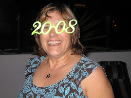
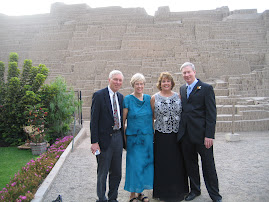
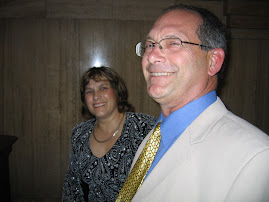
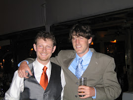
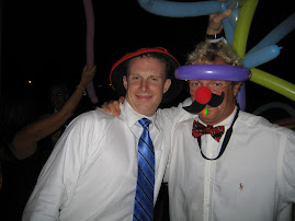
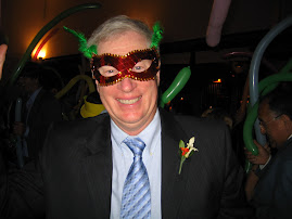
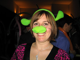
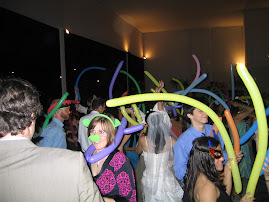
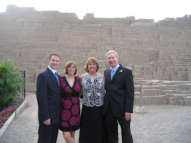
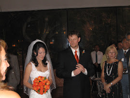

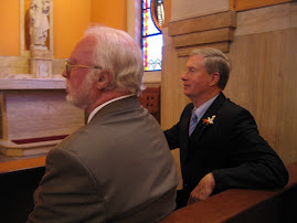
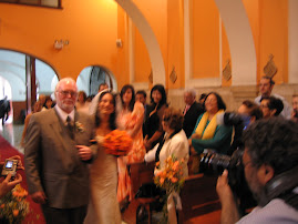
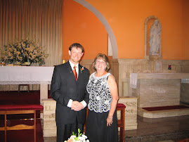
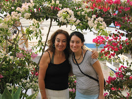
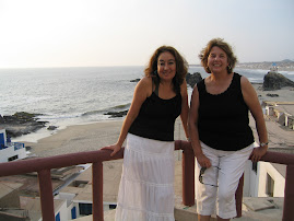
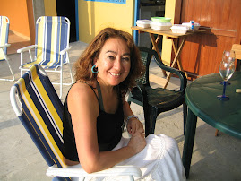
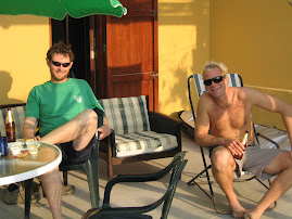
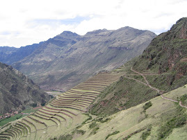
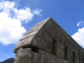
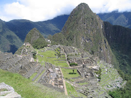
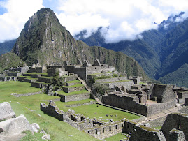
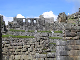
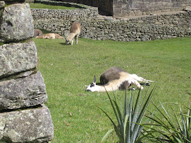
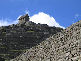
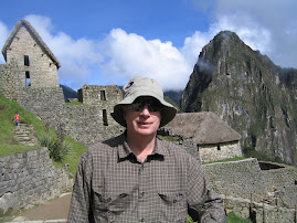
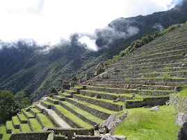
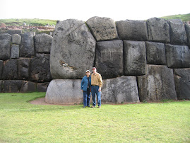
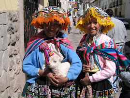
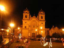
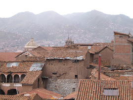
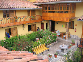
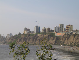
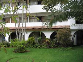
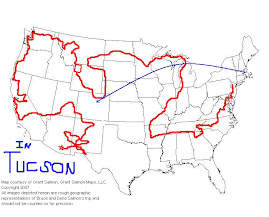
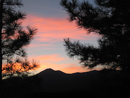
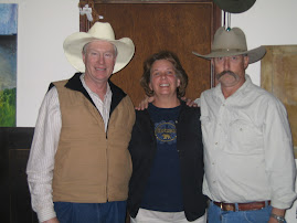
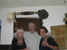
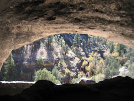
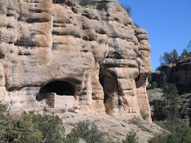
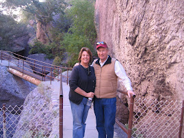
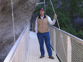
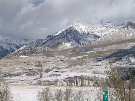
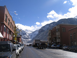
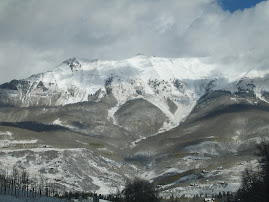
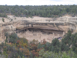
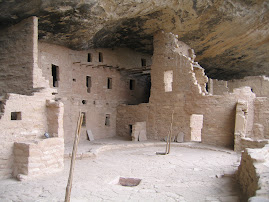
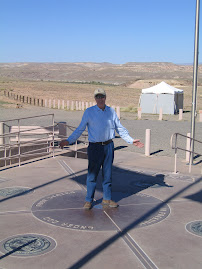
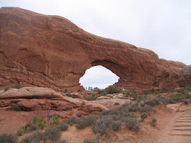
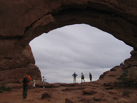
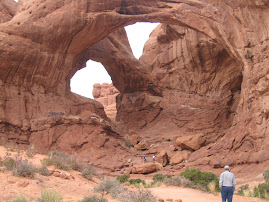
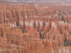
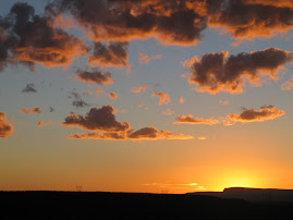
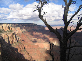
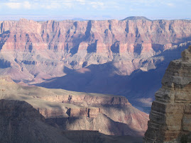
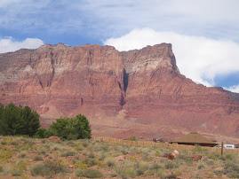
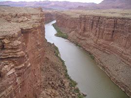
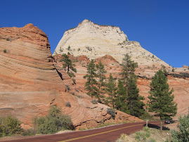
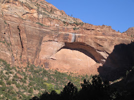
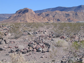
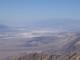
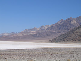
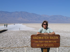
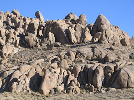
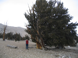
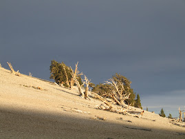
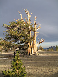
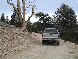
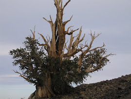
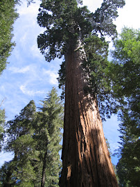
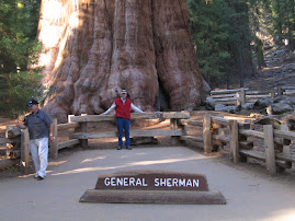
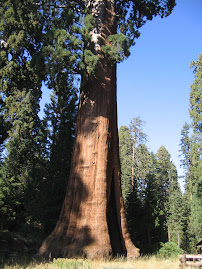
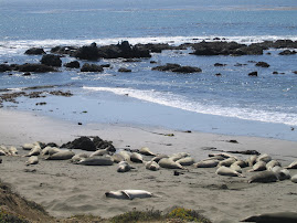
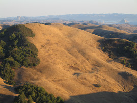
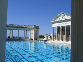
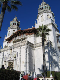
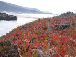
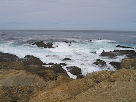
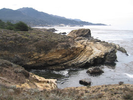
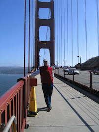
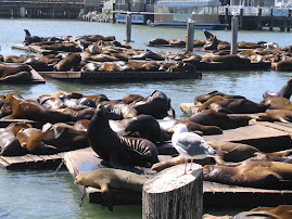
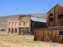
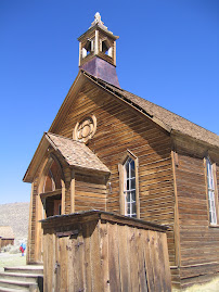
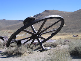
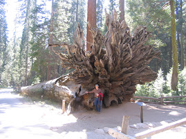
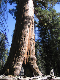
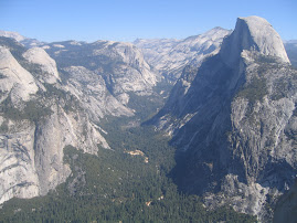
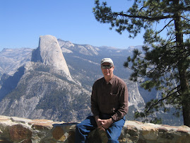
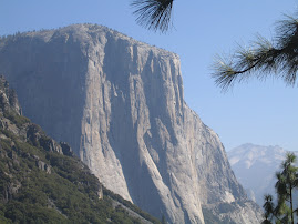
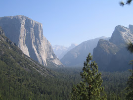
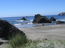
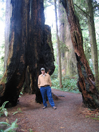
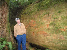
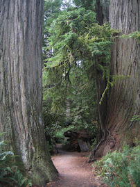
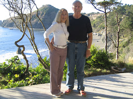
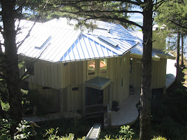
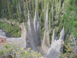
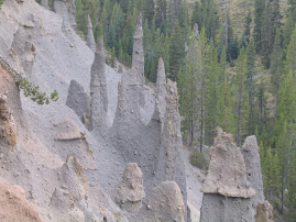
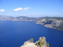
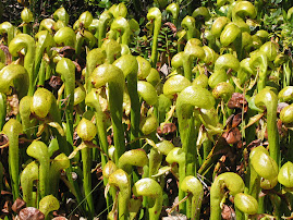
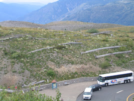
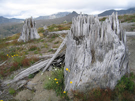
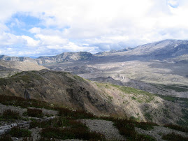
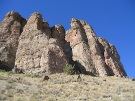
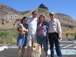
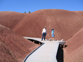
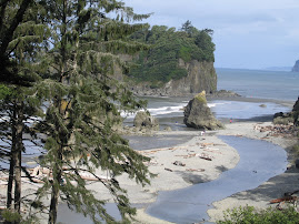
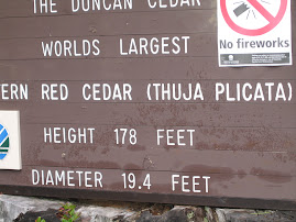
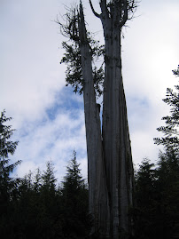
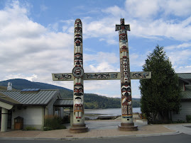
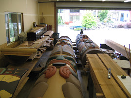
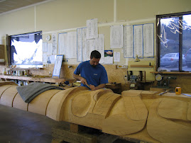
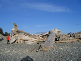
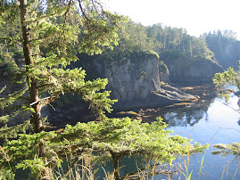
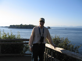
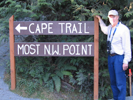
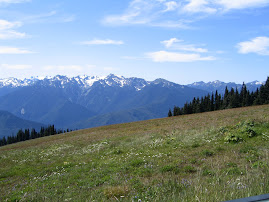
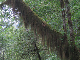
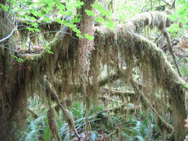
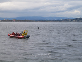
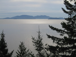
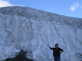
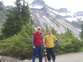
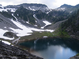
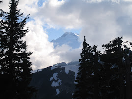
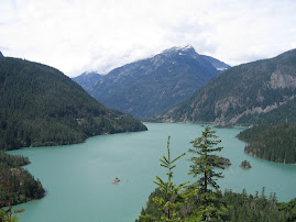
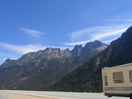
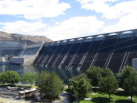
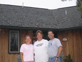
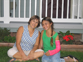
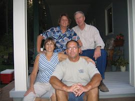
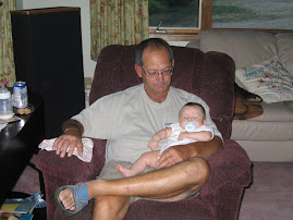
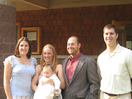
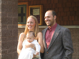
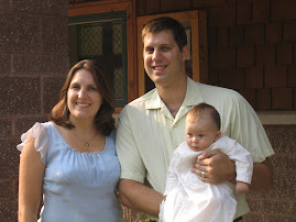
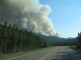
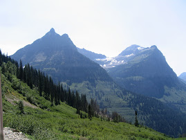
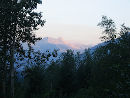
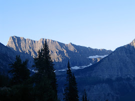
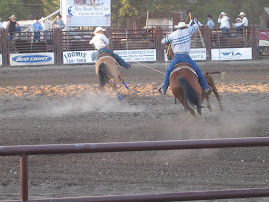
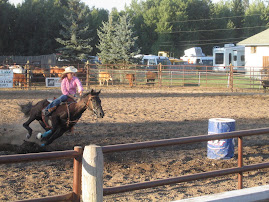
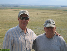
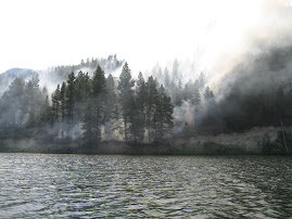
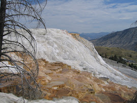
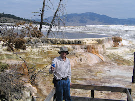
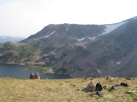
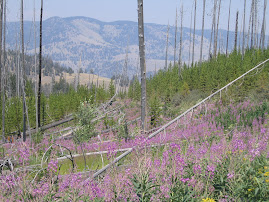
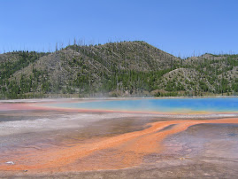


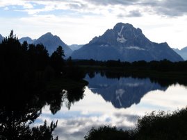


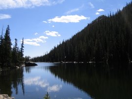


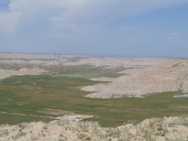

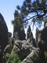
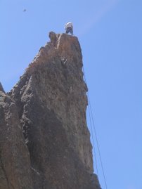

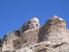
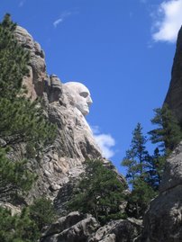
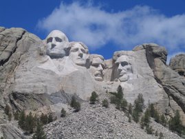


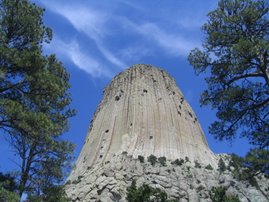


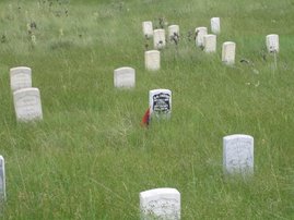
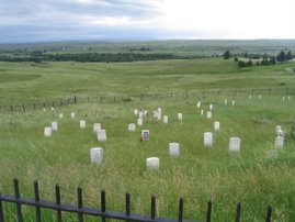


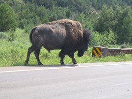
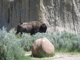
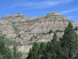

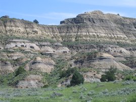


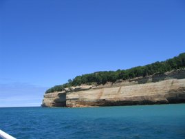


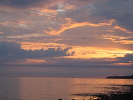


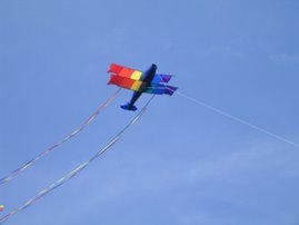


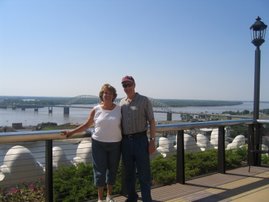


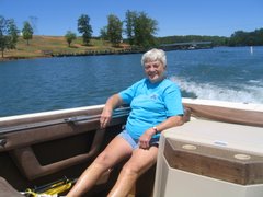


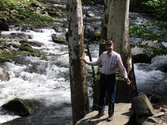


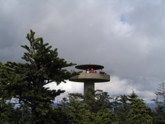


