Tuesday we traveled from Missoula, Mt, to Republic, Washington. We went up through the Idaho panhandle near Lake Pend Orelle (pronounced Ponderay), and then across northern Washington. The town of Republic was a gold mining town and also is known for fossils. It's only 25 miles from the Canadian border. The terrain in the area is very unusual severe rolling ground. It was shaped in the last ice ages by massive floods caused by ice dams creating huge lakes (Great Lake size) which periodically collapsed leading to unimaginable flood waters racing to the sea. A coulee is the low area between rises. It was about a 350 mile drive and quite scenic. Our camp ground in Republic was maintained as finely as a golf course. It had automatic irrigation and the owner must mow twice a week.
Wednesday I started the day with a visit to a local health clinic. I believe the smoke from the fires around Missoula got me. The Doc said she thought "flatlanders" could be suseptable to such conditions at the higher elevations. Never recall having a combination ear, sinus and bronchitis situation before. Glad I went instead of doing the normal and putting it off. Dana kicked my butt into going.
Upon return, we loaded up and headed south to the Grand Coulee Dam. The ride south on Rt. 21 was spectacular, through canyons, mountains and coulees. Roads designated as Scenic By-ways are marked in the atlas and we try to ride them when possible. The dam is unbelievable. Four times as large as Hoover Dam, and a mile across. Produces more electric than any dam in the world. The visitors center was great and we saw a movie on the Great Flood, where we got info on the local land formations, mentioned above. On the way back, we cut through the Colville Indian Reservation which was another scenic ride, but not denoted in the atlas. Got home and basically collapsed after dinner.
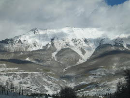
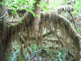
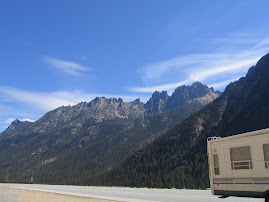
Thursday, Andy's birthday, we left Republic heading for Bellingham and the Strait of Georgia, just north of Puget Sound. We took Rt. 20 west which turned out to be the ride of a lifetime. The road through North Cascades National Park was as pretty as anything we've scene. Washington Pass was spectacular but the prettiest place we saw was the Diablo Overlook above Lake Diablo. Hopefully the picture do it justice. The water is torquoise caused by "glacial flour,"the powder that is produced by glacial movement over terrain.
The town of Bellingham is right on the water, and is a sea port. Our RV park is urban in nature, but nice. We had dinner at the Bayside Grill and Bistro overlooking the marina on Bellingham Bay and had some very good halibut. Went to a local park and watched a country trio play a few tunes, and called it a day.
HAPPY NEW YEAR to YOU ALL!!!

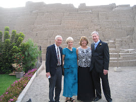
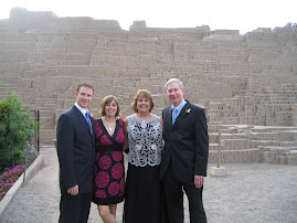
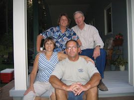
Mike, Carol,Dana and Bruce
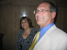
Linda and Chuck
finally made it from Montana
Brad and Patrick
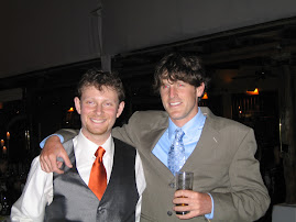
friends since 8th grade
Grant and Prescott
who is this masked man?

Michelle, is that you?

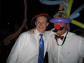
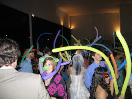
here's where the party really started
the Salmons at the reception
at he reception


the proud fathers
Bruce and Don
here comes the bride

Kim and her dad
Brad and Dana
keeping the groom calm before the cermony
Kim and Maria Teresa

the moms
Christmas Day
Kim's mom, Maria Teresa
our lovely hostess and tour guide
Christmas Day at the beach
Brad and Prescott
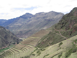
beautiful valley at Pisac
Incan stonework
look at those sharp angles!!!
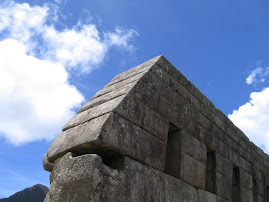
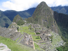
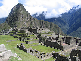
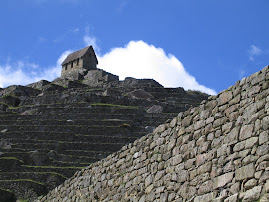
Machu Picchu
classic photo op
Machu Picchu
it sits in a "cloud forest"
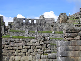
famous 3 windows
sunbathers
guardhouse at Machu Picchu
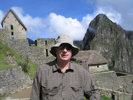
a familiar tourist
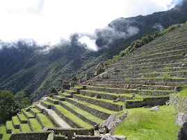
Incan terraces at Machu Picchu
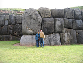
Sacsayhuaman-Incan fortress
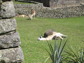
local children with their baby alpaca

posing for money
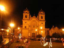
the plaza and a cathedral in Cusco
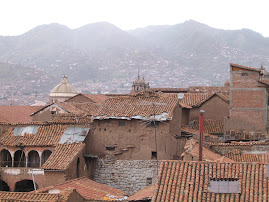
view of Cusco from our room
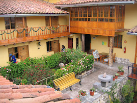
Hostal Amaru in Cusco
a winding staircase to our room
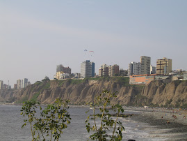
Pacific coast in Miraflores
parachute gliding and surfing
Hotel Senorial in Miraflores
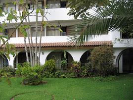
lovely spot with great service
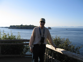
Where in the World are Bruce and Dana Salmon?
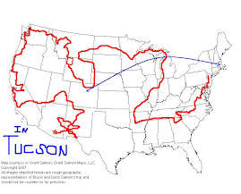
Relaxing for a few minutes in Tucson, Arizona. Catch 'em if you can!!!
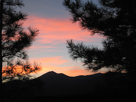
the last of many beautiful sunsets
Happy Trails to you!
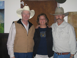
Dana and the "cowboys"
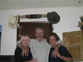
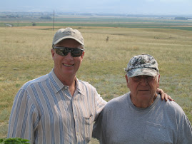
Ann and Grant Leonard and me
Gilla Cliff dwellings
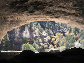
from the inside looking out
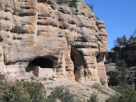
Gila Cliff Dwellings
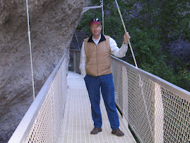
doing our stuff on the catwalk
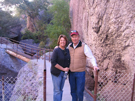
on the Catwalk
My Christmas Card--someday
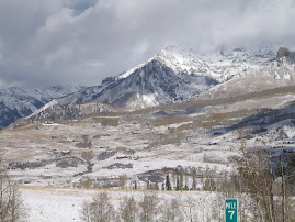
outside Telluride
for Brad and Grant
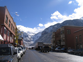
downtown Telluride
on the way to Telluride!!!!
Mesa Verde
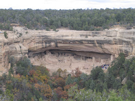
cliff dwellings across the canyon
Mesa Verde
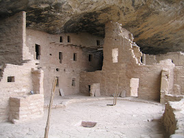
Spruce Tree House
Bruce--atFour Corners-in 4 states at once
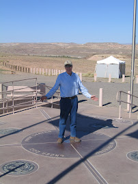
Utah,New Mexico,Colorado, Arizona
Arches National Park
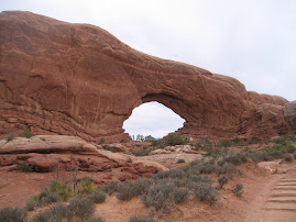
see next picture-for scale
another "little arch"
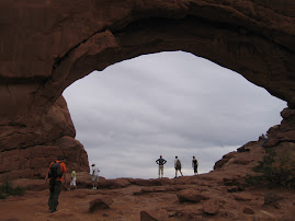
Arches National Park
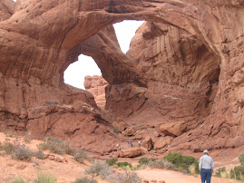
Bruce on his way to Double Arch
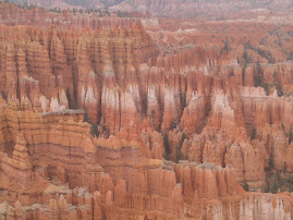
Bryce Canyon
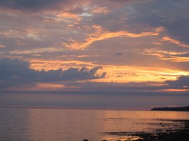
High desert sunset
went on for an hour or more
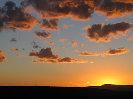
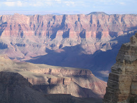
Grand Canyon
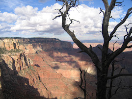
Grand Canyon view--North Rim
Utah scenery
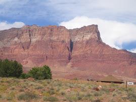
looping the fold
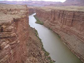
Colorado River
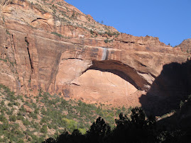
beautiful Zion National Park
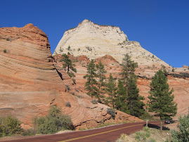
even the road is red!!
Zion National Park
one of our first views
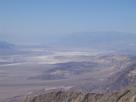
Death Valley
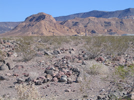
not just sand-rocks,rocks,rocks,rocks
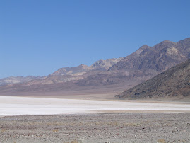
Death Valley
Death Valley--salt flats
Death Valley--Badwater
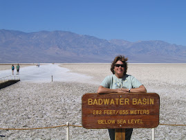
lowest spot in W. Hemisphere
Hi,Ho Silver, and Away!!!
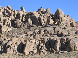
Alabama Hills-set of Western Movies and more
the old guys!!!
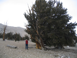
Bruce and Patriarch tree
bristlecones--not snow-dolomite rock
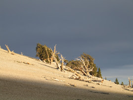
bristlecone--art picture!!
road to bristlecones
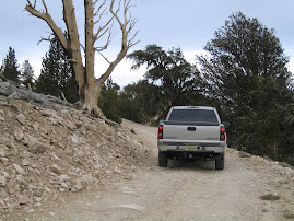
a typical "Bruce tour road"
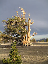
ancient bristlecone pine
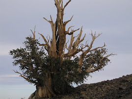
grow 7,000-10,000 feet above sea level
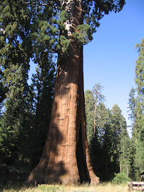
General Grant tree--for obvious reasons
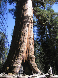
Bruce and General Sherman
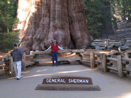
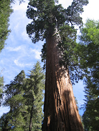
General Sherman sequoia
biggest plant on earth--by volume
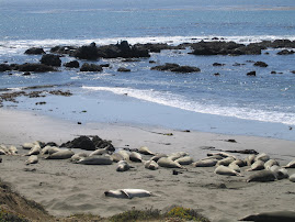
not logs--elephant seals on the beach
golden California hills
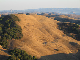
ocean in the background
San Simeon
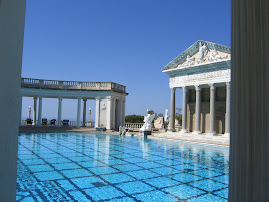
Bruce says I can have a pool--just like this one!!!
San Simeon--W.R.Hearst home
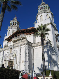
just another vacation cottage
Ocean bluffs
turning red in the early autumn sun
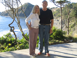
California Coast
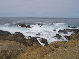
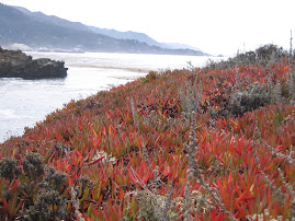
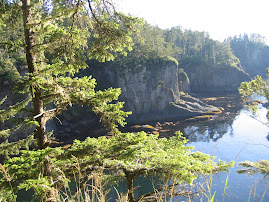
Point Lobos
Point Lobos--near Carmel by the Sea
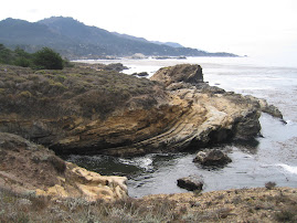
tide pools, and great fault layers
The Traveling Salmons
Bruce (foreground) and Dana
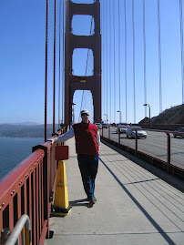
on the Golden Gate Bridge
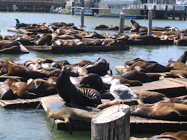
Sea lions at Fisherman's Wharf
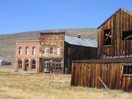
Main Street--Bodie
church in Bodie
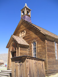
Bodie--a real ghost town
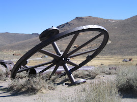
my "artsy picture"--mining relics
the "Fallen Monarch"
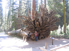
already fallen when Lincoln formed Yosemite Natl. Park
Mariposa Grove Sequoia
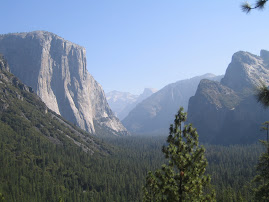
Yosemite Valley
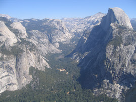
we can't help ourselves--too beautiful
Yosemite-Bruce at Glacier Point
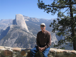
Half Dome in the background
El Capitan
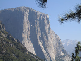
largest granite monolith in the world
Yosemite Valley
El Capitan on the left
Oregon Coast
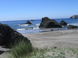
our picnic spot
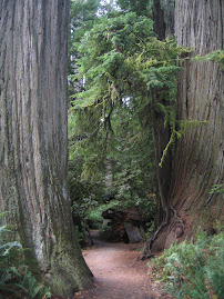
Redwoods
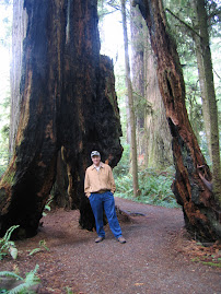
inside a redwood skeleton
Redwoods
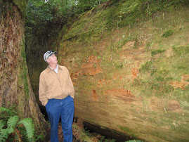
Bruce and huge old fallen tree
Redwoods
on the deck at Cliffhanger
Barbara and Greg--our hosts
Cliffhanger---Gold Beach
from the driveway--ocean in background
the Pinnacles near Crater Lake
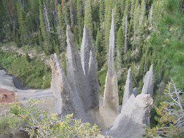
the Pinnacles near Crater Lake
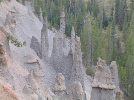
you think they look like what??!!
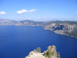
Beautiful Crater Lake
Huge pitcher plants
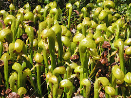
near Crater Lake
Mt. St. Helens
note size of trees blown over-5 mi.away
Mt. St. Helens
trees shattered 5 mi. away from blast
Mt. St. Helens
valley full of lava and ash and mud
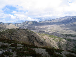
John Day Fossil Beds
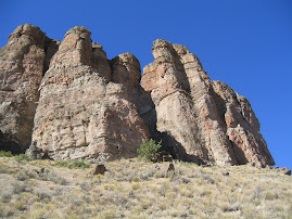
typical terrain
at the fossil beds
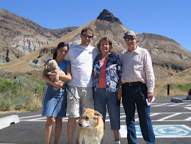
Kim,Tiki,Brad,Gwen,Dana,Bruce
John Day Fossil Beds
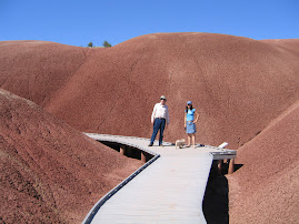
Painted Hills area
beautiful Ruby Beach
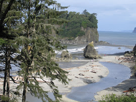
we checked out some tide pools here
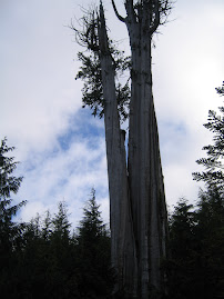
we love these big trees
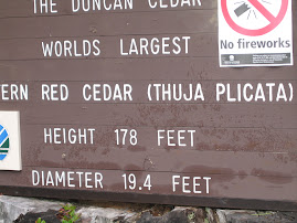
world's largest red cedar
contemporary totem poles
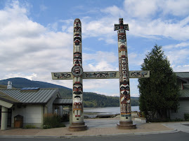
the old ones are all in museums
Totem poles awaiting delivery
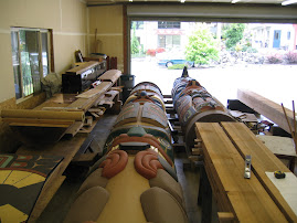
2,000 hours of work!!!
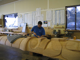
Totem pole carver at work
Rialto Beach
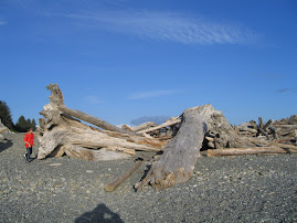
strewn with HUGE trees
Cape Flattery
rocks,seaweed,birds,seals
Cape Flattery
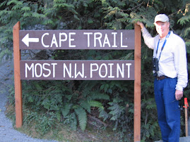
most western point in continental U.S.
on the trail to Cape Flattery
we made it to the Pacific!!
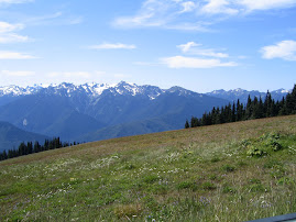
Hurricane Ridge
rainforest slug
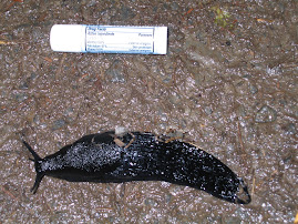
Hoh Rainforest
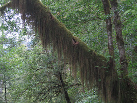
Dorothy--this isn't Kansas
Hoh Rainforest
raft and Orcas
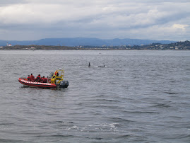
Canada in the background
Puget Sound and the San Juans
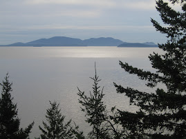
from Chuckanut Drive
I refuse to live here!!!!!!
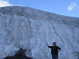
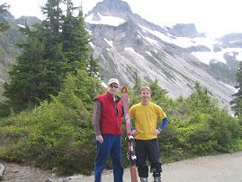
mid-August near Mt. Baker
Jeff--setting out to ski--at 4:00pm
obviously a hike to get there--sorry Russ
Tabletop Mt.--near Mt. Baker
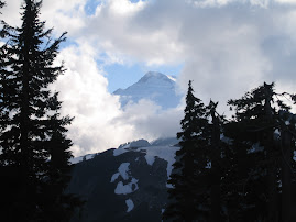
Mt. Baker peeking through the clouds
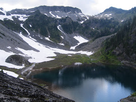
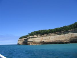
Diablo Lake
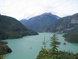
mediterranean blue due to glacial runoff
"pulling" the Cascades
no problemo
Grand Coulee Dam
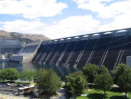
Bruce digs dams
at the Mangold ranch
Marci,Dana and Dave
for Mia
Linda and Mia
Last night in Alberton
on the back porch
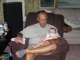
Only Grandpa had the golden touch
Chuck and SLEEPING Lydia
Christening Day
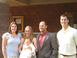
all the parents
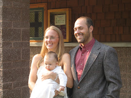
the Godparents
Jerilyn,Jake and Lydia
Christening Day

Polly,Rob and Lydia
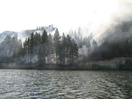
Wildfires near Glacier
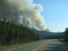
started by lightning
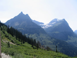
Glacier National Park
Sunrise on Going to the Sun Road
Going to the Sun Road--Glacier
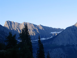
just after sunrise
Rodeo
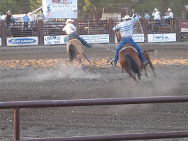
team roping
Rodeo
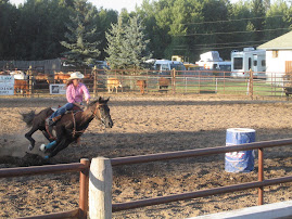
turning the corner--barrel racing
Three Bucks
Bruce,Bob and..............
Gates of the Mountains
our first encounter with fire
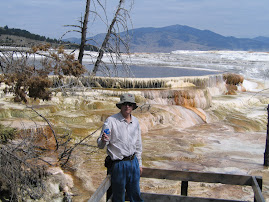
Mammoth Hot Springs
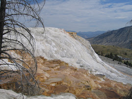
Mammoth Hot Springs
Beartooth Highway
up on the tundra
Yellowstone
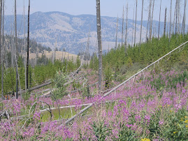
fire flowers--first in a burned out area
Yellowstone
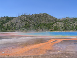
Grand Prismatic Spring
One More Jenny Lake

Sunrise!!!!

we got up at 5:15
Geyser field

Old Faithful

Baby Buffalo

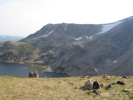
High above Jenny Lake

Scenery
Scenery

I can't help myself!!!!
Fire damage from 1988--Yellowstone

regrowth has definitely begun
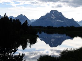
the Tetons

from Oxbow Bend
the Tetons

Jenny Lake
the Tetons

first views--many more to come!!
South Pass--Oregon Trail

can you imagine walking this for months?
for my sister Karen

Hi--relaxing in Loveland
Medicine Bow

our rig with Medicine Bow in background
Rocky Mt. Natl. Park

on the tundra in the clouds
sunset over Lake Loveland

Marion and Carls house across the lake
Emerald Lake-taken by Bruce
the guys , Amy and a friend hiked up to here
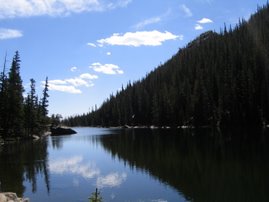
Dream Lake

Marion and I sat here and painted
Rocky Mountain National Park

what can you say about this?
Estes Park

Estes Park

we took to tram up the mountain
for my family

Bruce and Joyce and Tom Gerlitz
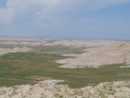
Badlands

around every corner a different view
Badlands for miles and miles

South Dakota Badlands
hot,hot,hot!!!
Needles Highway

eye of the needle
Needles Highway
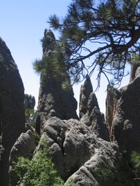
needles
Needles Highway-Custer State Park
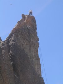
a climber on a needle
us and Crazy Horse

Crazy Horse
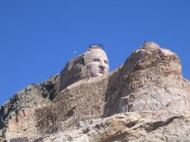
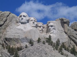
all 4 heads from Mt. Rushmore could fit in the hollow where the ear will be
Mt. Rushmore
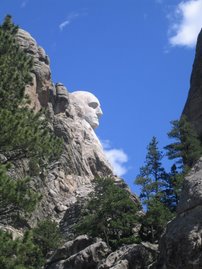
G. Washington's profile
Mt. Rushmore
at sunrise(5:20 a.m.)

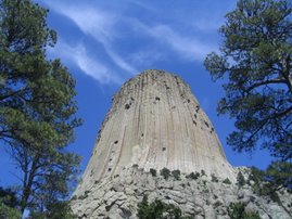
Devil's Tower

a storm brewing
Devil's Tower

Devil's Tower

tell Richard Dreyfus you can't really climb these boulders!!
Devil's Tower
Pompeys Pillar

contains only record of Wm. Clark's presence in area
Wm. Clark carved in Pompey's Pillar

Little Bighorn

typical terrain
Little Bighorn

Indian Marker
Little Bighorn Battlefield
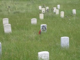
marker where Custer fell-as far as they know
Little Bighorn Battlefield
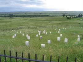
Last stand hill
Clouds over Little Bighorn

Little Bighorn Battlefield

marker for soldier
at TR National Park

settling a dispute
Theodore Roosevelt National Park

this guy was a poser
Theodore Roosevelt National Park
hitting the road
Theodore Roosevelt National Park
a large resident
Theodore Roosevelt National Park
Theodore Roosevelt National Park--Bruce

Theodore Roosevelt National Park
the Capitol in Minneapolis

Bruce,Dana,Karen and Jay Loufek

Kitch-iti-ki-pi Spring

big trout
Looking into Kitch-iti-ki-pi spring

those are trout (and logs)
Lake Superior

from the top of Pictured Rocks
Pictured Rocks

the tourists
Pictured Rocks--Lake Superior


Pictured Rocks--Lake Superior
from the boat
On the Macinac Bridge

in the rain
Tahquamenon Falls--Michigan

Lake Superior

fog on Whitefish Bay
After the Dragon

sunset over Lake Michigan
The Dragon
sunset over Lake Michigan
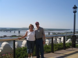
St. Louis

the Arch
Bruce, Dana, Carol, and Andy

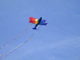
Memorial Day--Go Fly a Kite

our hostess--Marge Hazelton
Menorial Day--Go Fly a Kite
Yahoo!!!!
Memorial Day--Go Fly a Kite

How Many Salmons Does it Take to Fly a Kite?
Memorial Day---Go Fly a Kite

Bruce and Andy ponder their kite
The Ozarks

Andy and Bruce at Alley Spring
The Ozarks

a small Arkansas town near our campground
Cowboys

young, lean and tough as nails
Bulls

mee too!!!~
Bull riding competition

waiting to perform
A lovely magnolia

for me to paint--sometime
Garvan Woodland Garden-Hot Springs

Cathedral in the woods-
Garvan Woodland Garden

cathedral in the woods
Graceland

"the" pink cadillac
Graceland

Elvis has left the building
Graceland

walls full of gold recordsand costumes
Beale Street at night

Band groupie

dancing,dancing!!
Canaan Gage and his band

free concert on Beale Street
"the" place to be --Madison Hotel
from the roof--Mississippi in background
Another for Grant

still "tooling" along
For Grant

"tool bus" #2
Mother's Day

the "tool" bus
bridge across the Mississippi

from Memphis to Arkansas on far left
on our way to Mud Island

Mississippi River in background
Bob and Eloise Pino

our wonderful tour guides and hosts in Atlanta area
Ruth,Joan,Bruce and Dana

our last night in Seneca
Our Presidential

from the lake
On the Lake
Joan enjoying the ride
Lake Keowee

our ship comes in
North Carolina Arboretum

pansy quilt
Looking Glass Falls

Moonshine Creek

elevation 3200ft.
Moonshine Creek Campground

the creek is just on the far side of the rv
Dollywood

just to prove I was there also
Dollllly

The inflatable doll was too expensive
Cades Cove

lovely valley view
Mt. stream and Bruce
no snakes here!
mountain stream and Bruce

the poser
Clingman's Dome observation tower

Tennessee countryside

The top of Tennessee
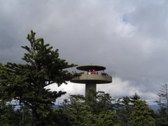
the observation deck at Clingman's Dome
Smoky Mt. View

from Clingman's Dome
pets at the N.C. Gold festival

won't see this in N.J.
Hoops anyone?

Bruce and Rich at Debbie's
Big bad bass boat

Blue Ridge Mts.

from Blue Ridge Parkway

Foamhenge???????
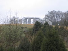
goodness knows--raining too hard to get closer
Natural Bridge

G. Washington carved initials here--20+ ft. up left side
Montpelier

from a distance
Montpelier

tree given by Lafayette? or U.S. Marines?
sculpture in Nat'n Gallery


our first guests

Dick Gallant, Rip , and Molly Gallant
our new rig

Bruce with the new rig
our new rig

Bruce and the new rig
our new rig

view of slide-out master suite
our new rig

vie of kitchen/entertainment center
our new rig

our living/diing room
our new rig

the library
2 comments:
Good to hear such a positive response from the butt kickin'. Is there something we might glean from this? At least now that you're on the left coast the ragweed potential should lessen? Not here in the good ol' midwest where the abundant rains we've received this year are suppose to yield a bumper crop in about a week or two.
Are you planning to go over to the Olympic National Forest area east of Seattle or Vancouver Island? Some interesting stuff that's been uncovered in waters off the coast in the past 15-20 years up through Canada to Alaska...evidence of how Siberians navigated along the coast to eventually get down to the states 13,000 years ago (I think).
Keep up the good work, Dana.
Feel better Bruce and keep kickin' his butt Dana!!
Seattle should be nice this time of year - if you end up in Duvall by any chance - Jim and I always loved the Duvall Cafe for a good bacon eggs and pancake breakfast. Kirkland is pretty charming too and worth a stroll around. Ah so much to see and do!!
XXX
Jim and Joan
Post a Comment